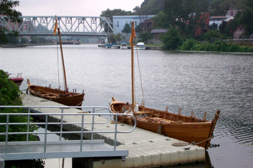
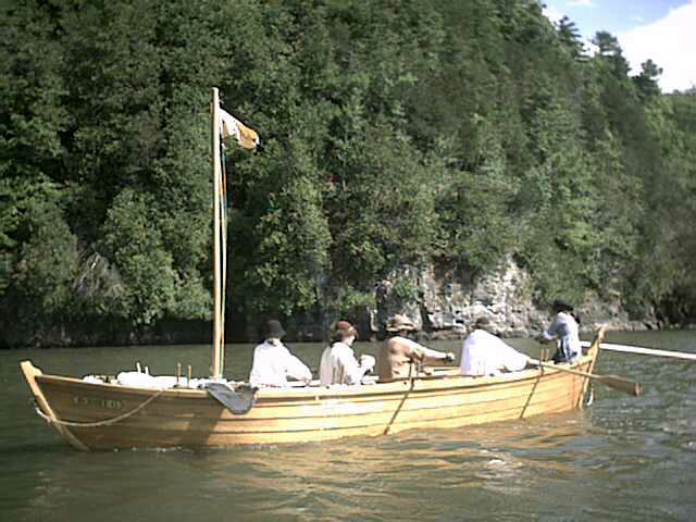
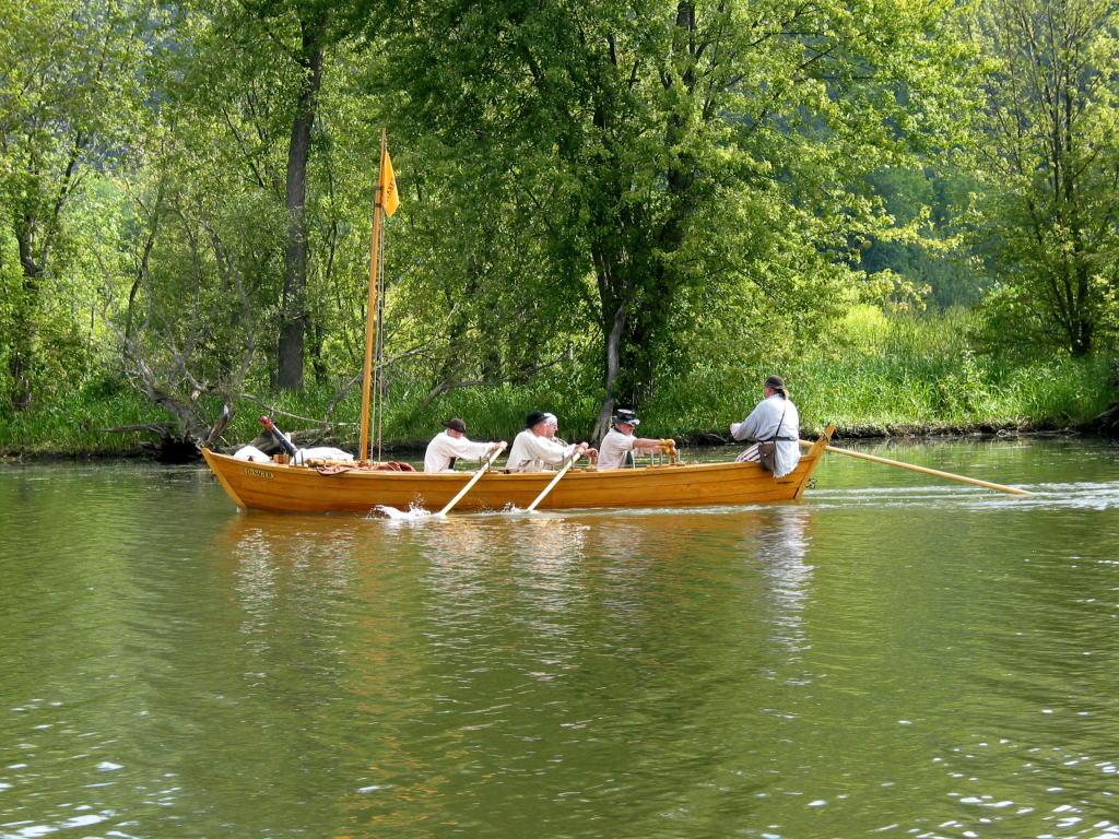
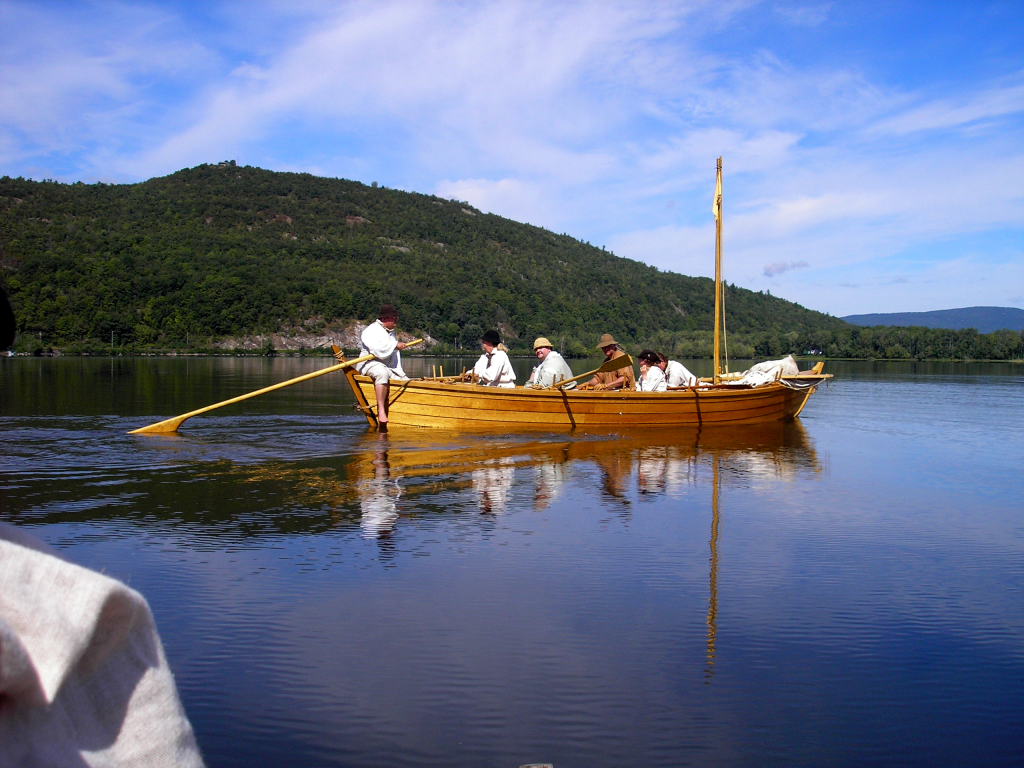
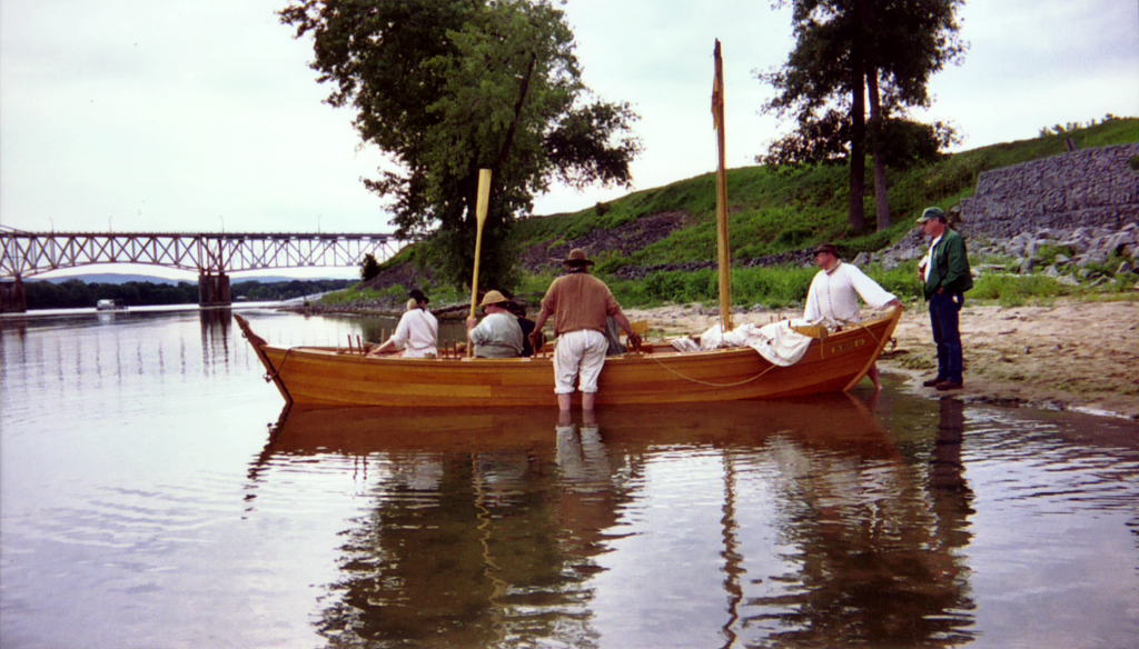
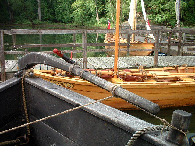
The Mabee Farm Historic Site (part of the Schenectady County Historical Society) owns two replica bateaux, the DeSager and the Bobbie G. The boats are crewed by volunteers, largely from the 2nd Albany County Militia, and are propelled by oars or sail. These two boats were taken on a trip, starting at Rogers Island in Fort Edward, New York and proceeding up the Champlain Canal and down Lake Champlain to the Lake Champlain Maritime Museum in Vergennes, Vermont.
For more information on the boats and the organizations behind them, see the introduction for last year's rowing trip.
The photographs were taken by Ed Williams, Dean Barnes, Bill Manthey, Monica Fredell, Dave Wheadon, and myself, David Manthey. All of them are copyrighted 2005 to one of us. Please inquire before using any of them. I have much larger versions of most of the photos. As always, click on a photo for a larger version.
To my ability, I've merged everyone's photographs to form a continuous set in chronological order. A few of the pictures may be slightly out of sequence.
What follows is a journal written after the event based on my memory. It leaves out many details; I could easily have written twice as much.
Prior to the trip, I had secured permission to use our various camping sites, I had prepared and sent extensive information to all of the potential crew, and I had done quite a lot of work on the bateaux to ensure that they would be in good shape for the trip.
The rest of the journal is written 'as it happened', even though the writing was actually done at a later time.
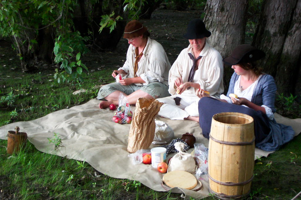
I spent last night and this morning packing the last of the gear I'm responsible for into appropriate containers. As with last year, it feels like I have too much - dinner for three nights for up to 14 people, breakfast for one day, a couple of blankets and some spare clothes, two "captain's baskets", a tent and poles, two water "buffaloes", canteen, eating gear, sailor and sewing kits, cookies, barrels, lines for rigging a second sail, spare line, rum, a camera, spare money, and so forth. As I'm in charge, and this is a fairly large crew, I felt it my duty to have a bit of backup gear and emergency equipment.
Reb and Bill arrived at my apartment around 11:30.
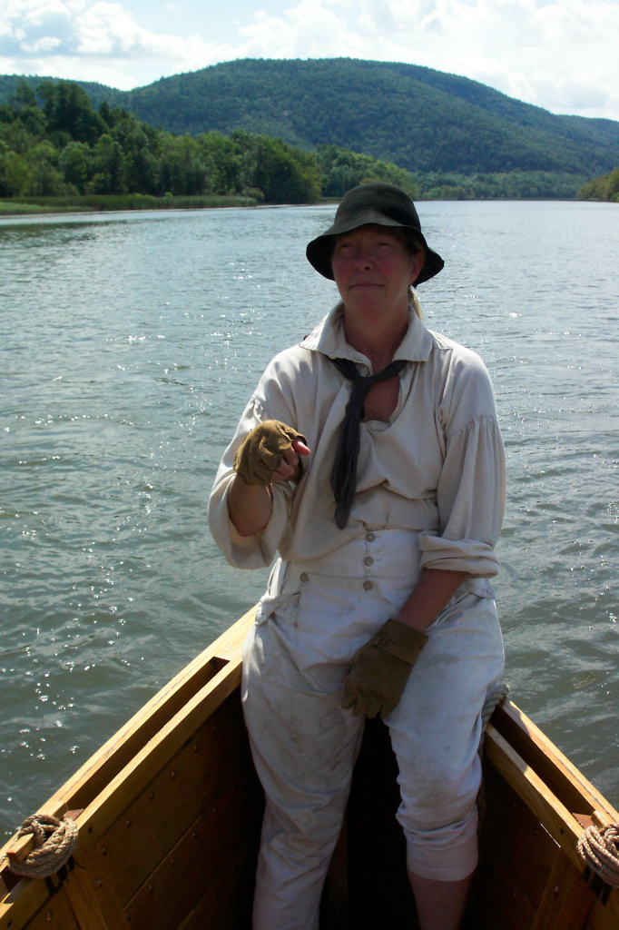
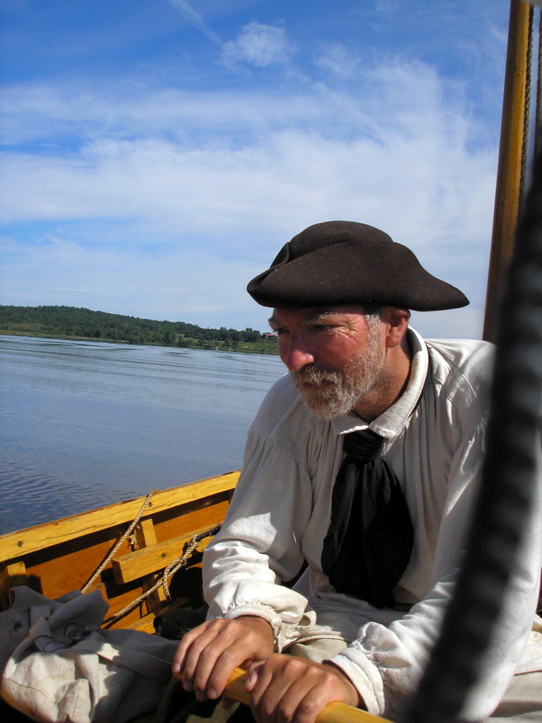
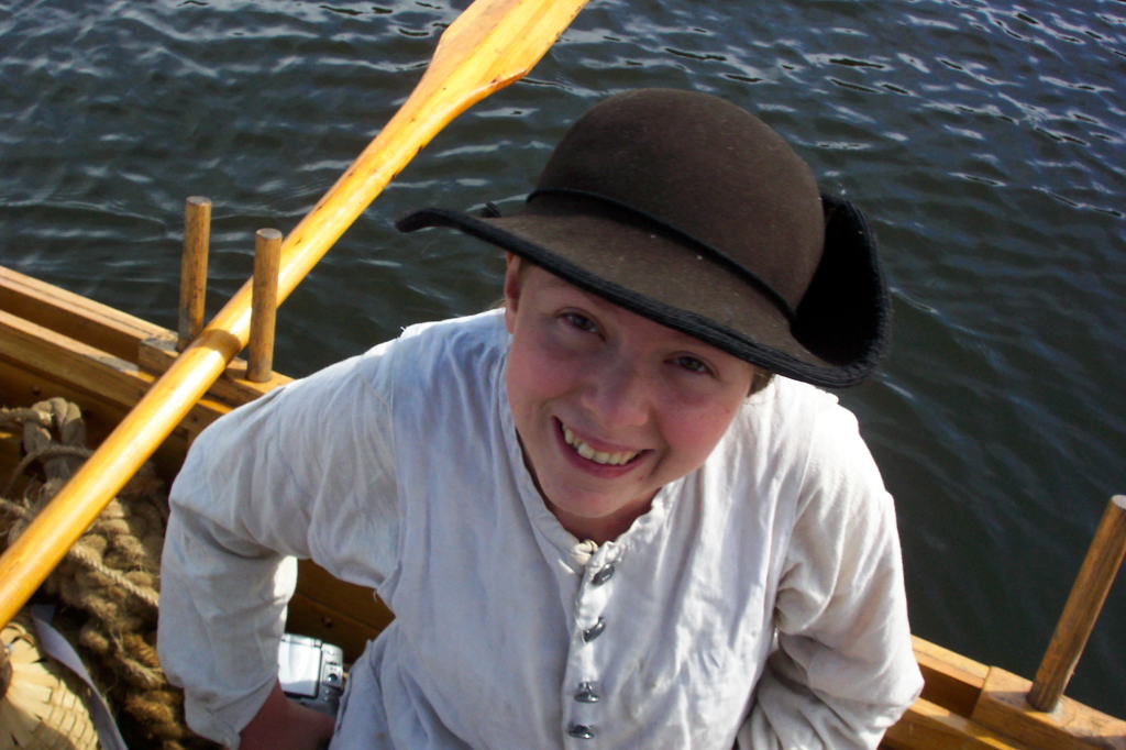
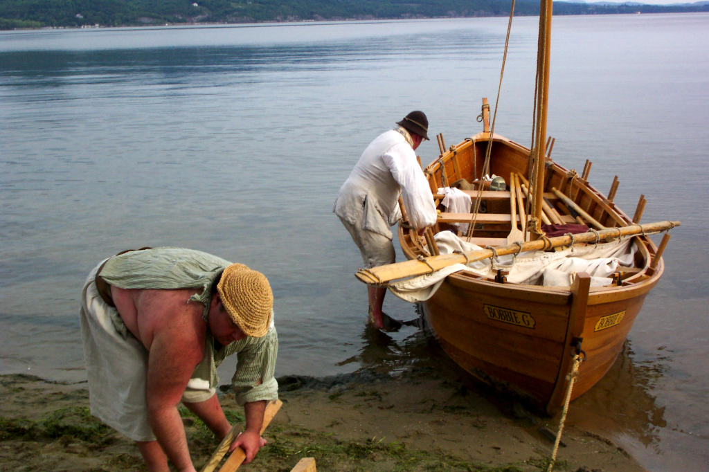
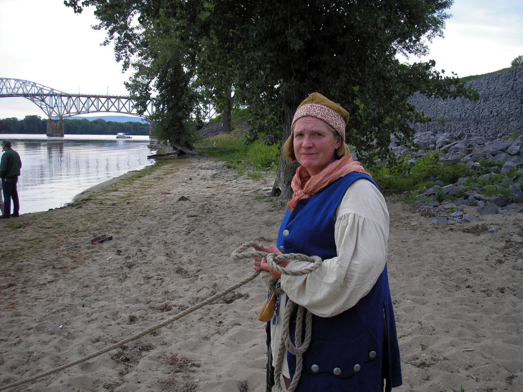
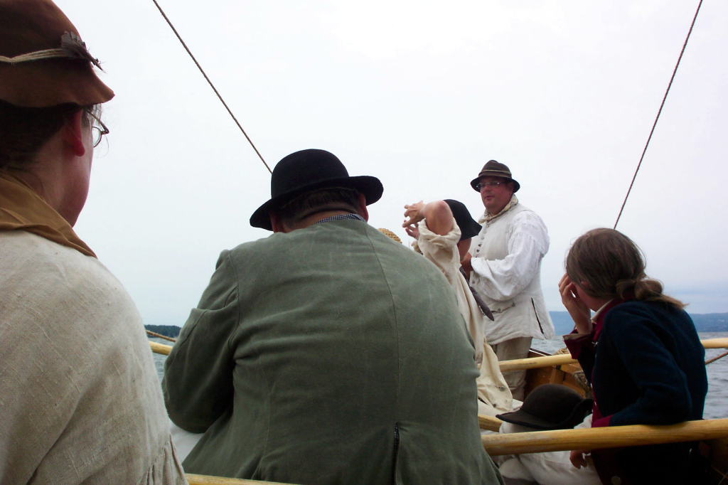
Reb lives up in China, Maine, yet makes it to quite a few events with our group each year. She is excellent at being "Bows" - always willing to leap in the water, haul up a boat, or do whatever else is necessary to make things work. As an explanation, "Bows" is the person seated closest to the front of the boat. It is their job to fend the boat off of docks, secure the first mooring line, pull the boat up onto shore, and so forth.
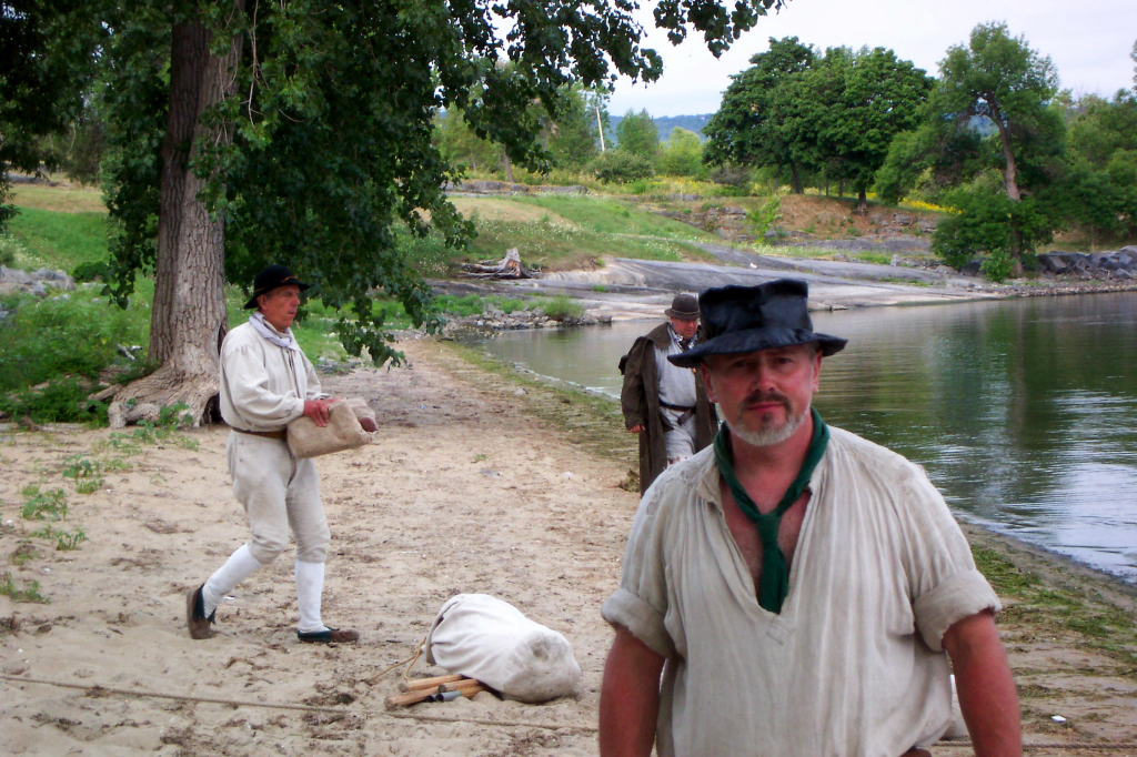
Bill lives in Manchester, New Hampshire. He's a relative novice to reenacting, though he has plenty of outdoors experience.
Reb and Bill were basically packed and ready to go, with everything in the back of Reb's pickup truck. We had agreed to meet Kevin at the airport to help collect Ed who was flying in to join us. We trundled off just before noon.
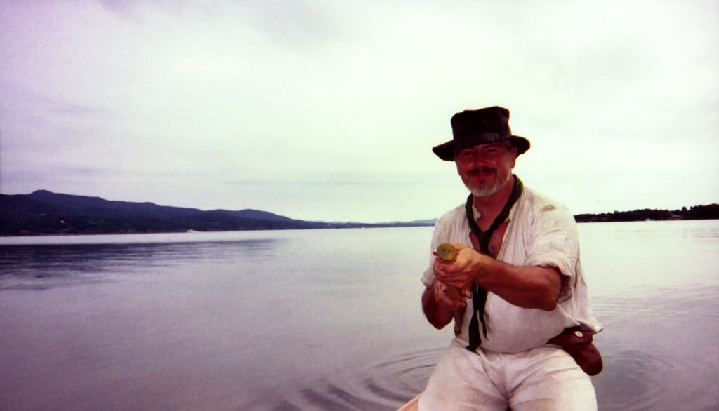
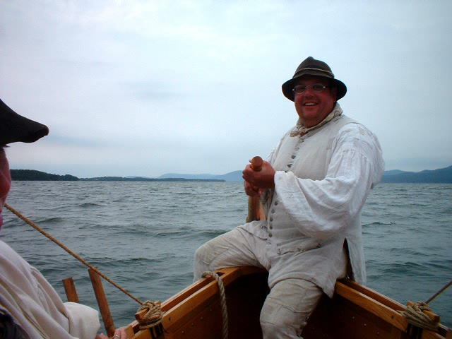
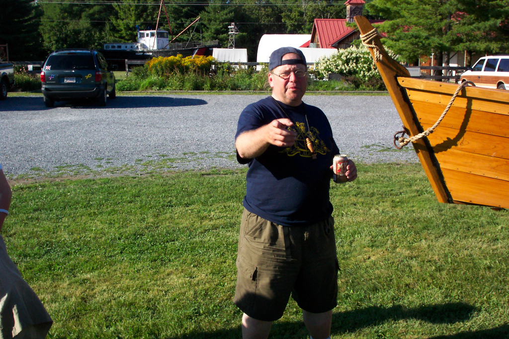
Kevin lives in Albany and is one of our most ardent crew. He is almost always available, whether for rowing or maintenance. He is frequently stroke oar, in charge of the swivel gun, and often the trailer wrangler. For this trip, Kevin is captain of the DeSager while I am captaining the Bobbie G.
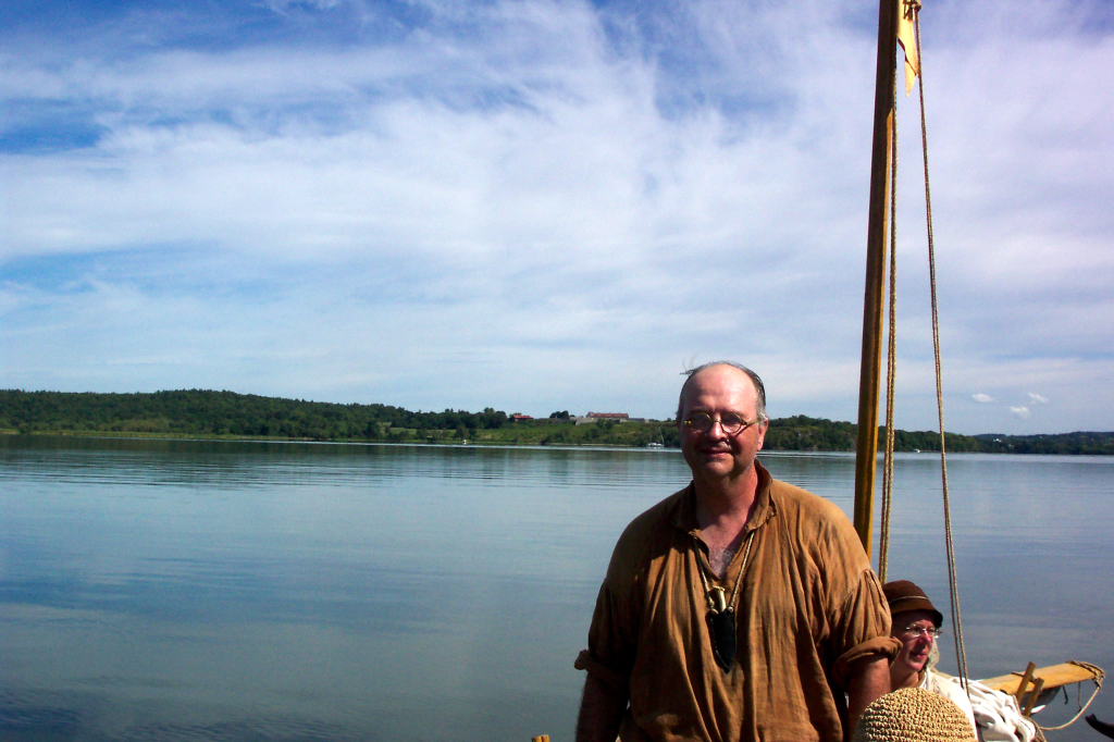
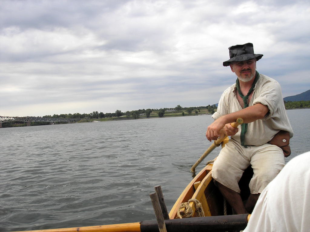
Ed is an interesting fellow from Arkansas. He heard about our trip through the ALRA (American Long-Rifle Association), to which Kevin is a member. Ed is captain of a 40 foot replica keelboat, and has a fair amount of rowing experience. He was quite brave in signing on to a four day rowing trip with a group of strangers.
Ed's plane arrive a little early. Kevin, on the other hand, was running late. Kevin had said he'd bring a sign to let Ed know where we were. As he hadn't arrived yet, Reb made a small improvised sign. Ed recognized us before he saw the sign. Kevin showed up while we waited for Ed's bags, then the five of us stopped at a diner for lunch and drove over to the Mabee Farm.
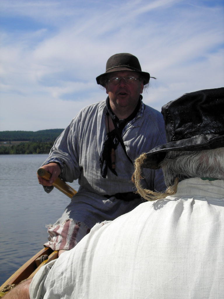
Waiting for us at the Farm were Harvey and Mary. Harvey is another of our frequent crew. He rows modern rowing shells and tries to teach new rowers proper rowing technique, which oftentimes is a losing battle. As we've found in years past, people generally do well when they aren't talking, but as soon as the conversation becomes interesting, the rowing technique suffers.
Mary isn't quite as frequent a rower as Harvey. She is always cheerful and willing to help with the ask at hand. Mary and Harvey live in Schenectady.
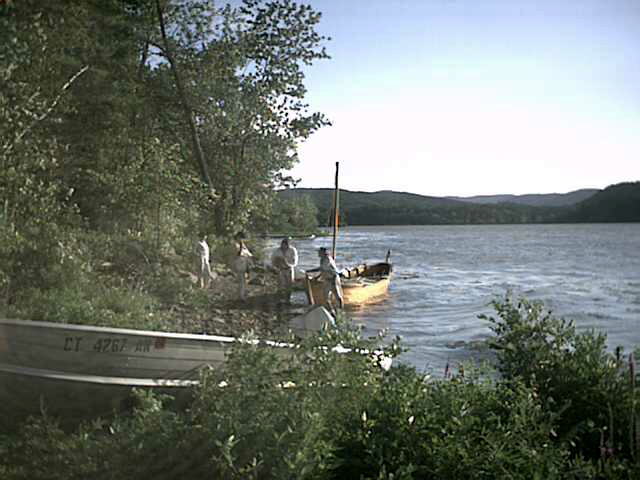
Prior to today, we had loaded both boats onto trailers. The DeSager was on the Farm's flatbed trailer. This is a nice rig with twin axles and brakes. The Bobbie G was on Gary Mabee's trailer, which he loaned to us for the trip. His trailer is designed for a shallow V-hull boat, so doesn't fit the bateaux as well as it might. Last year we had the DeSager on it, which worked poorly. The Bobbie G fits a quite a bit better, but still isn't optimal.
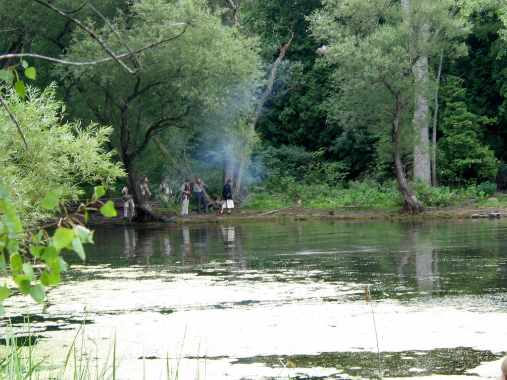
After making sure the boats and trailers were ready to go, we set out in caravan. The drive up to Roger's Island was uneventful (always a good thing when towing boats), and we arrived there just after 4 p.m.
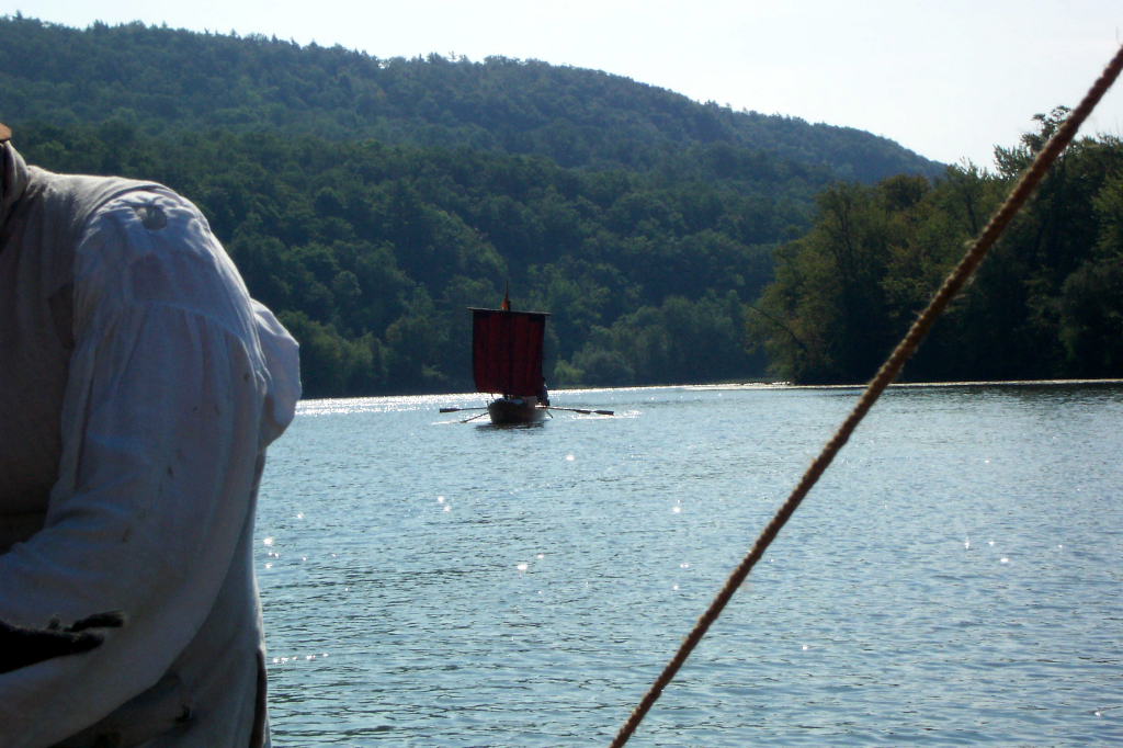
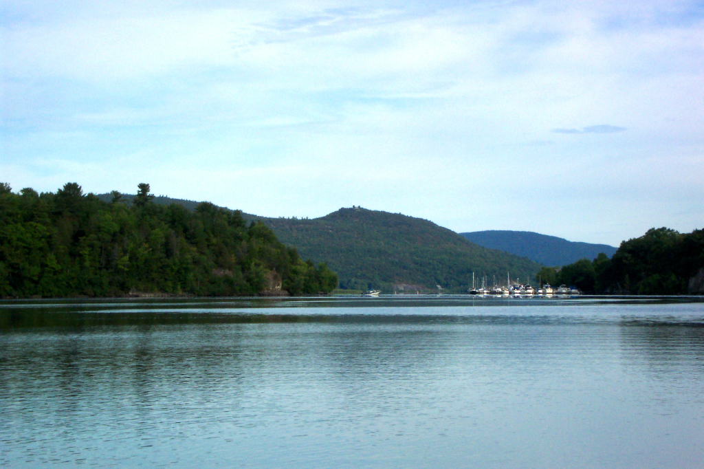
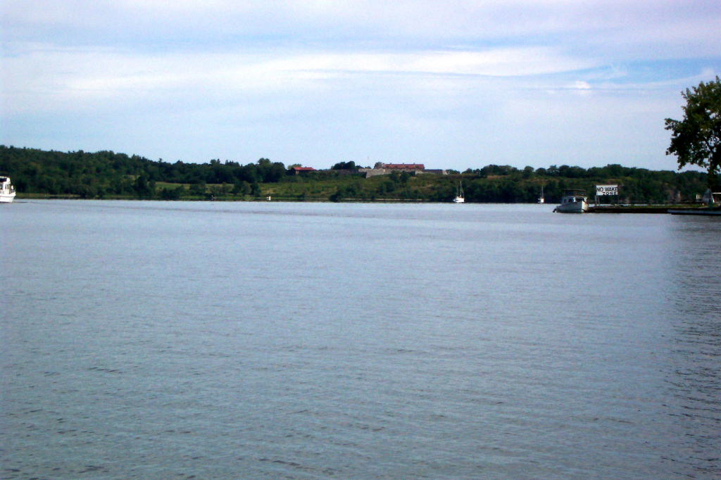
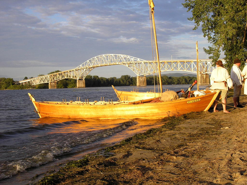
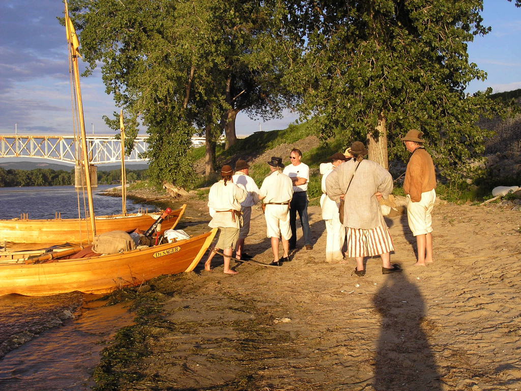
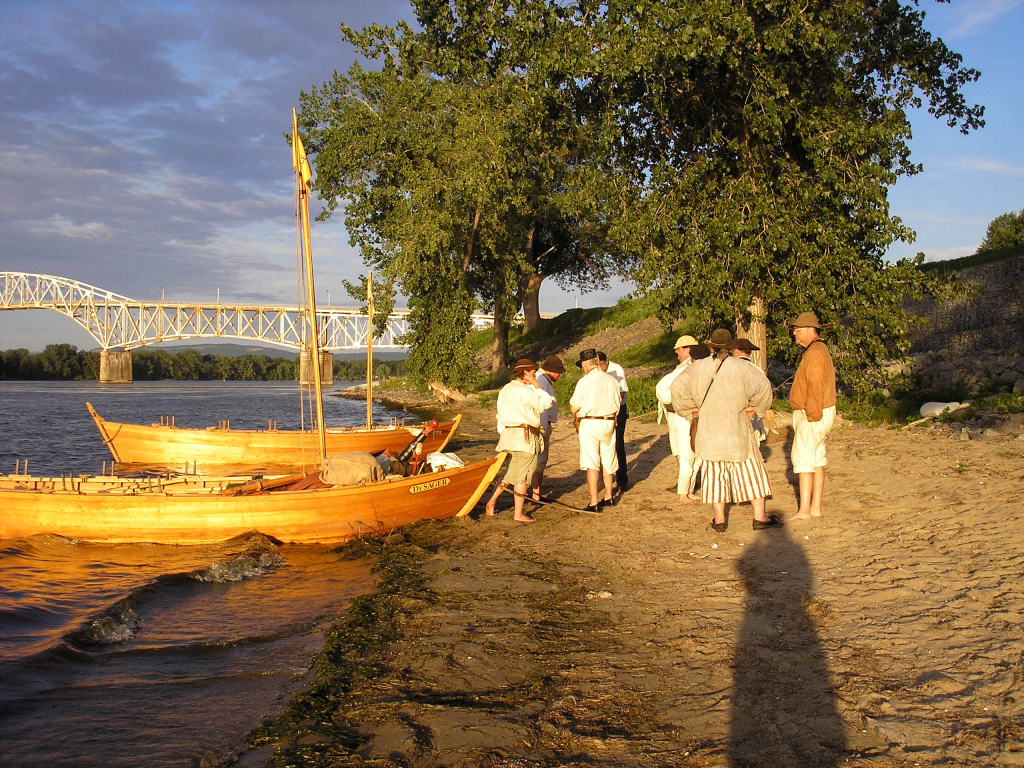
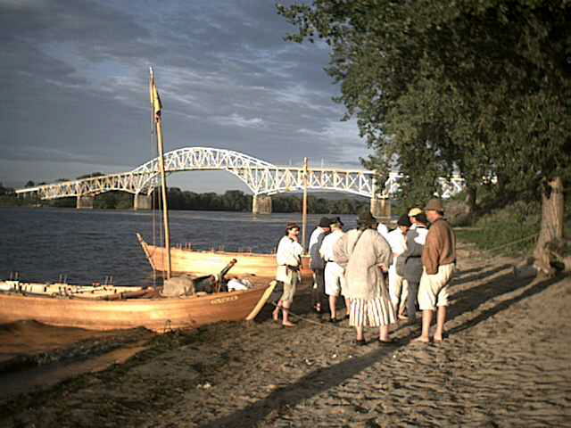
There is a visitors' center and historic site on Roger's Island. In 2003, we rowed the DeSager 62 miles from the Mabee Farm in Rotterdam Junction to Roger's Island. By starting at Roger's Island on this trip, we will have rowed all the way from the Farm to Vergennes.
Although the woman I communicated with at the Roger's Island Visitors' Center was very cheerful and excited about having us start there, the center closes at 4 p.m., and no one was present to greet us. The center was all locked up and deserted. In some ways, it was a bit eerie.
We drove both boats to the sand boat launch at the northern end of the island, launched them without incident, and rowed them the third of a mile down to the dock next to the visitors' center. I say without incident, though there was a very drunk man drinking Zima who spoke incoherently at us.
We returned the trailers to the visitors' center, backing them against a row of trees so that they would be secure. We knew that Gary and other people at the Farm would want us to secure the trailers, and this was easier and more effective than locking them up.
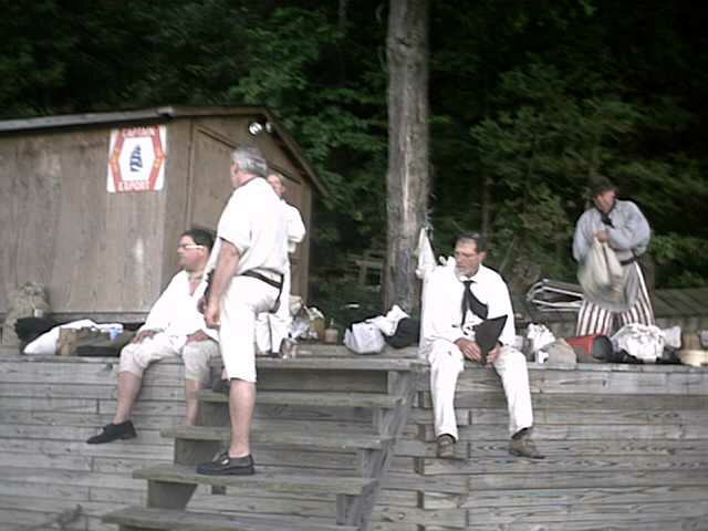
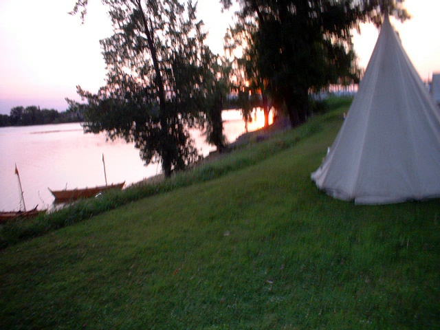
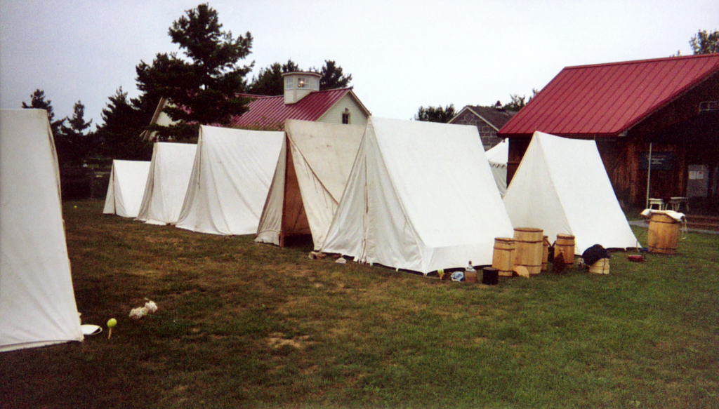
As we were still in modern clothing, we decided to stay 'modern' for dinner. Ed, Kevin, and I went and fetched some pizzas. We milled around eating, setting up camp, and talking. Our camp was a typical row of white wedge tents overlooking the dock and the two boats below.
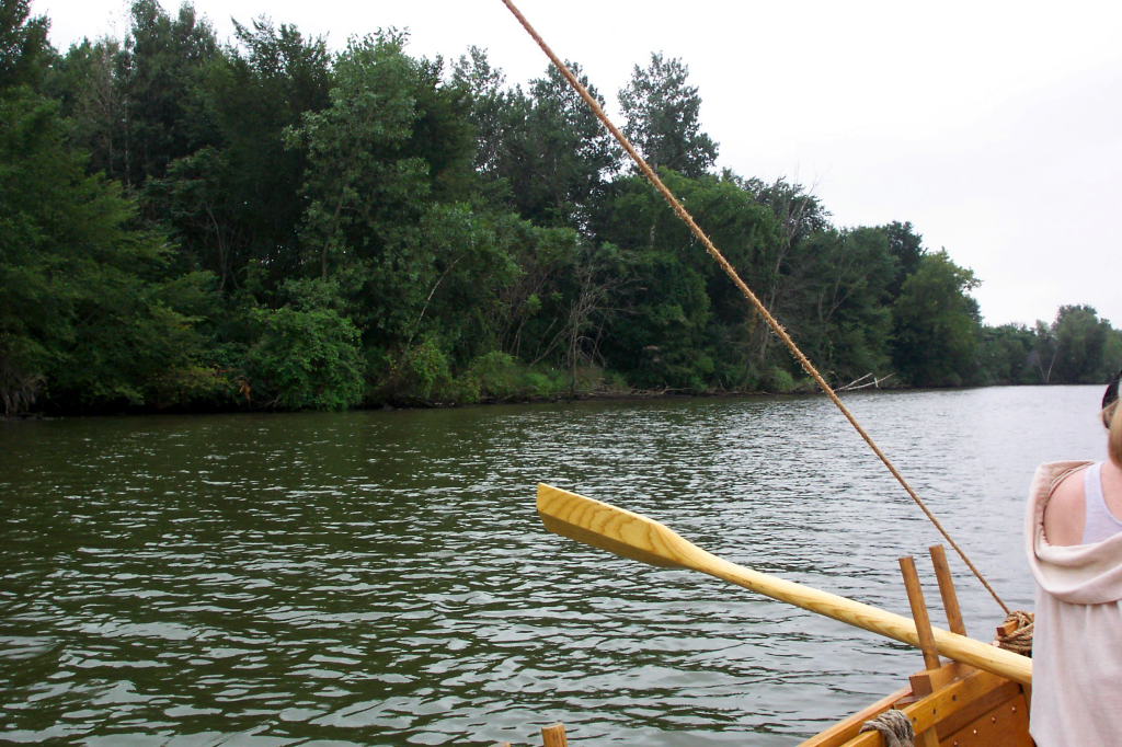
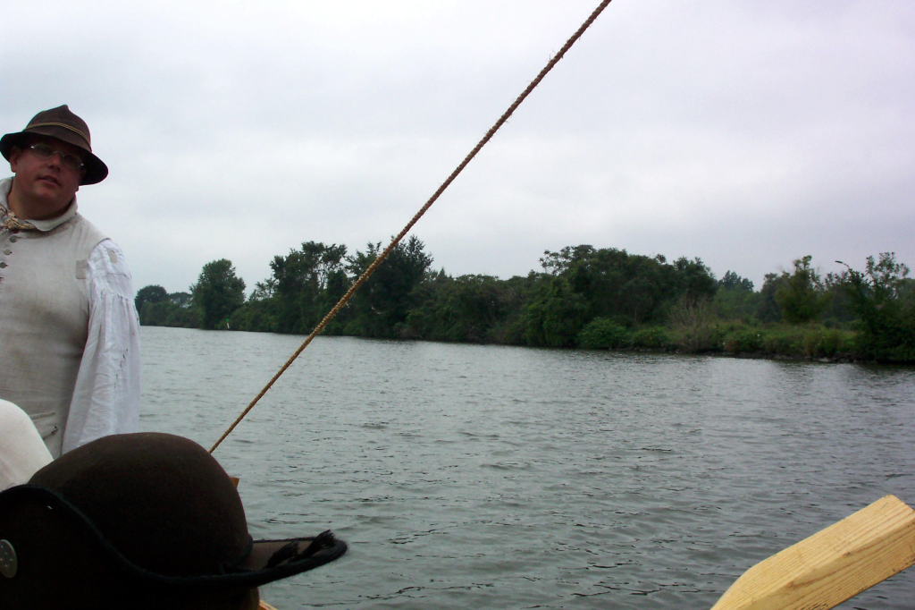
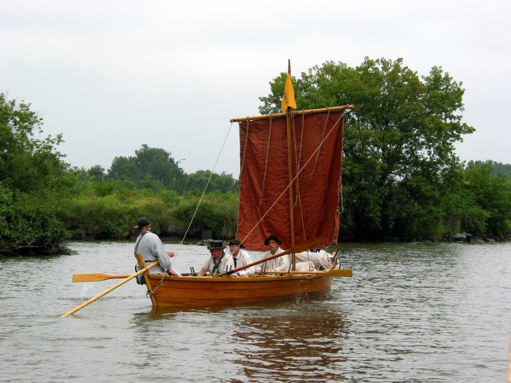
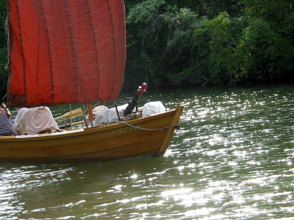
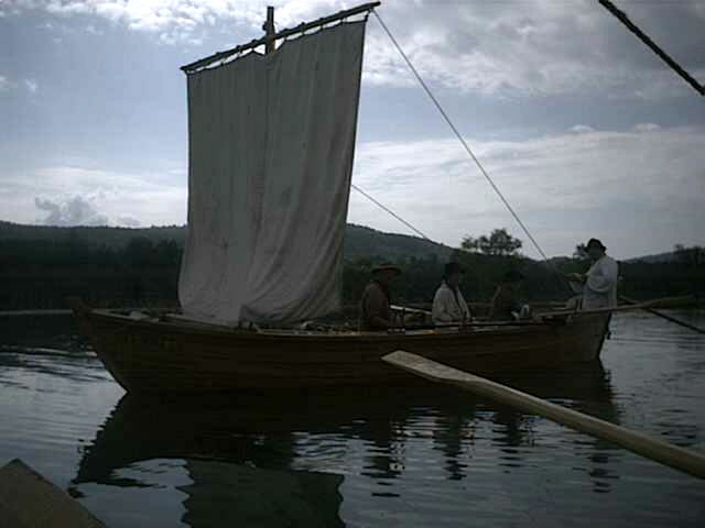
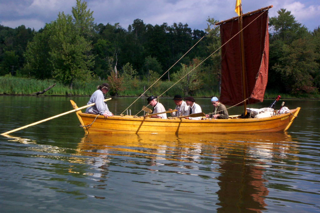
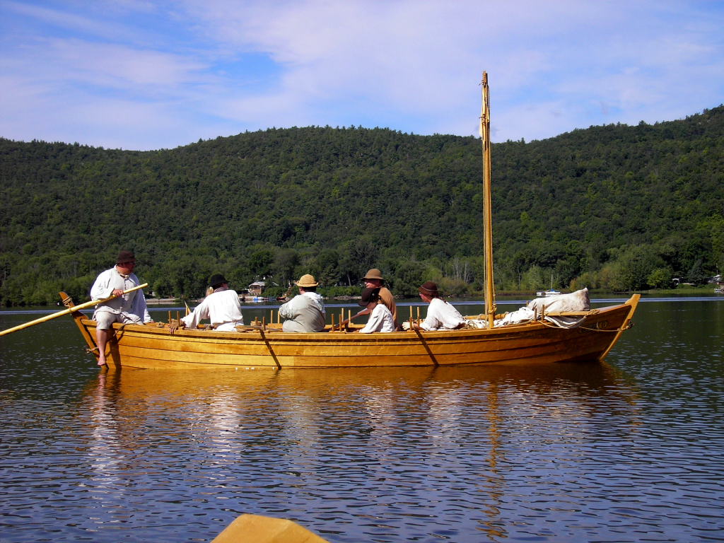
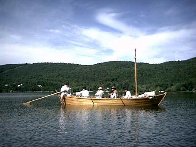
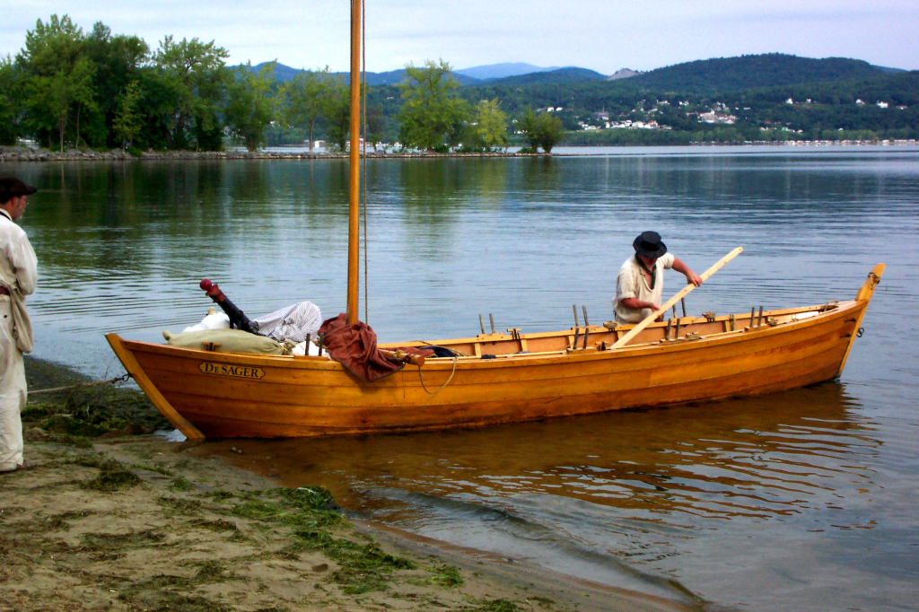
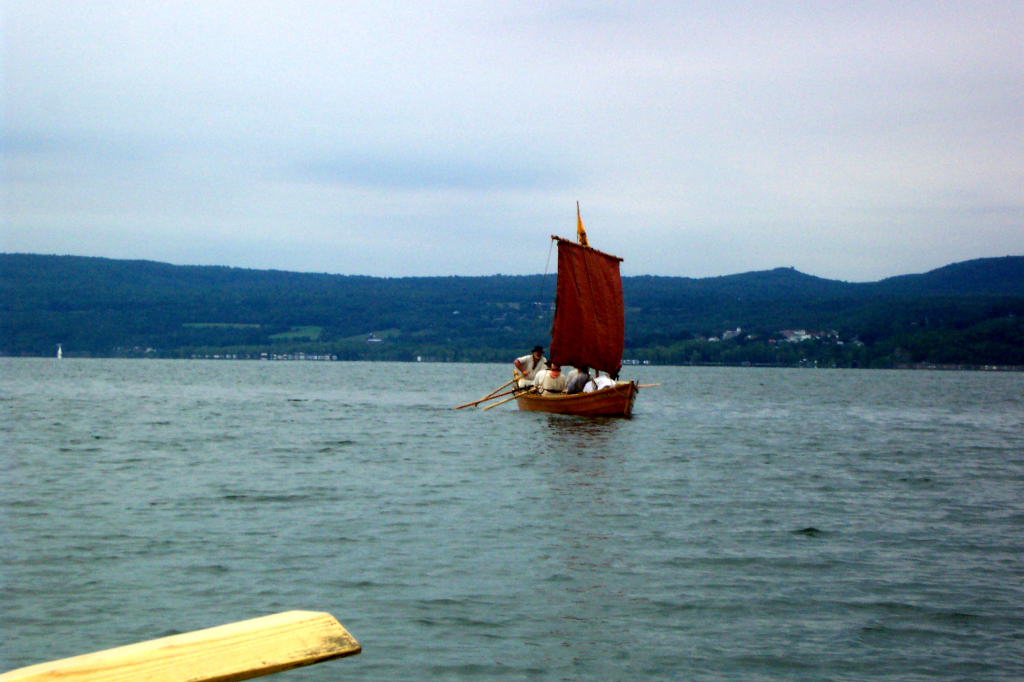
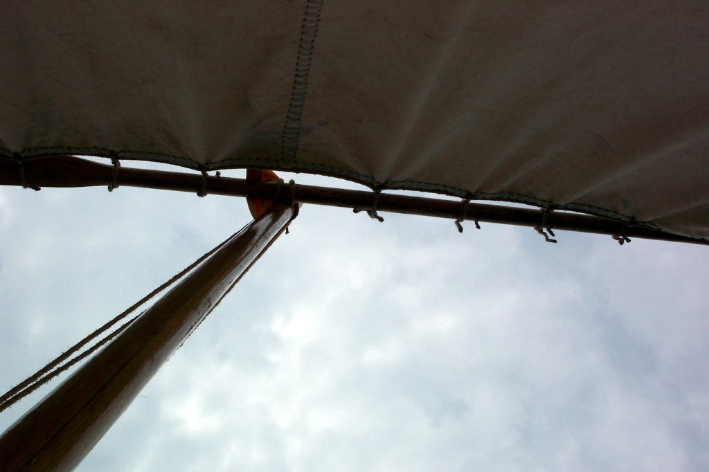
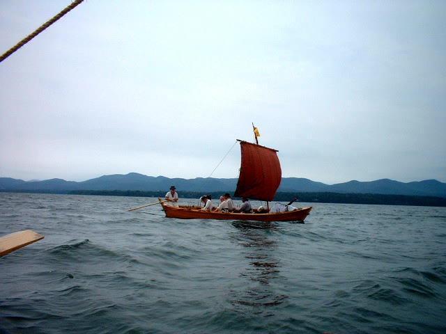
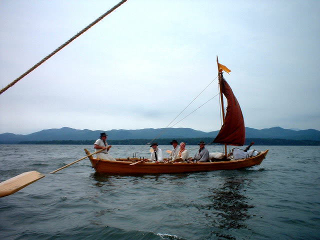
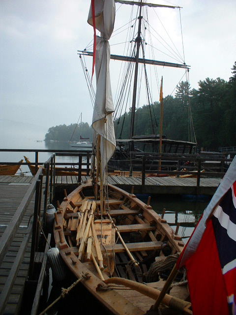
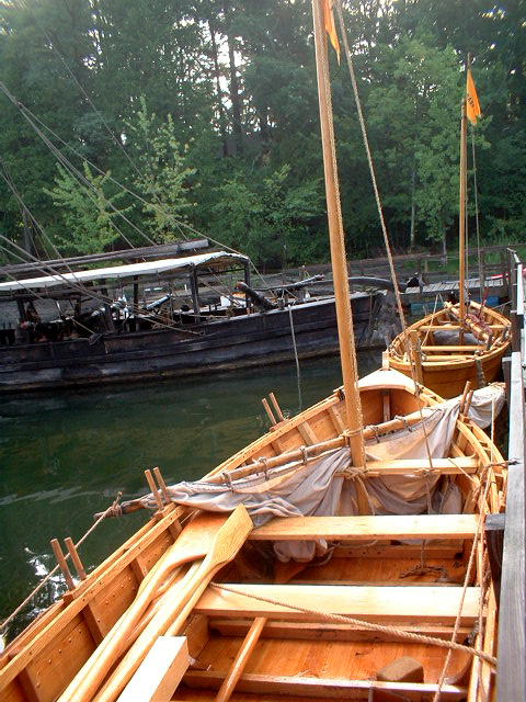
I rigged both boats. For the DeSager, this is an easy process. Last year I made a yard and sail for the boat. Rigging involves stepping the mast, making sure it is placed through the parrel holding the yard and that the halyard is run through the sheave at the top of the mast. The sail in then unfurled, leaving the furling gaskets aft of the sail for use as downhauls. The brace lines at either end of the yard are made to the aftmost cleats, and the sheet lines at either clew (bottom corner) of the sail are made to the next cleats forward.
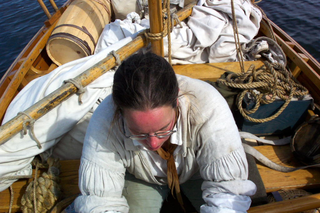
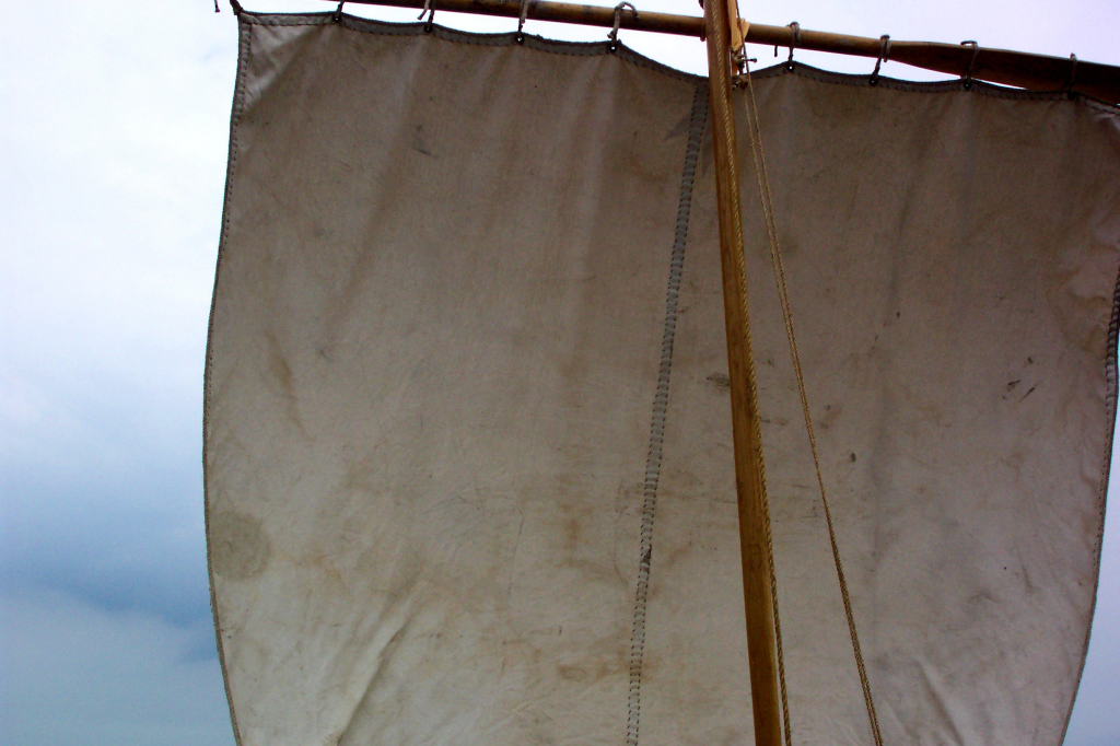
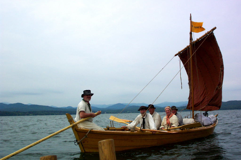
The Bobbie G doesn't have her own sail yet. In truth, she doesn't really even have a yard. Reb borrowed a 10 foot by 10 foot sail from Paul Daiute, and some 10-foot oars from Erle Morse. I had prepared a variety of lines for rigging this sail. One oar was secured to the mast as a yard using an improvised halyard that also functioned as a parrel. The sail was then tied to the oar using a set of ties that Paul had fashioned into the sail. The head cringles (top corners) were secured to the ends of the yard using tarred marline. The braces were affixed to the ends of the oar, and the sheets to the clews of the sail, and all brought aft to their proper cleats. This rig functions well enough, though tends to get strangely tight or loose as time passes.
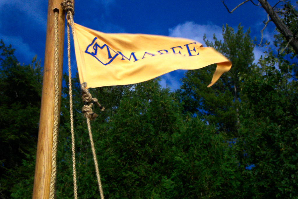
We ran up the Mabee Farm pennant for both boats. The pennants are both yellow with blue text, and are swallow-tailed. The text is a stylized M taken from an old branding iron found at the Farm and the word 'MABEE'.
The DeSager has a pennant staff affixed to the top of the mast, allowing the pennant to fly proudly above the sail, even when the sail is hoisted. The Bobbie G doesn't yet have a pennant staff, leaving the pennant at the same height as the sheave in the mast. When the sail is hoisted, the pennant is somewhat fouled.
While we finished dinner, Mike stopped by along with his son. Mike is a reenactor who joined our group earlier this year. He lives near to Rogers Island, and came by to see us off.
After dinner was over and Mike had departed, we set off to spot cars in various locations. We had to leave one vehicle in Whitehall and one at Chipman's Point, so that two different people who were rowing with us for one day only would be able to get back to their own cars. This seemed like it would be even more complex, until we realized that someone would meet us at LCMM with a car, so we didn't need to leave one there. Harvey, Reb, and I set out, leaving her truck and my car and returning in Harvey's van. It was a long tedious operation.
While we were away, Dawn arrived. Dawn is a slight woman from New Paltz. She's part of the First Ulster County Militia reenactment group. The Ulster's are sort of sibling reenactors to us in the Second Albany, and we often work and play together at events. Dawn has been rowing with us a few times before, but not often as she lives at a distance.
We retired to our blankets for the evening. I, for one, would be mightily glad once we were underway.
 |
 |
 |
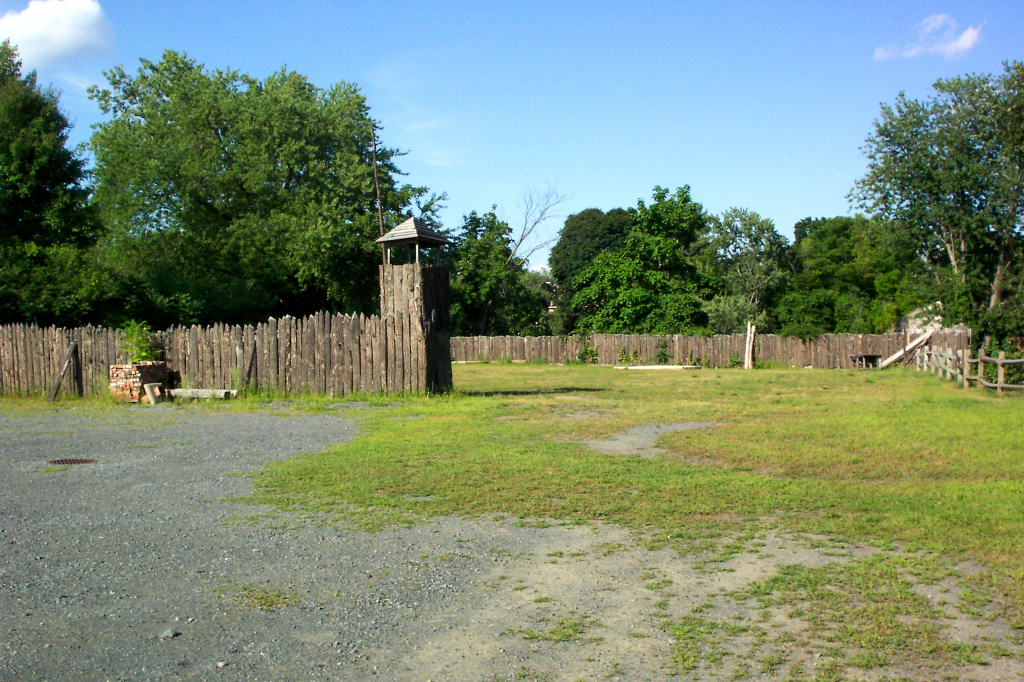 |
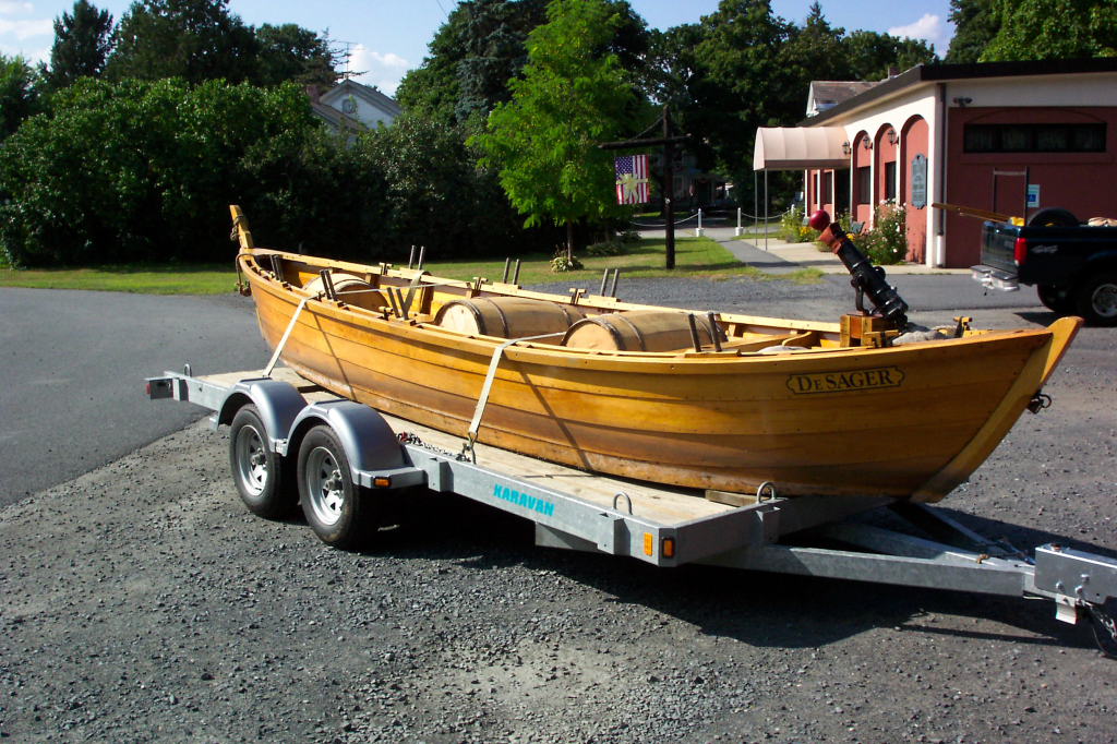
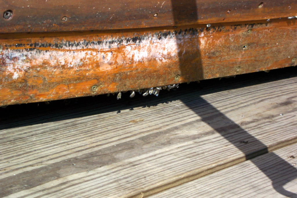
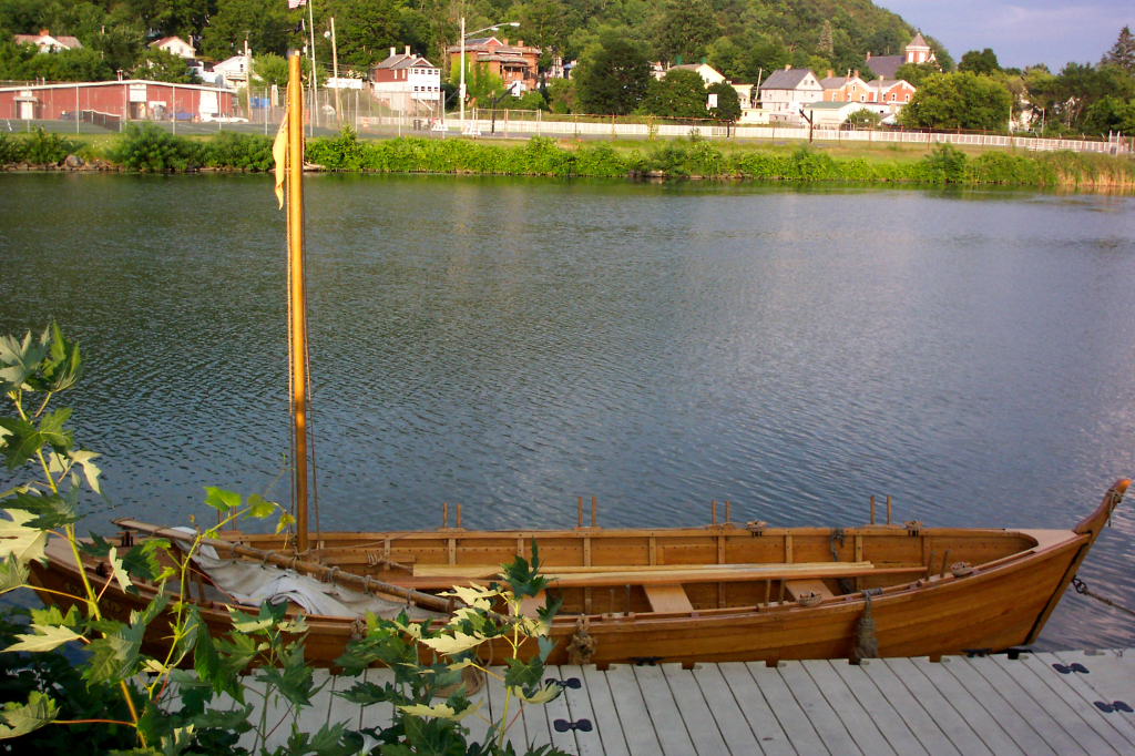
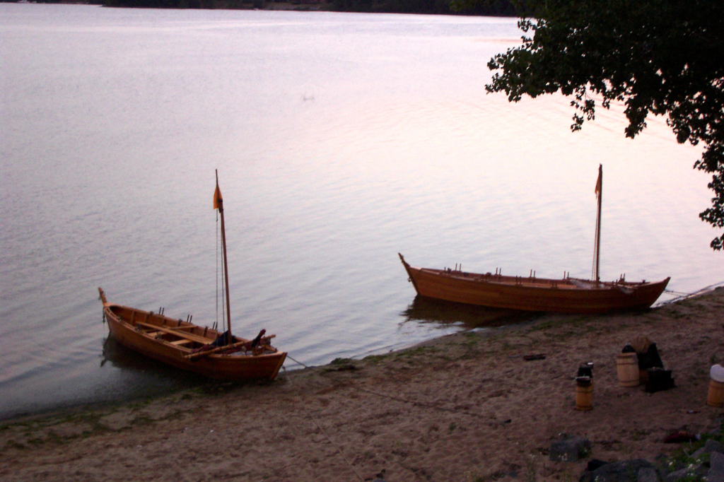
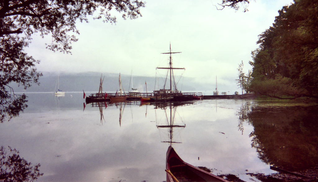
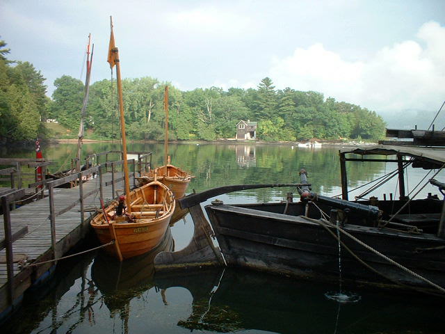
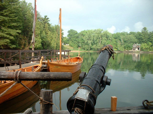
| The DeSager on the Mabee Farm's trailer at Rogers Island | The Bobbie G on Gary's trailer | Mussels on the DeSager. These accumulated at our dock | The stockade on Roger's Island |
Our longest day mileage wise.
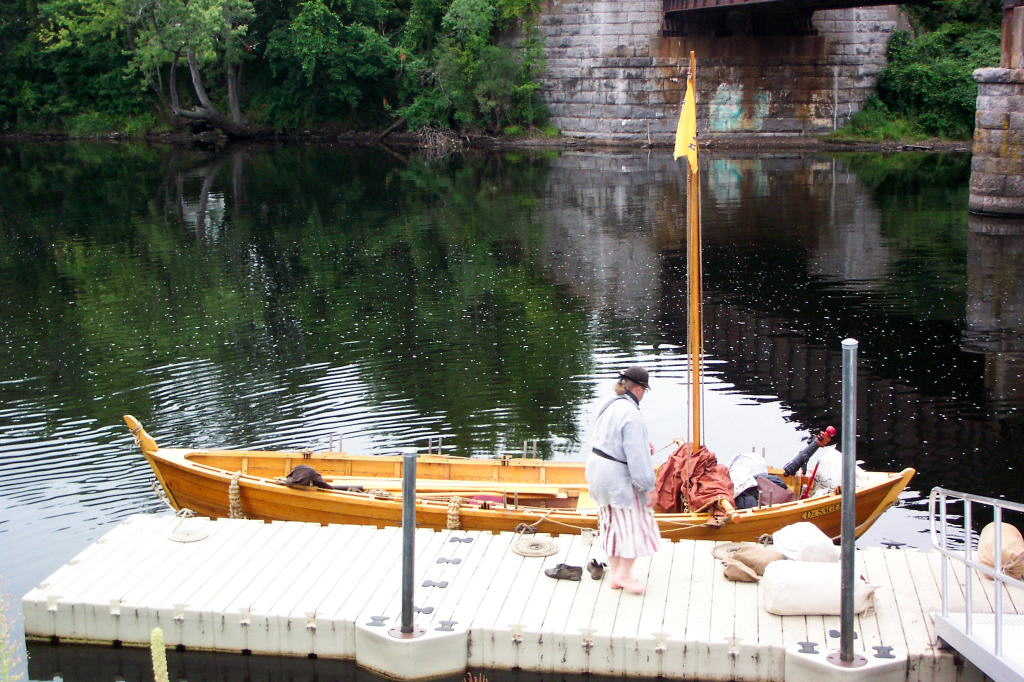
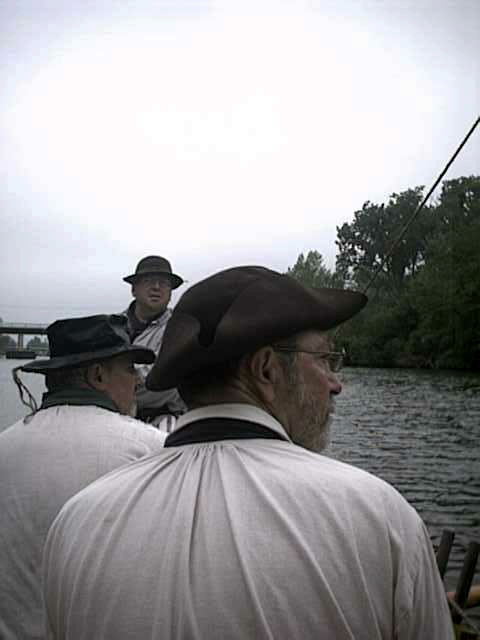
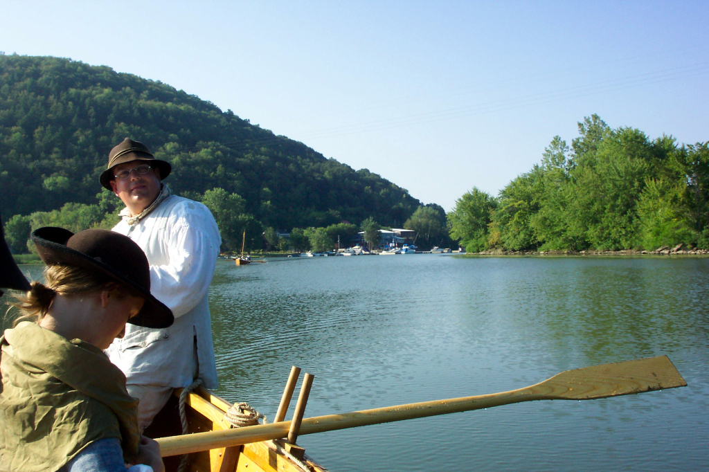
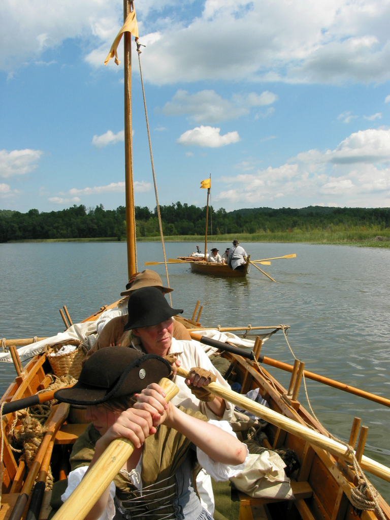
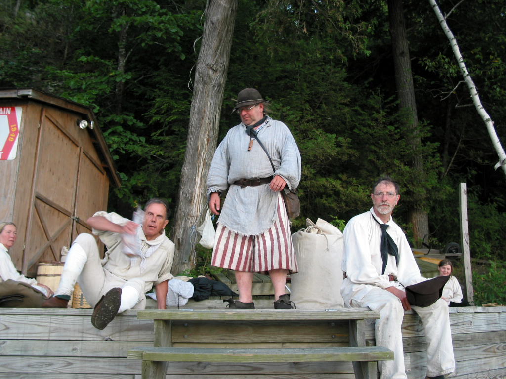
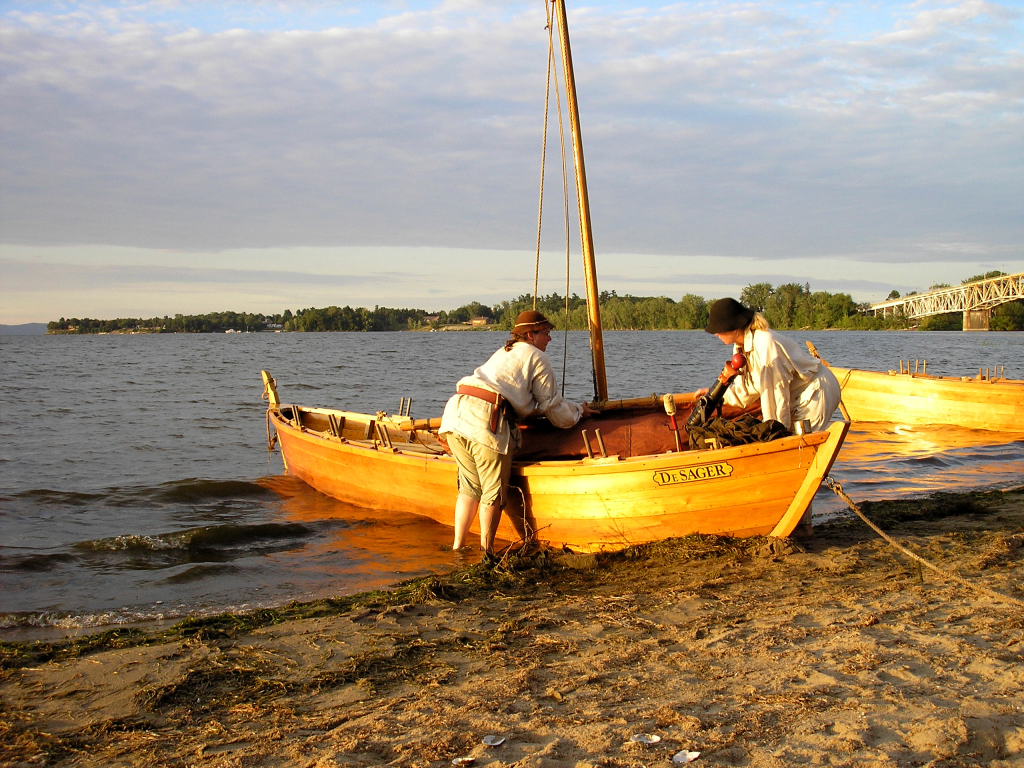
Up around 6. I've told people that our official start time is 7:30. Everyone is now in 18th century gear and will remain so for the rest of the trip.
As the dock is practically beneath a railroad bridge, we hadn't slept as well as we might have - the trains accelerating overhead at 3 a.m. were not conducive to sound slumber.
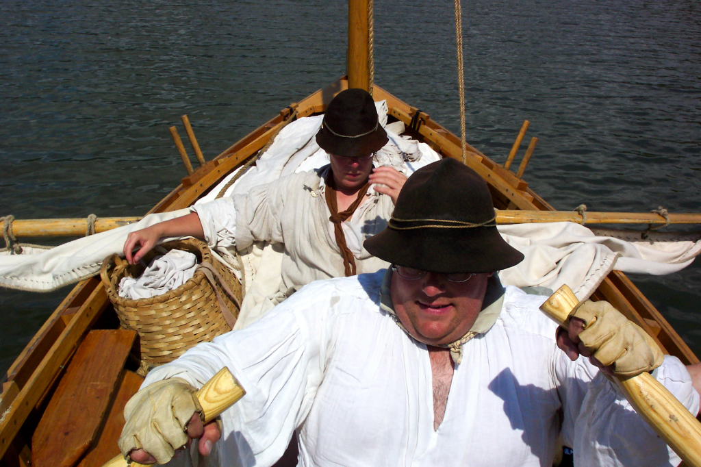
Almost as soon as I'm up, Dave W. arrives. Dave joined our boat crew this spring, and has become one of our regulars. He's a very strong and capable fellow with a ready laugh and smile. I've asked him to be Bows for the DeSager on this trip.
We cook up a breakfast of sausage and eggs. Two pounds of sausage, a dozen eggs, and a pot of coffee seems to satisfy our crew of nine. We cooked on a brazier - a cast iron box filled with charcoal. We are using lump-style charcoal, though are cheating in how we light it.
Camp is struck and the boats are packed. This is a much more time-consuming affair than it was last year. I don't know if this is because we have some people who are new to boat trips, or just because we have a larger crew, but it is somewhat vexing.
While we are getting ready to go, Ann showed up with her little black dog to see us off. Ann is a frequent rower on our Tuesday-night rows. She can't join us for the trip, unfortunately.
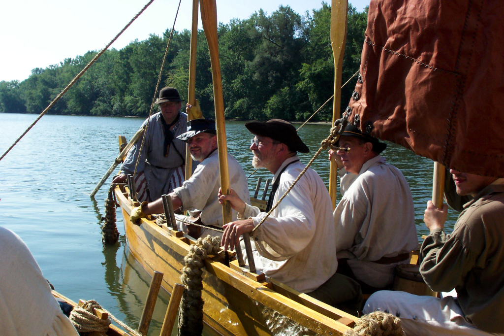
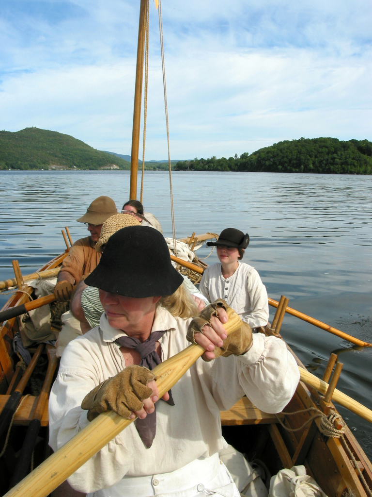
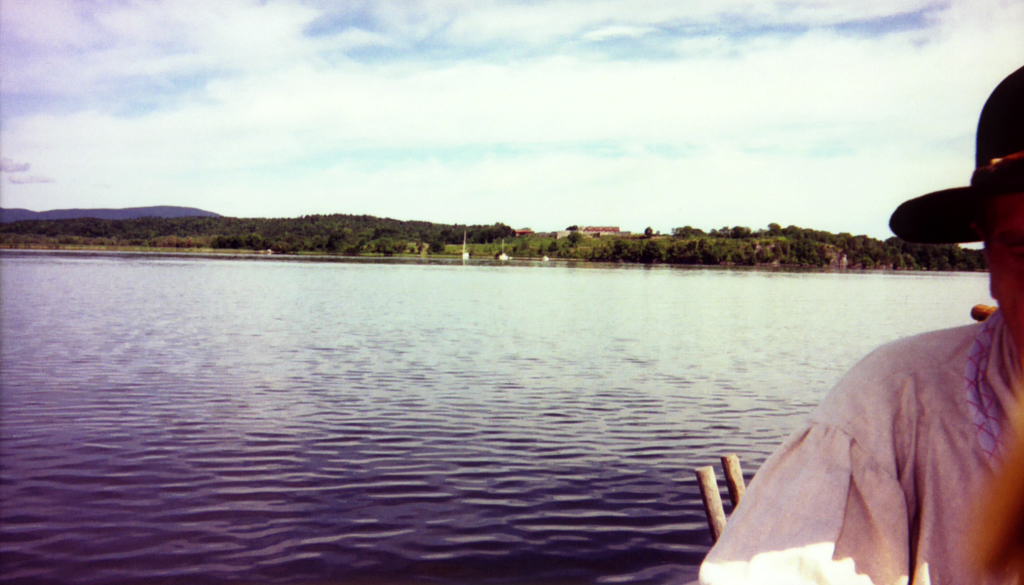
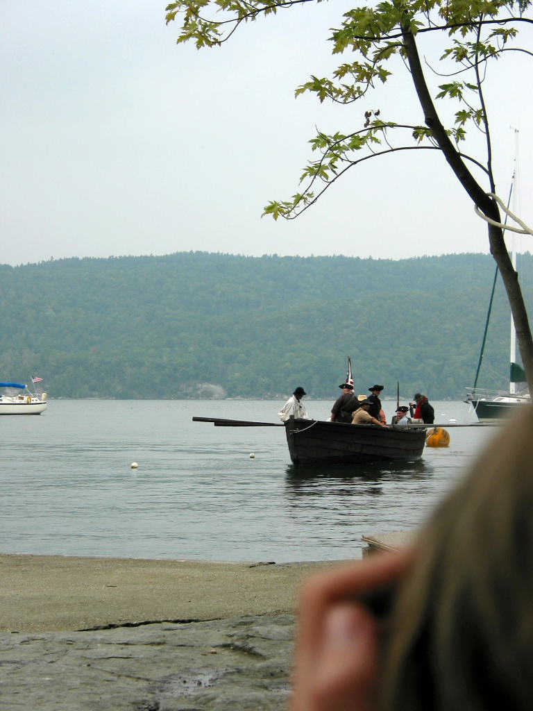
We launch around 8 a.m., both boats setting out in the fast current flowing south. I'm captaining the Bobbie G with Mary, Dawn, Ed, and Reb as my crew. Kevin is captaining the DeSager with Dave W., Harvey, and Bill as his crew.
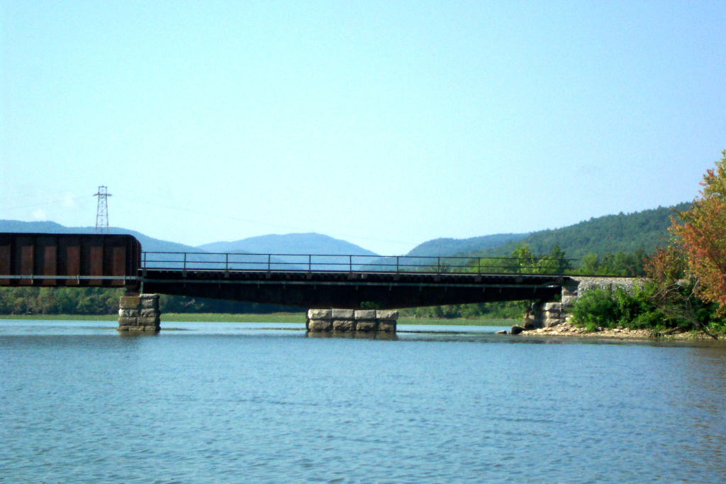
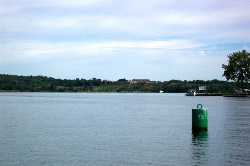
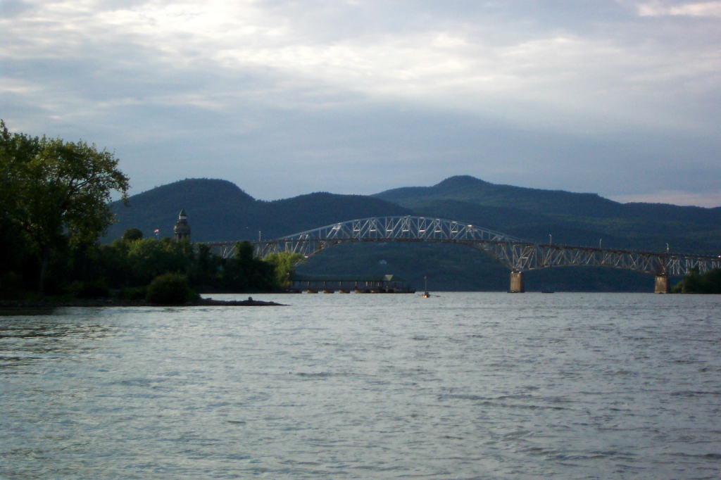
In short order we are at the southern end of Rogers Island. The Hudson River flows south, splitting around the island, and continues on down to Albany and New York City. Just at the southern end of the island, the Champlain Canal separates off from the Hudson. Between Troy and Rogers Island there are six locks. Northward on the Champlain Canal, there are five more locks, the first of which is here at the tip of the Island.
The Champlain Canal roughly follows the original 18th century portage between Fort Edward and Fort Ann, then follows Wood Creek which flows from Fort Ann to the southern tip of Lake Champlain in the town Skenesborough or Whitehall. In wet seasons, the portage was only a few miles. With the modern barge canal (constructed at the beginning of the twentieth century), neither the portage nor Wood Creek are especially identifible. Using the locks, the process is much easier, though in the eighteenth century, a bateau crew would have paid some local residents to trailer their boat across the portage.
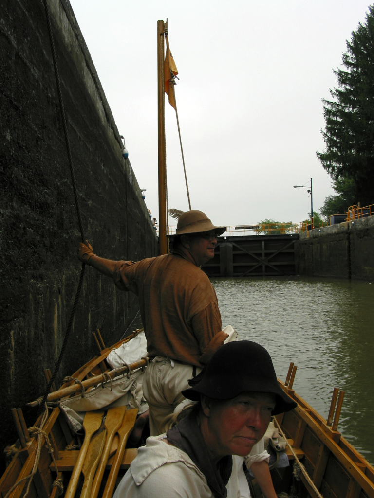
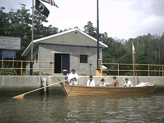
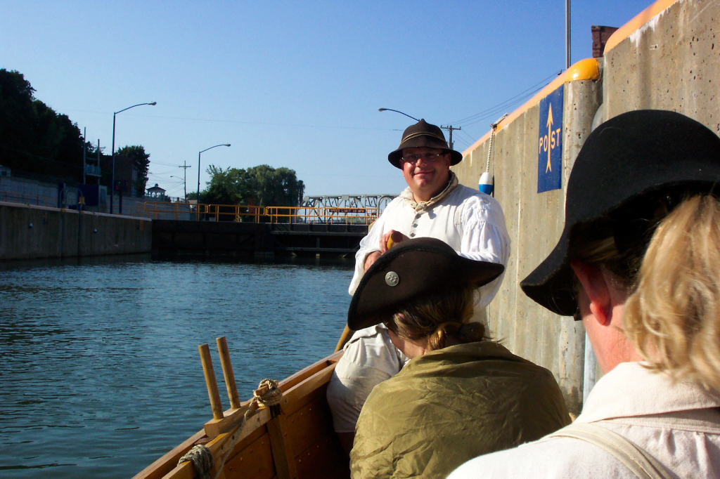
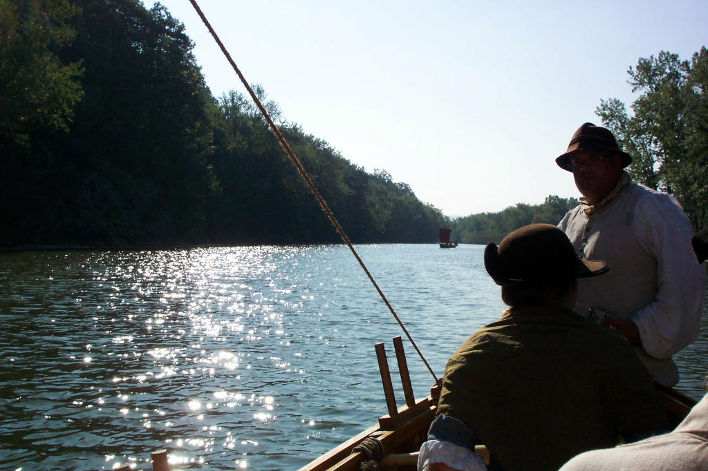
I use my VHF radio to call the lock. This is lock C-7 (Champlain Canal lock number 7). It is a long concrete edifice, with its western wall along the Hudson River. The VHF radio isn't correct for the eighteenth century, but neither are the locks. In the past I've tried using my tin horn (a period boat horn) to call the locks, but it is nowhere near loud enough. Even a compressed air horn is often too quiet to work. The VHF radio gets the job done, and the gates of the lock swing open. We row our two boats into the lock chamber.
The locks are large - capable of handling a ship 300 feet long and 43.5 feet wide. The lock masters are generally a cheerful bunch who are happy to lock us through. The lower gates close and water bubbles up from below, filling the chamber. 10 feet higher, the upper gates open, and we row out.
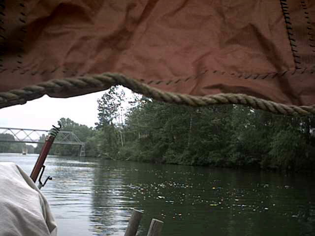
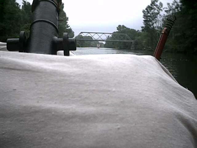
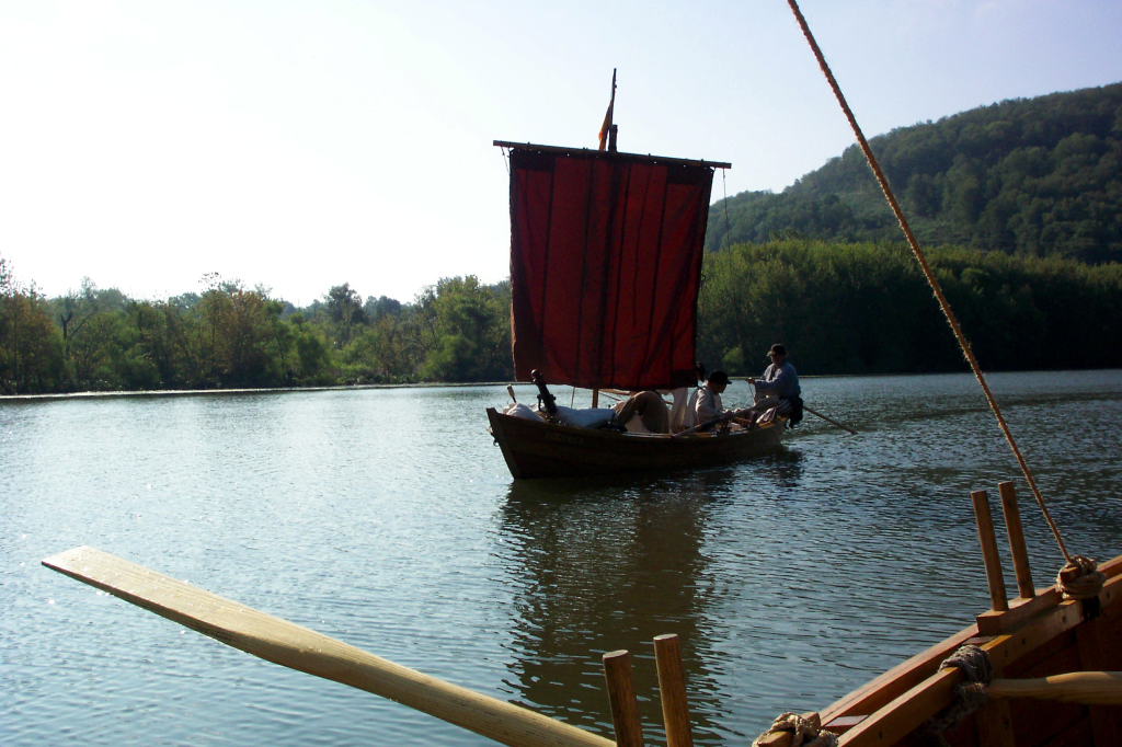
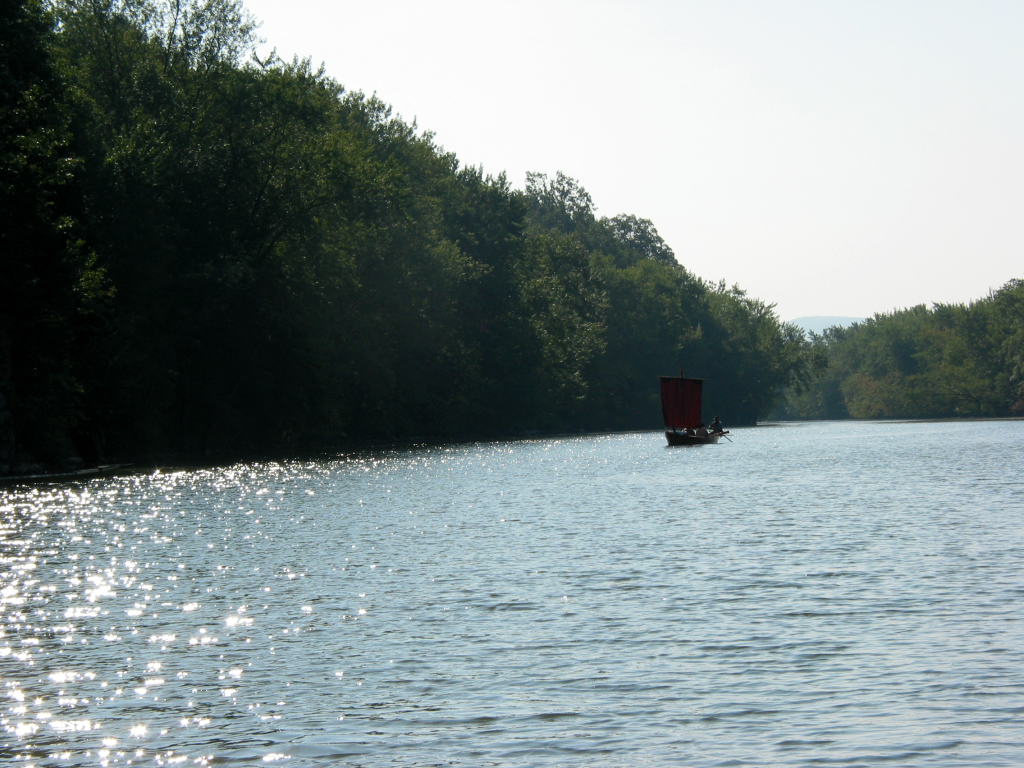
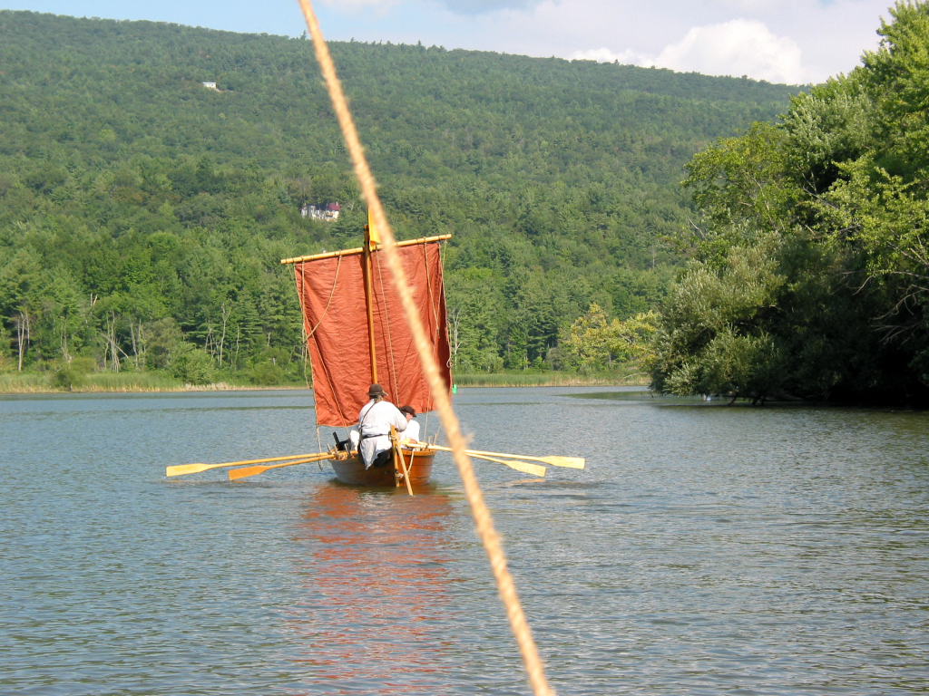
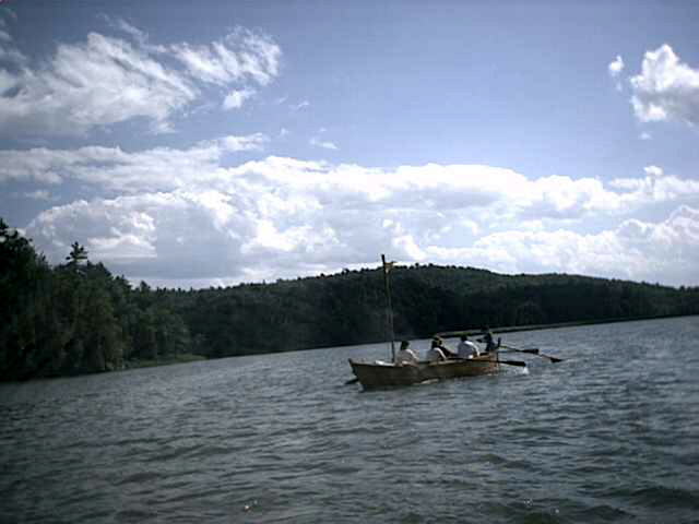
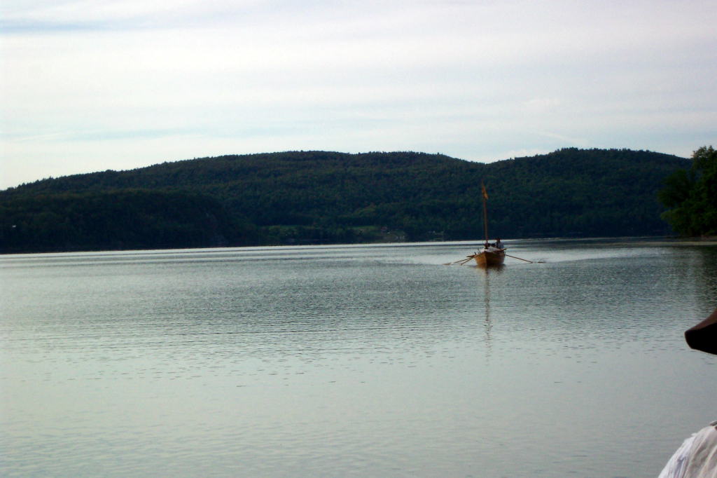
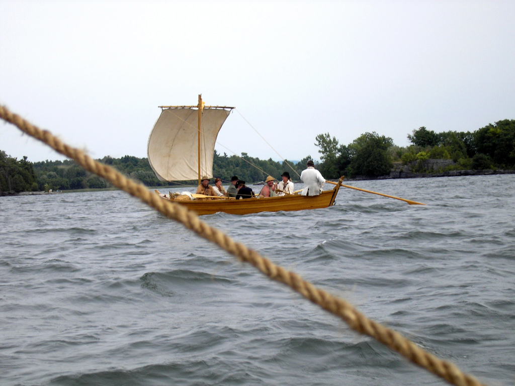
Shortly out of Lock C-7, we feel a slight south wind blowing. The sails are raised. For most of the day, the sails are kept raised. Occasionally a gust of wind helps speed us on our way. More often, the sails hang limp against the masts. As long as the sails aren't an impediment, we leave them up. The sails make the boats appear very striking, especially the DeSager which has a red sail.
A relatively quick two miles brings us to Lock C-8. We doused sails before entering the lock chamber, as the wind was non-existent. Naturally, the wind appeared to spring into being as soon as the sails were down, and continue blowing strongly while we ascended 11 feet in the lock chamber. We tried sailing the Bobbie G out of the lock, but the wind died before we had gone a hundred feet, and we resorted to rowing.
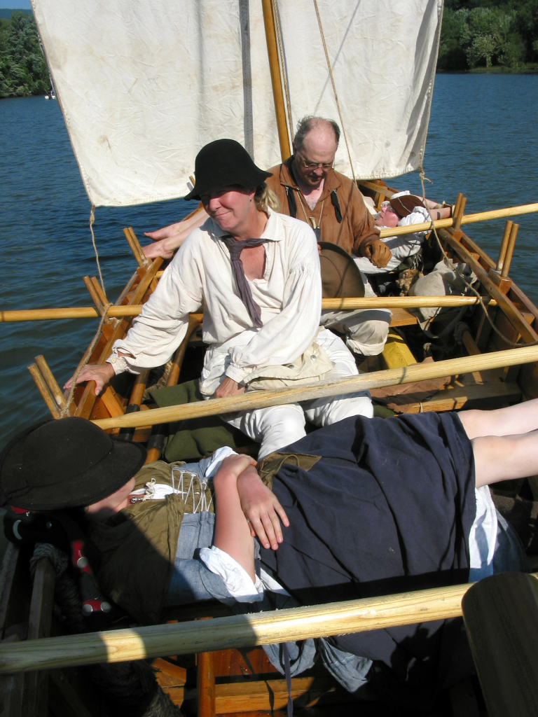
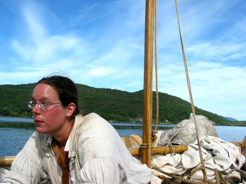
Two facts became clear as we continued to row along the canal. The first was that the Bobbie G contained all the people who felt like singing during the boat trip. Although we started with eighteenth century nautical songs, we soon ran out of those. 'Cleaner' rugby songs soon followed, as Mary knew many of those (she also demonstrated that there were much coarser songs that she avoided). Ed contributed with a variety of songs that were from down south. Eventually, the songs would range quite far afield.
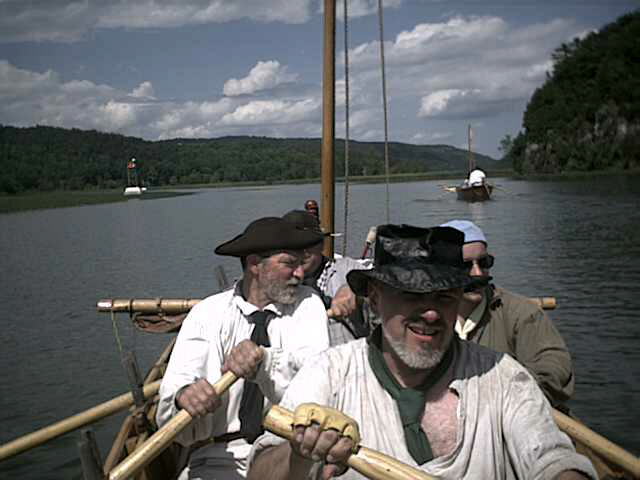
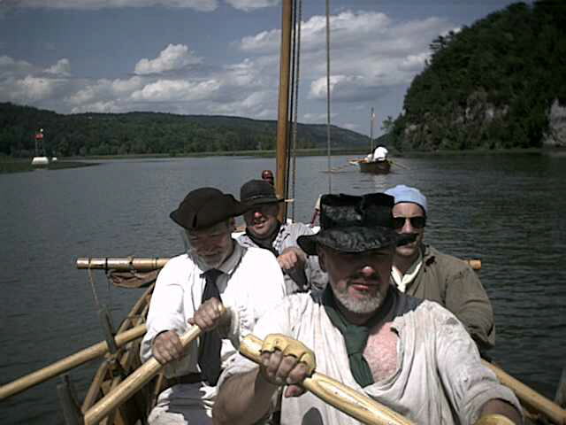
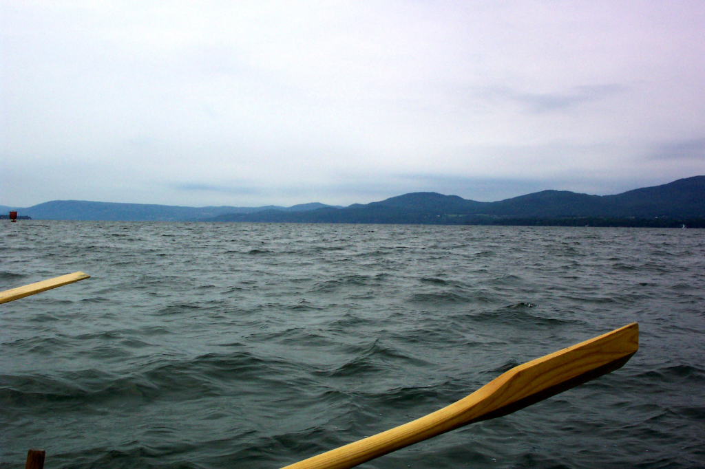
The second fact was the importance of quality oars. We have a varied collection of oars. There are 5 pairs of oars of various lengths for rowing or sculling either boat. Some are made of ash, which are wonderful. Our older oars are made of cedar, which are very weak and springy. We refer to these derogatorily as the 'rubber' oars.
In addition to these five pairs of oars, we have three steering oars. Two are cedar (the original supplied equipment), and one is ash (made per my request). The older cedar steering oar bends very alarmingly, and is very hard to use as a consequence. The newer cedar steering oar isn't as floppy, but still isn't nearly as good as the ash steering oar.
Today we have the Bobbie G outfitted with the two 10-foot ash oars, the two 8-foot ash oars, and the better of the two cedar steering oars. The DeSager has the two 9-foot cedar oars, the two 7-foot ash oars, and the ash steering oar. With all ash rowing oars, the Bobbie G handily outdistanced the DeSager for the same amount of rowing effort.
A short distance up from Lock C-8, we passed the heighth of land. Hereafter, our journey is technically downstream. There isn't enough of a current in the canal to make a noticeable difference, and there is even less current in Lake Champlain. The Glen Falls Feeder Canal passed by on our left, and 'down' we went.
The travel between locks C-8 and C-9 was somewhat slow. The Bobbie G was in the lead, and we kept waiting a bit for the DeSager. The DeSager thought we were intentionally resting, and would slow up. As such, we got to lock C-9 around 11:30.
Teresa was waiting on the lock wall for us. The lockmaster was nice enough to let her climb aboard while we were in the lock chamber, which is usually strictly forbidden. T climbed down into the DeSager just as the lock begin to empty.
Teresa is a tall, lean woman who comes to a fair number of reenactments. She hasn't done as much rowing as some of our other crew, but is very cheerful and energetic when she does show up. T (as she's often called) lives somewhere vaguely near Albany. She joined us for the rest of the day's row.
After a 16 foot drop, we rowed out of the lock. We stopped immediately at the long, capacious dock that extended out from the lower western lock wall. Here we took a break, primarily for use of restroom facilities.
The restroom at Lock C-9 is bizarre - there are two toilets, side by each in the same room, with no dividers or walls of any sort between them. I wonder what the designer was thinking when it was constructed.
Back in the boats, we continued on our way. Here and there the original Wood Creek joined and departed the Canal. It is but a shadow of its former self, as the main current flows in the canal, and there is no significant water to keep the creek's channel clear.
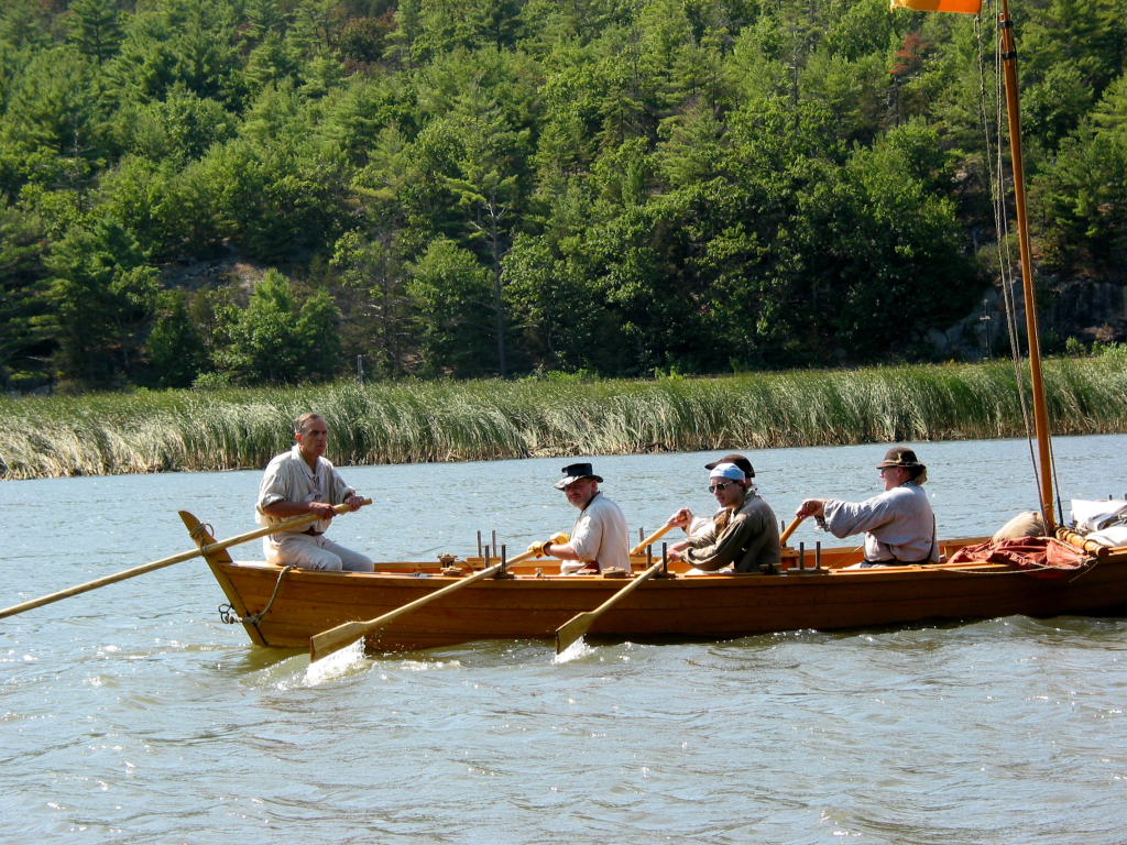
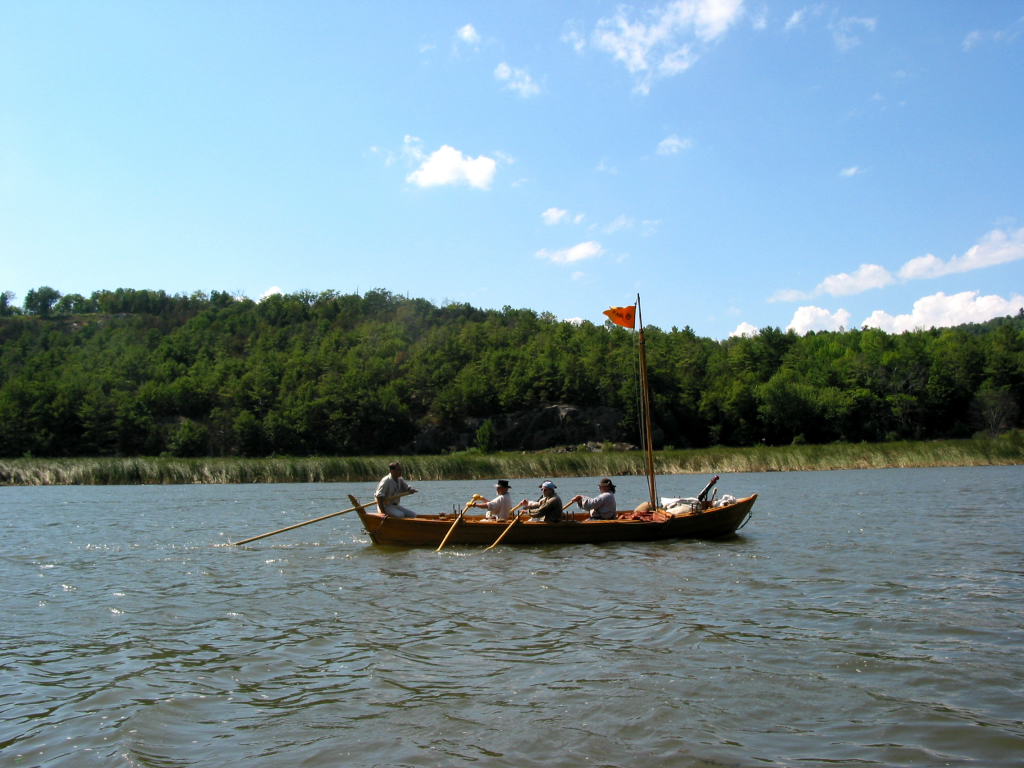
Shortly after departing Lock C-9 we had a moving lunch. As with years previous, I took up a set of sculls (the 8-foot ash oars), and rowed the boat while we ate. Mary steered for this section, and Reb handed out apples, sausage, cheese, and bread.
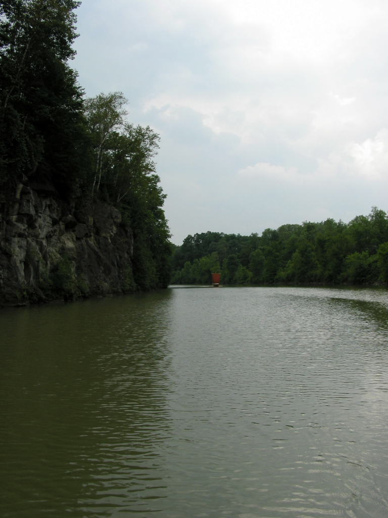
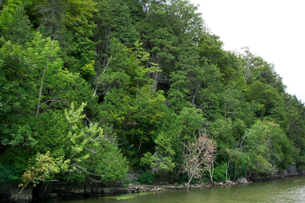
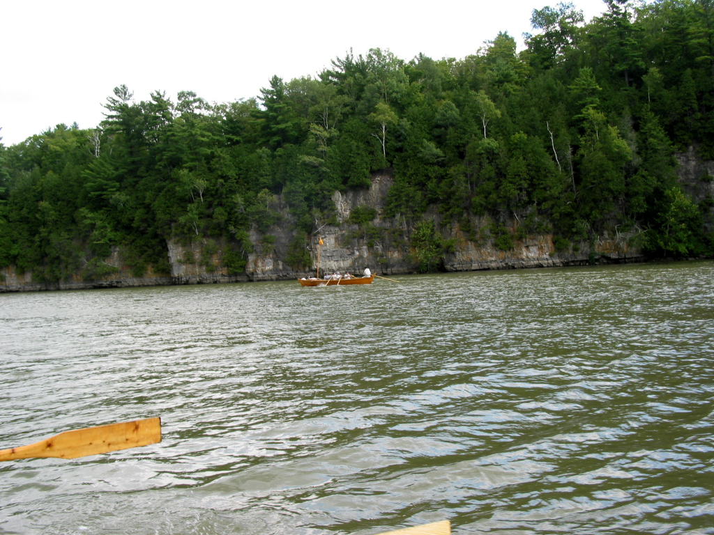
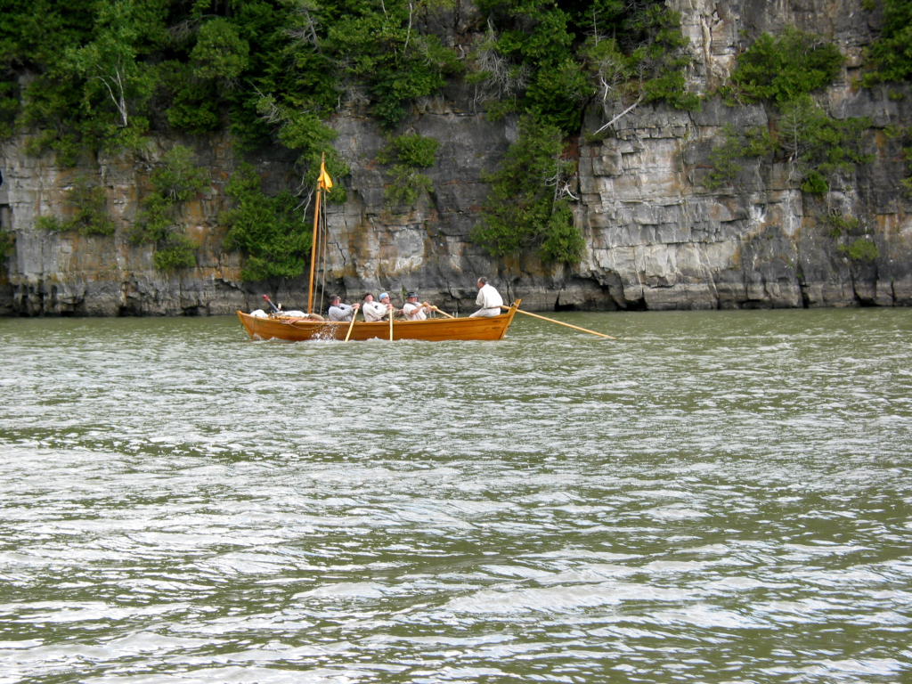
The stretch of canal between Lock C-9 and Lock C-11 is comprised of long straight sections with gentle curves between them, and only the occasional bridge or creek to break up the scenery. The western side has a railroad track winding along it. The eastern side begins in woods and gradually builds to interesting and pleasant cliffs.
The cliffs just north of Fort Ann are perhaps the most scenic of the lot. We were treated to the view of the DeSager coming up behind us along side the cliffs. If one ignored the flat area that connoted the railroad on the west bank, and also ignored the occasional channel marker, the canal looked nearly wild. This is hardly the case - the channel is dredged to 12 feet of depth and 120 feet wide. My charts claim that the canal is officially 75 feet wide in some sections and 200 feet wide in others (depending on the terrain), yet my measurements seem to be closer to 120 feet.
Above Lock C-11 there is a wide marshy area and a small island. The eastern side of the island leads to a dam, and is well marked as a prohibited area. The western side rounds the island and arrives at the lock. I called the last lock of the day on the radio, and they opened promptly for us. Down 12 feet and out into a very long straight away.
All day, the Bobbie G had been keeping ahead of the DeSager. I believe this was almost entirely due to the oars. The crew, Dawn especially, wanted to beat the DeSager to Whitehall, as we had been leading all day and it would be disappointing to be passed in the last few miles. We steadily pulled ahead.
Soon the bridges of Whitehall came into view, then the docks. There was a large amount of small boat activity at the boat launch. It turned out to be the boy scouts, out for an evening paddle in a varied assortment of canoes and one small power boat.
One of the fellows in charge of the scouts was Dan Gordon, a reenactor who often attends the Rabble in Arms event at LCMM, and portrays a preacher. He recognized us, though it took me a moment to recognize him. We conversed briefly, and then he went off with his charges.
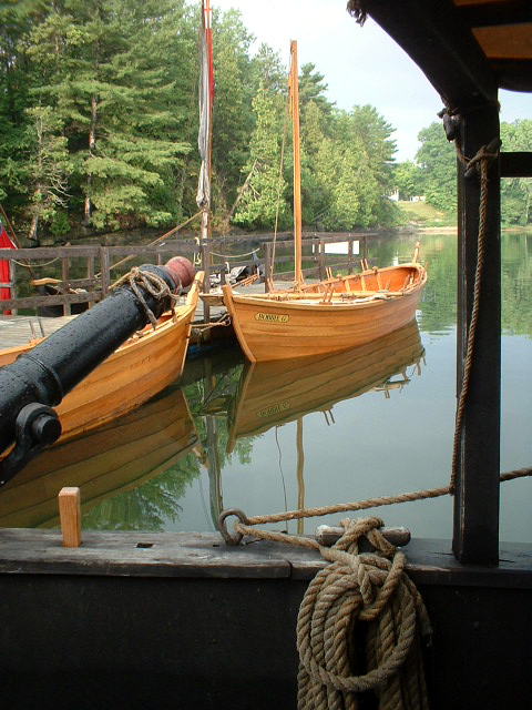
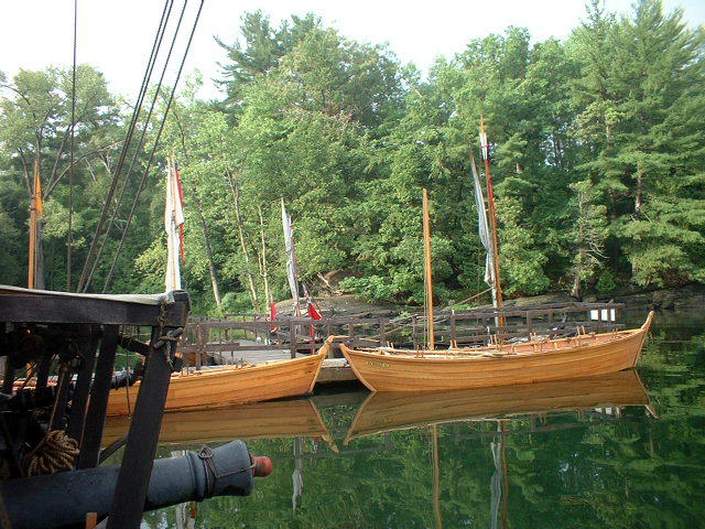
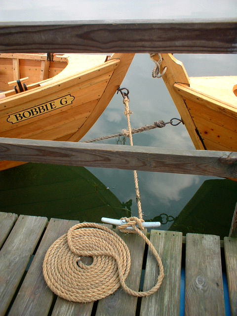
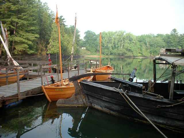
Our dock for the evening was the middle dock at Whitehall. The docks are low plastic affairs of the same make as the ones at Herkimer Home. Aside from a few broken plastic cleats, these are wonderful docks for our size boats. We pulled in and tied up neatly. As always, we flemished down our lines.
The DeSager was not long behind. She turned around before arriving at the dock, as we only have fenders on her starboard side (so far). A good run - we averaged very close to three miles and hour (I think a mite over), including going through four locks. Everyone appeared in good spirits and condition. The time was 6:20 or so.
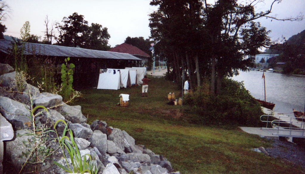
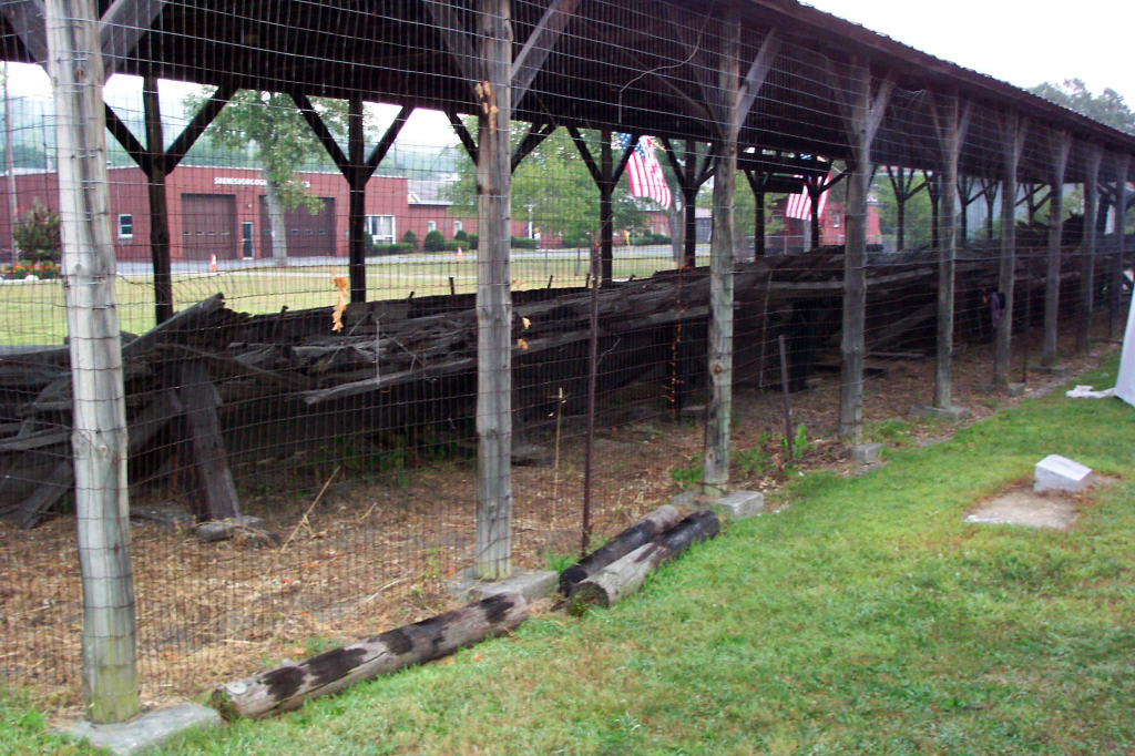
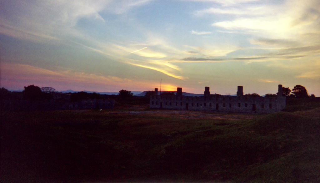
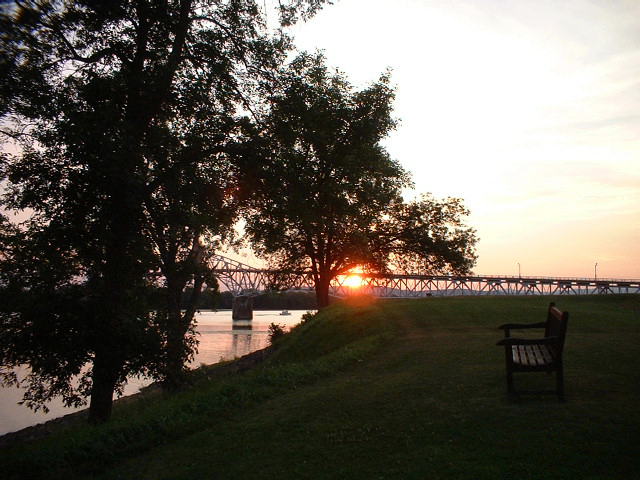
We set up camp between the waterfront and the remains of the Ticonderoga. The Ticonderoga was the flagship of Macdonough's fleet at the battle of Plattsburgh Bay. The battle was a naval engagement that occurred in September 1814, and resulted in a conclusion to the War of 1812. The Ticonderoga was a civilian steamship that was refitted for military use. The remains of her hull lie under a pole barn in Skenesborough Harbor Park as part of the Skenesborough Museum. It is a shame that there is no way to have preserved her for history.
We pitched our row of five tents facing the creek. The town had been gracious enough to leave the Chamber of Commerce pavilion open for us. It is a wonderful clean and airy facility, with nice bathrooms and showers. Additionally, good water was to be had in several spots. Altogether a welcoming accommodation.
We talked with several of the local people as we pitched camp and made dinner. There was a friendly man originally from Spain who was involved in the local park. There were several couples and singles who stopped by and talked with us. There were a few people from boats that had passed us on the canal during the day and were now docked at the terminal wall above Lock C-12 or at one of the marinas.
Dinner was chicken stew with vegetables, made with a 'portable soup' I had prepared. We cooked this on the braziers. We had more than enough, which is much better than having too little on a trip like this.
After dinner, Teresa departed, using Reb's truck to drive back to Lock C-9. Dan Gordon stopped by again and talked for a while.
The mosquitoes came out in force. Harvey, Mary, and Dawn elected to sleep in the pavilion (which we had been given permission to do), as the mosquitoes were thick. The rest of us declined, as it seemed out of character of the trip.
 |
 |
 |
 |
 |
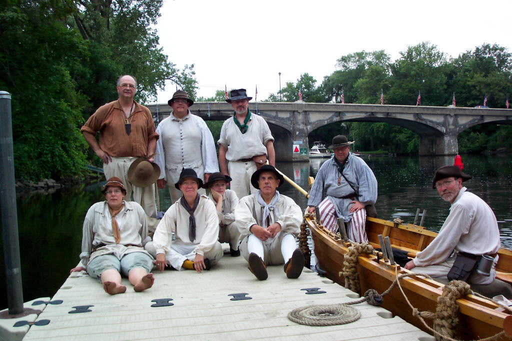
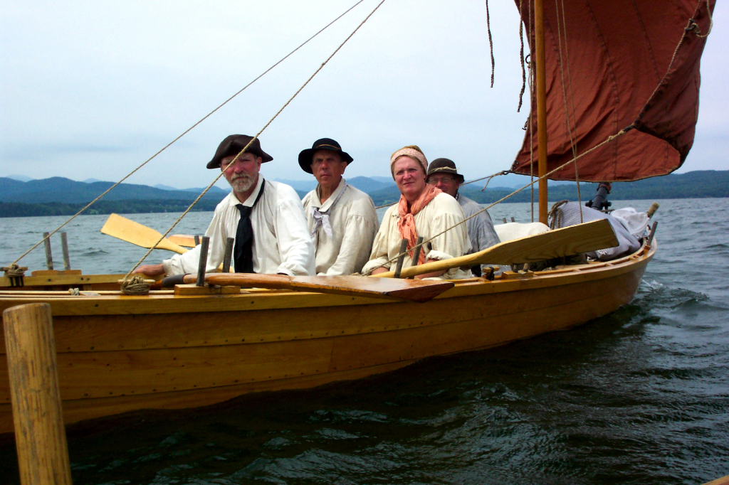
| Kevin on the dock loading the DeSager | Myself and Dawn on the dock loading the Bobbie G | Kevin and Harvey loading the DeSager | Group photo (taken by Ann): Back Left: Ed, myself, Dave W.; Front: Reb, Mary, Dawn, Bill; In the DeSager: Kevin, Harvey | Under way; looking back at the DeSager and the railroad bridge |
 |
 |
 |
 |
 |
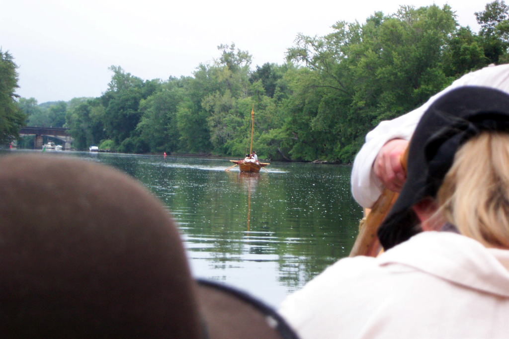
| The DeSager in Lock C-8 | The DeSager bateau in Lock C-8; Bill, Harvey, Dave W., and Kevin | The Bobbie G in Lock C-8, Ed Williams and Mary | Kevin captaining the DeSager with Dave and Harvey in the foreground | On the Champlain Canal, looking ahead under the sail at the Bobbie G under a bridge |
 |
 |
 |
 |
 |
| The Bobbie G under a bridge in the distance | The shore as we sail along | Myself steering and the shore | The Bobbie G in a lock | The Bobbie G under sail |
 |
 |
 |
 |
 |
| An old run-down building | The Bobbie G under sail | The Bobbie G under sail | Both boats under oars and sail, Dawn in the foreground, Ed asleep | At the top of Lock C-9 |
 |
 |
 |
 |
 |
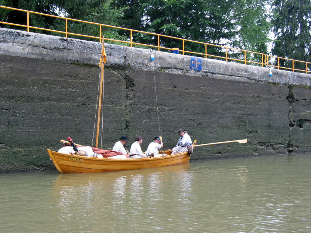
| The DeSager under oars and sail on the Champlain Canal | The DeSager under sail and oars near the cliffs | The DeSager near the steep rock cut between locks C-9 and C-11 | The DeSager near the steep rock cut between locks C-9 and C-11 | Skenesborough (Whitehall), including the Skenesborough Manor |
 |
 |
 |
 |
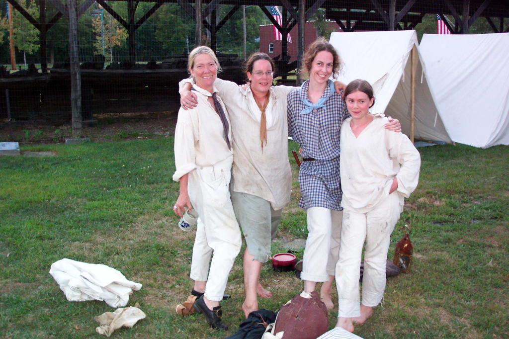 |
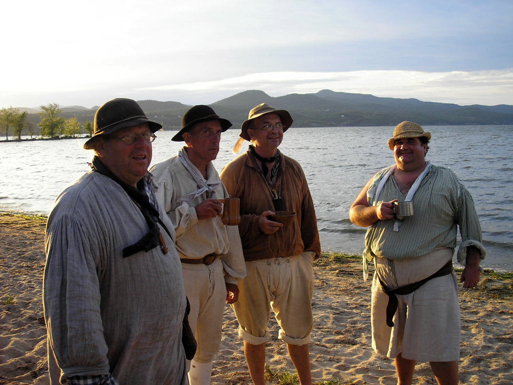
| Skenesborough in the evening sun | The Bobbie G at dock in Whitehall | Teresa | Kevin looking tired and thirsty | The women bateaumen: Mary, Reb, T, and Dawn |
A tough day - our toughest of any trip yet.
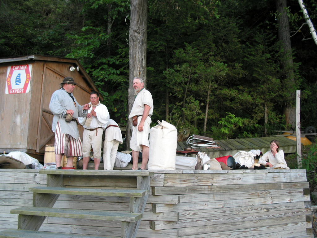
Sometime in the evening my brother Dan arrived to join us for the day's row. Dan asserts that he isn't a reenactor, despite showing up to a half dozen events a year. We half-joke that the only difference between him and a real reenactor is that a real reenactor owns his own clothes and doesn't borrow them for every event. Dan brought us eggs and sausage for breakfast.
We struck camp as we made breakfast. We're not as prompt as I would like, especially on packing. We didn't get underway until 9 a.m.
As soon as we had cast off, I called Lock C-12. The lock was visible from our camping spot. The lock opened obligingly, and in we rowed. There was a very light south wind.
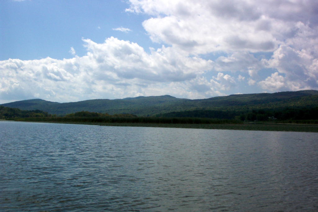
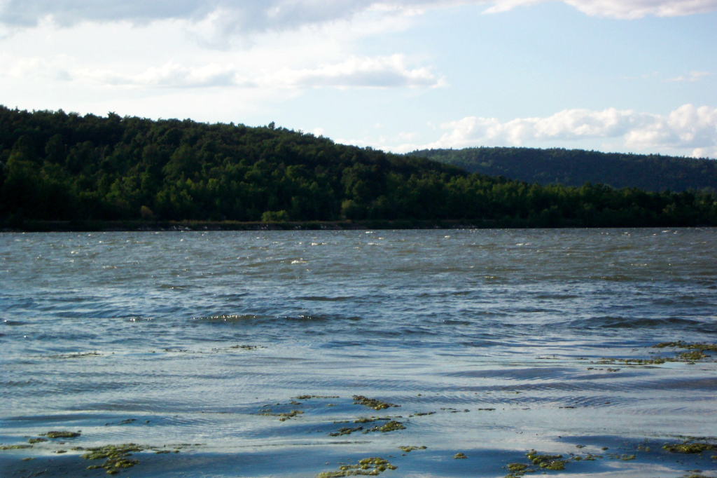
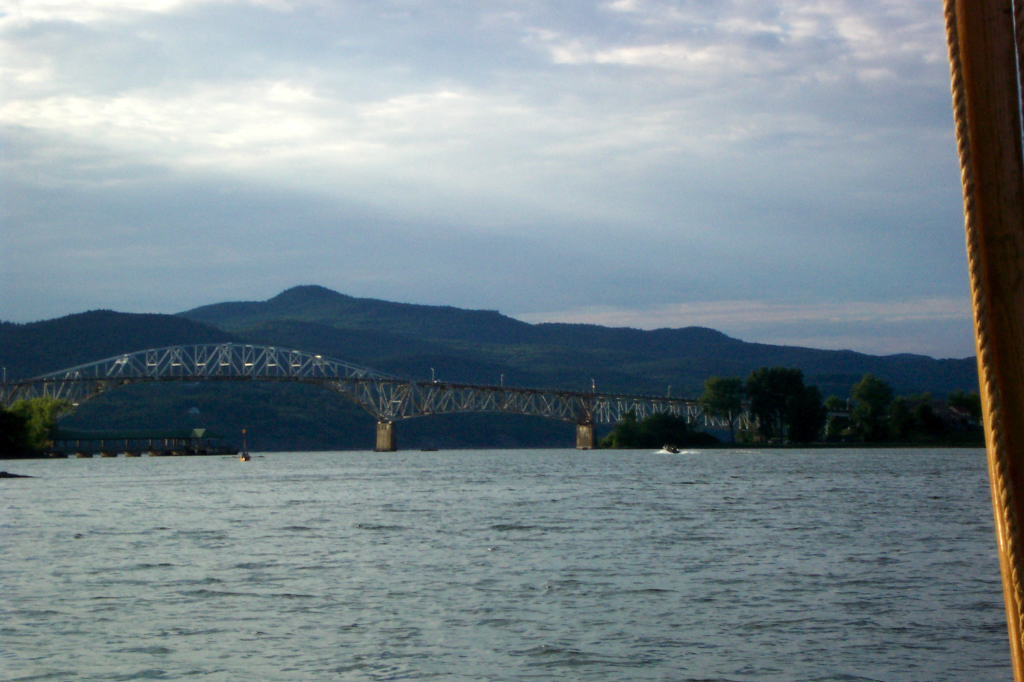
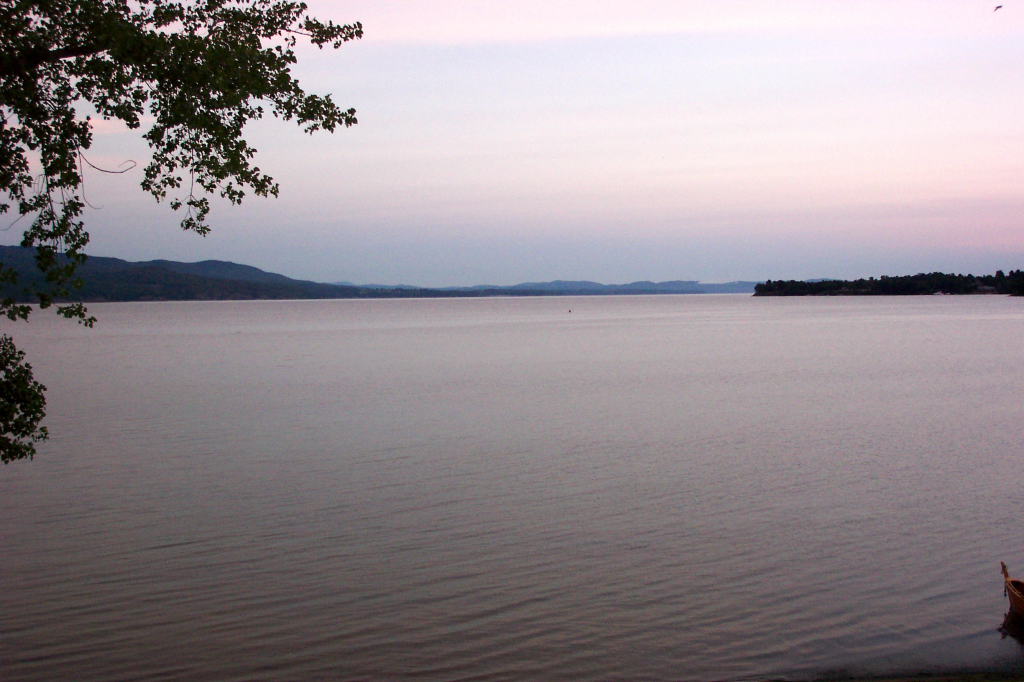
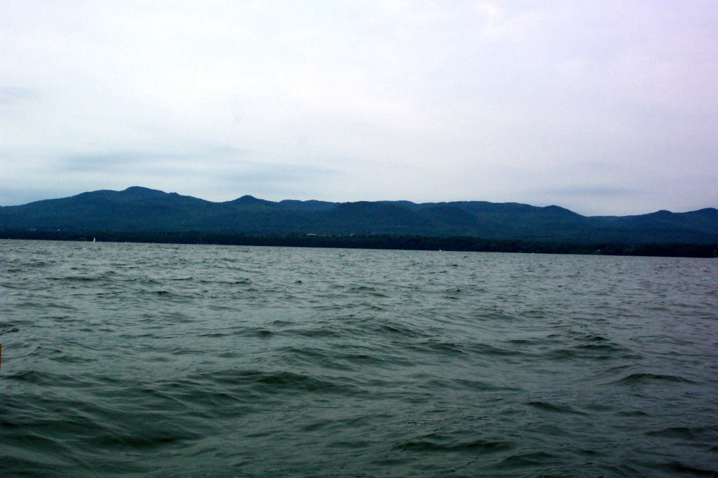
Down 15 or 16 feet, and out into Lake Champlain. Historically, this area of the lake was sometimes still called Wood Creek, or, less often, the Poultney River. Today it is known as the Narrows of Lake Champlain.
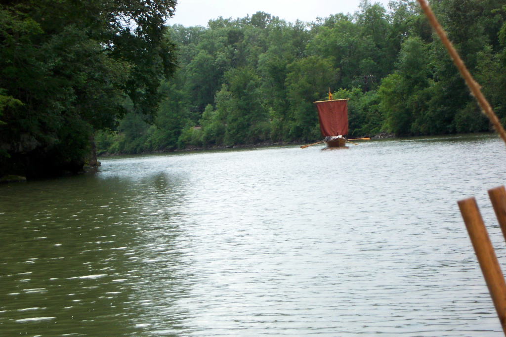
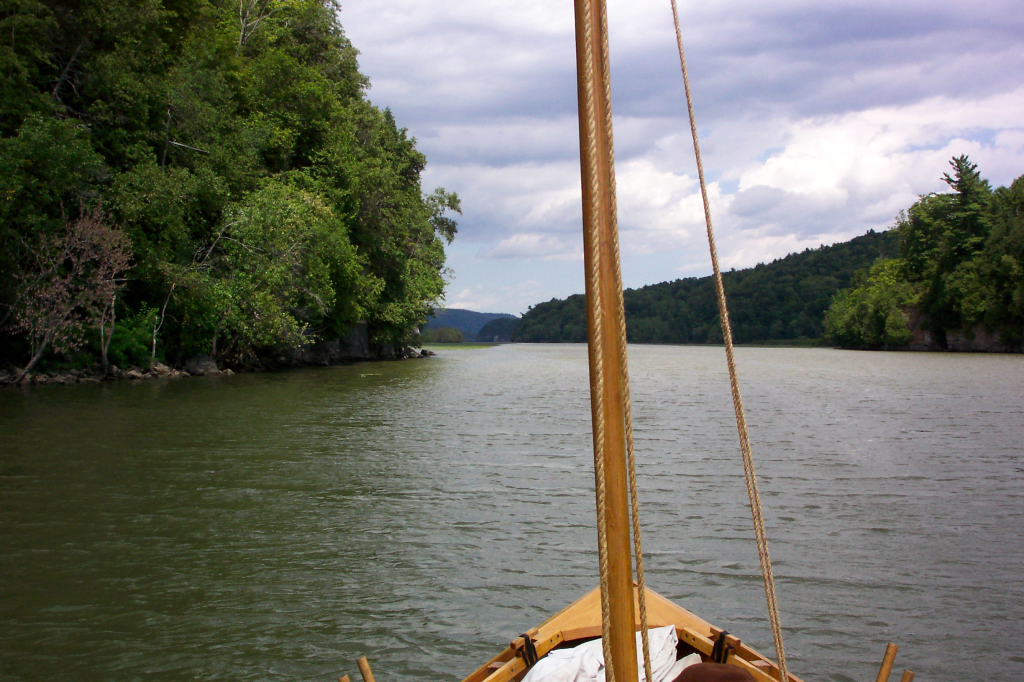
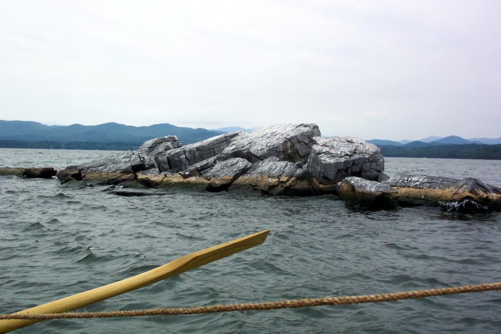
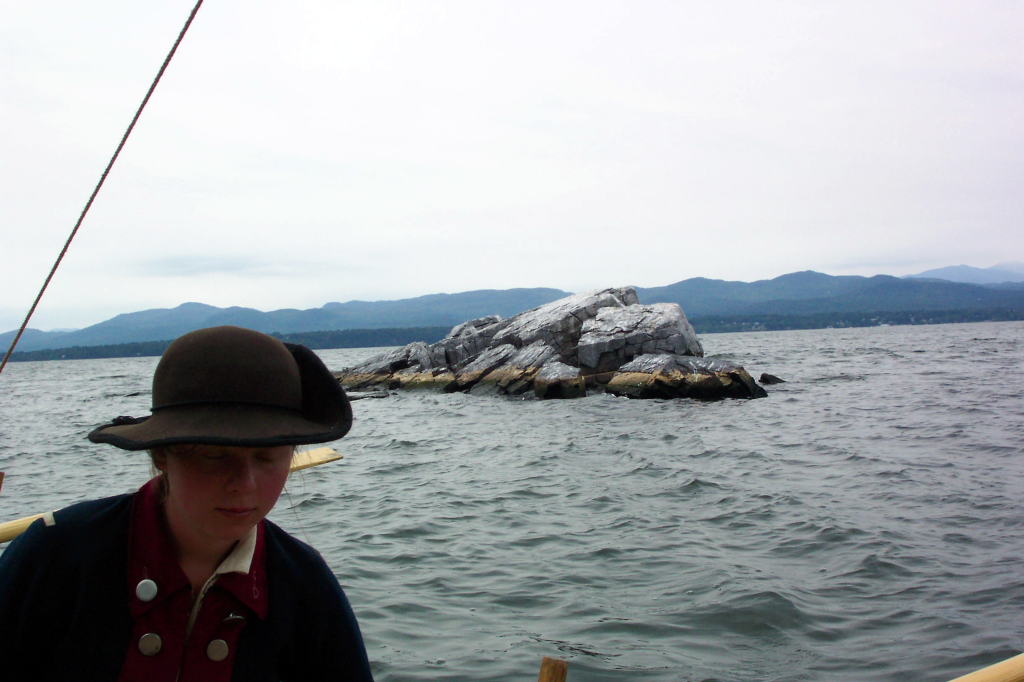
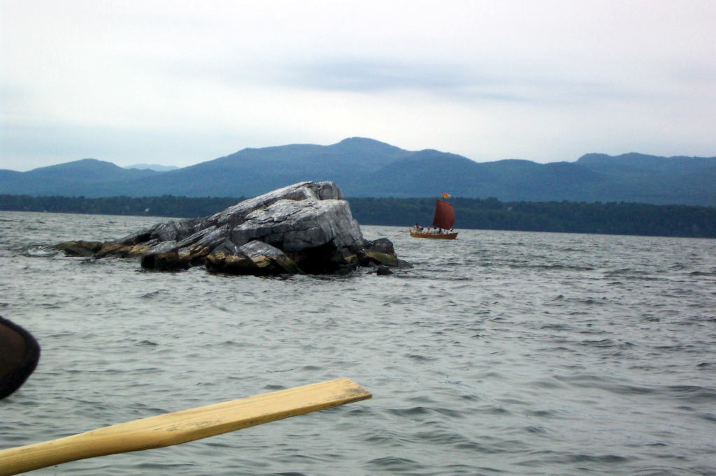
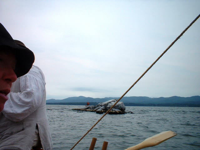
We rowed by a few marinas, past a long island with homes on it, and on down the lake. Vermont is now on our starboard side. Once again, we raised sails to catch any gust of wind which might help us on our way. Cool cliffs stud the Vermont shore, interspersed with drowned lands.
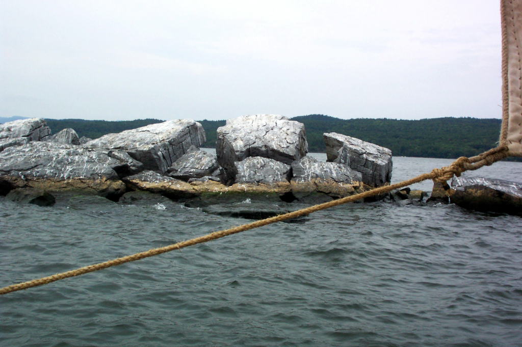
There is a spot that is very narrow - narrower than the canal, excepting the locks themselves. A short blunt cliff rises on either side of the lake. Floating along the base of the cliffs are long wooden platforms that are chained together and to the cliff. These are fenders for large boats or barges, so that they won't be damaged if they have trouble steering through the gap.
Once again, the Bobbie G outdistances the DeSager. The DeSager has what looks to be a strong crew - Dave W., Bill, Harvey, Dan, and Kevin. While the crew in the Bobbie G isn't weak, the DeSager should be more powerful. I've also loaded the Bobbie G a bit heavier than yesterday, lightening the DeSager. We stop rowing and drift a bit, letting the DeSager catch up to us. We exchange, with regrets, the effective 10-foot ash oars for the 'rubber' 9-foot cedar oars. The DeSager is now as fast at the Bobbie G, and would soon prove to be faster when our mild south wind died.
We passed the entrance to South Bay. South Bay is a four-mile long section of Lake Champlain which is off of our route. It is separated from the narrows of the lake by natural land which bears a railroad causeway and bridge. Surprisingly, there aren't as many fishing boats here as I usually see.
We have a morning rum ration, and continue to row. The wind gradually fades to nothing and begins to blow lightly from the north.
Along the Vermont shore is a long stretch of drowned lands. Here the water and land co-mingle, so that everything is marshy and wet. In spots, the trees predominate. In others, it is all reeds and grasses. There are some areas where pools can be seen behind a narrow screen of reeds. Set further back are hills, sometimes with rock faces but more often with trees.
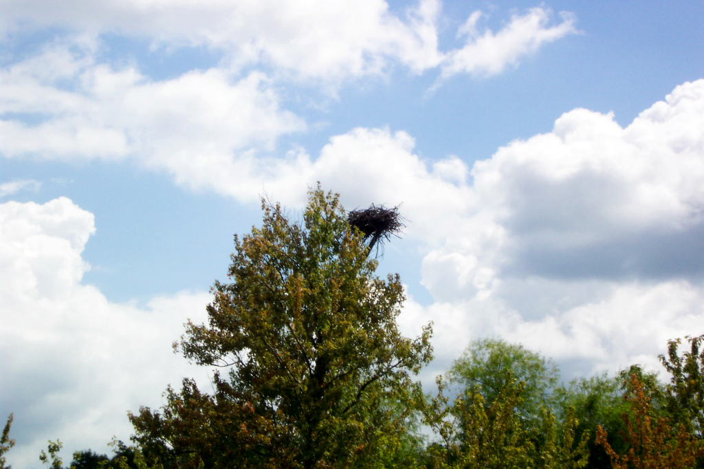
Along these drowned lands there are strange tripods set at intervals. The tripods are intended to provide a spot for ospreys to nest. Only one in four or five is used, partly because they are too close together. There are also osprey nests in trees, and we occasionally spot an osprey soaring overhead.
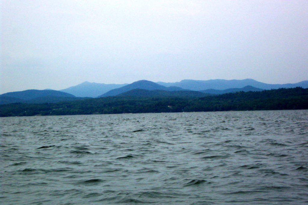
The New York side of the lake has a railroad along it, though this is often far back from the shore with a marsh between the lake and the railbed. A line of hills gradually rises in the far distance; it is the beginning of the Adirondacks.
The crew of the Bobbie G continues to sing songs. The crew of the DeSager continues to be glad that they can't hear them very well.
The north wind gradually freshens, but the lake is still smooth. This is of some concern to me, as I want to get through the Dresden Narrows before any significant wind arises. The lake broadens rapidly to the north of the Dresden Narrows, which means that when there is a north wind there can be very short and nasty waves pounding through the gap. I once encountered two-foot waves there in my canoe; I would prefer to not see them again.
The lake snakes back and forth. I take a turn at the oars while Mary steers. Noon approaches, and we decide to land for lunch. We pick a slightly less marshy area on the New York shore, and run the Bobbie G into land.
A ground cloth for a tent makes a fine picnic blanket. We have a pleasant lunch, with the DeSager joining us a few minutes after we begin. I could wish for less modern containers for our food.
We push off and continue. As always, Reb servers as an exemplary Bows. She gets the crew of the DeSager situated at their stations and shoves them off, then does the same for the Bobbie G, climbing in last.
We row for Dresden. The north wind comes and goes, gradually increasing. The Dresden Narrows are not especially steep on either side, but are still quite a prominent obstruction. Trees cover a rocky base. We row through the narrows with the two boats almost side by side.
The town of Dresden is on the New York shore, now nearly half a mile away on our beam since we cleared the Narrows. The sky has a few clouds scudding along at high speed. For the most part we are in the sun.
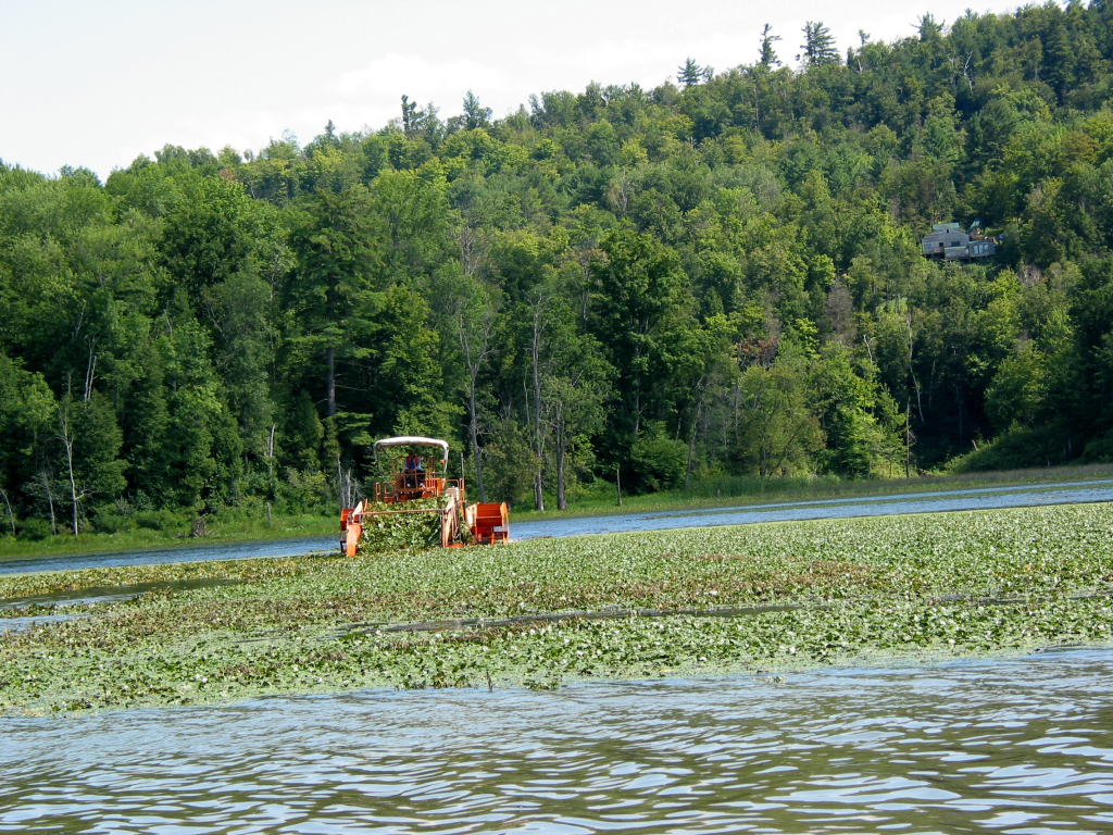
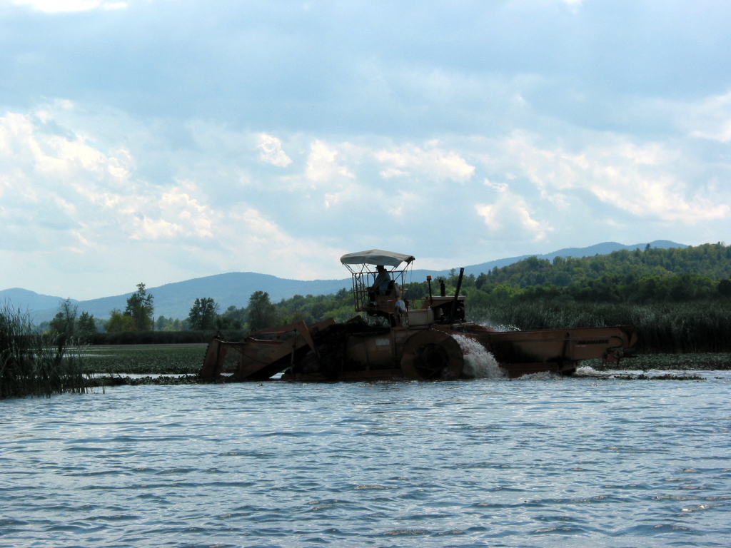
Several miles further down the lake, we pass an area known as Pulpit Point. The New York shore has the railroad, interspersed with the occasional spit of land or house. The Vermont shore has a wide basin of water, which in the past I've always seen overgrown with water chestnuts. Today there is a strange craft and open water in the basin.
As we approach, we see that the strange boat is a water chestnut harvester. The intent is to eradicate the devilweed. The harvester turns towards us as we approach. It is a long hopper, above which sits the operator. There are paddlewheels on either side, allowing it to move in weed-infested waters without getting jammed. The front is a ramp with cutters on the sides and bottom. As the harvester travels forward, the cutters trim off all of the foliage on the water chestnuts, sending it up a ramp and into the hopper, which contains a tangled mass of the weeds.
The harvester turns north and heads off at a faster pace than we can manage. We spot another harvester along the New York shore, and yet a third passes us heading back to the spot where we saw the first.
Another two miles gets us to the town of Benson. Throughout the trip, Ed has been joking about seeing 'Roger's Slide'. Roger's Slide is a cliff along Lake George, which Robert Rogers allegedly slid down when fleeing some indians. The cliff on Lake George is too ludicrously steep to make this a believable story. Ed, knowing full well that Roger's Slide is on Lake George, keeps pointing to cliffs and rock slides and saying "Hey, that must be Roger's Slide!"
Along the Benson waterfront is a small floating dock with a plastic slide for sliding into the water. A metal ladder leads up it. Ed proclaims "That's Roger's Slide!" We have visions of Indians chasing a ranger up the ladder, and then the ranger sliding with his arms held high as he zooms down into the water. Somehow, this is no less plausible than the historical legend of Roger's Slide.
The wind has been in our teeth for some time now, and our speed is slow. Although it is possible to sail the bateaux somewhat to windward, with a direct headwind and a narrow lake it is hard to make much progress. Added to this that one boat has an improvised rig and that we've split what little square-rigged sailing experience we have between two boats, and the conclusion is that rowing into the wind is preferable to trying to tack back and forth.
We pull in to the state boat launch at the north end of Benson. This is to give people a rest break and use the port-a-john.
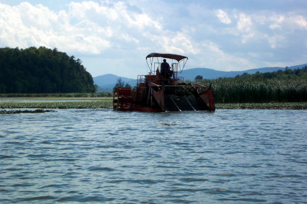
On the boat landing is a conveyor and hopper to which the devilweed harvesters attach. The foliage is off-loaded onto the conveyer and fed into a dump truck beneath the hopper. One harvester load completely fills a dump truck. The dump truck then trundles away to dispose of the weeds.
A few people come and talk to us on the landing. I hand out a couple of bateau business cards, as well as telling them about the boats and our trip. The business cards have a drawing of the DeSager on one side, and information about the Mabee Farm and our reenacting group on the other. After eating some cookies, we set out again.
The wind continues to freshen. We fight past Stony Point and into a wide section of the lake, which is perhaps two miles broad here. This portion of the lake has six or seven miles of fetch, with Chipman's Point marina (our intended destination for the day) located at the north end. The wind screams down the lake and raises whitecaps on the waves. The waves get bigger as time progresses.
The DeSager continues to make slow progress to the north. The Bobbie G is struggling to make any way at all. The cedar steering oar is hard to work, and the cedar rowing oars are sapping the crew's strength without great benefit.
As time passes, it becomes clear that we cannot proceed under the wind. I look for a landing I can make. We try to signal to the DeSager, but the wind prohibits any sound from us reaching them, even with the speaking trumpet. I steer toward shore, still keeping the bow to the wind for control. The rowers row vigorously to little effect. I can tell they are very tired.
As we near shore, there are several logs embedded in the lake bottom and jutting above the water. I ask for the crew to give me three more minutes of hard effort. They rise to the occasion magnificently. Ed sings the fastest version of Dixie I've ever heard, and Reb practically stands for each stroke. Her face is as red with effort as I have ever seen it. We get clear of the obstruction and in a slightly less windy zone near shore.
I find that I can't land on the beach directly to our starboard, as the boat loses all control when I turn in that direction (I blame the cedar steering oar). Thus we proceed another 50 yards up the shore and land on a gravel beach that is partially sheltered by a dock with a boat stand. We pull the boat onto shore and tiredly climb out.
Reb takes the speaking trumpet (a tin cone with a mouthpiece that works quite well for speaking at a distance, though not in high winds) and heads up the lake shore in an attempt to recall the DeSager. The DeSager is still making way, though at a painfully slow pace. She is perhaps a third of a mile away. They see Reb with the speaking trumpet and come about. They fly back to the beach we are on and land on the shore on the opposite side of the dock that the Bobbie G near.
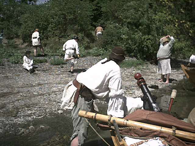
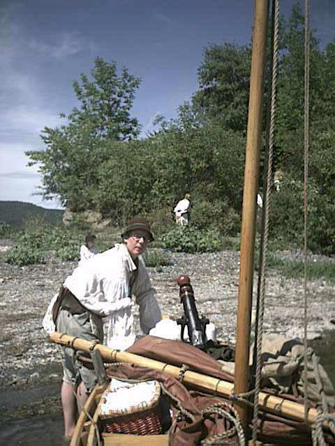
We pull up the boats and secure their bow and stern painters. The spot where we have landed is the dock and deck of someone's summer camp. We walk up to the house above. A carved sign states that it is the McPhearson's place. A grassy camp road leads away. No one is home. We tuck a bateau business card in their door.
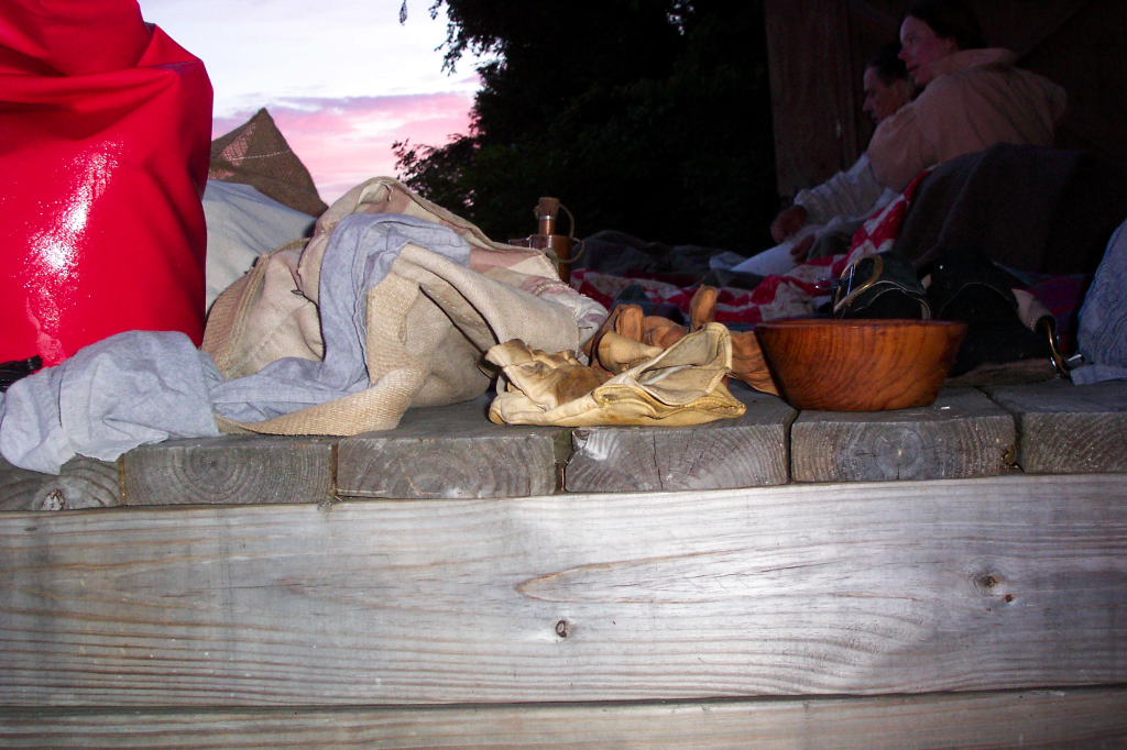
Back on the deck, I call the crew together. I decide based on the advice of others and my own observations that we can't proceed any further today. Going back to Benson is undesirable, as the wind may be just as strong tomorrow. We have a pleasant deck and beach to camp on, and we will make the best of it for the night. It is after 6:30, and light will only last a few more hours. We covered around 16 miles, which, while less then we hoped, is still quire respectable. We unpack blanket rolls but not tents, then start cooking dinner.
Dan has to be at work tomorrow, and was planning on driving my car back to Whitehall to get his truck. My car is at Chipman's Point, where we had intended to spend the night. It is three miles by water. Reb announces that since she is the least shy of any of us, that she'll accompany Dan to go get my car. Ed volunteers to go as well. We give them my cell phone, retaining Mary's so we can contact each other if necessary. The three of them set out.
We have a lovely view of the lake. The wind continues unabated as we eat dinner and roll out bedrolls. By 9, most of the crew is very sleepy or abed. I call the away party to find out how they are doing. They've recovered my car, eaten food, and are heading back.
The away party arrives sometime between 9:30 and 10 p.m. It turns out that it is quite far by road from here to Chipman's Point. The camp road runs five miles south to the main road, then one has to return north to Chipman's Point. Reb stopped and knocked at the first house they came to. An older couple lives there, and they had seen us on the landing in Benson. The man gave Reb, Dan, and Ed a ride to Chipman's point, though ended up going to Larabee's Point first. The group stopped for sandwiches at the store with the large otter sign on the way. Ed and Reb report that Dan is a terrible driver, going far too fast for conditions.
We wish Dan well, and he departs. We talk for another half hour, then all go to bed. The stars are overhead, and the wind blows strongly. On the far side of the lake, we can see the occasionally train winding along the shore.
 |
 |
 |
 |
|
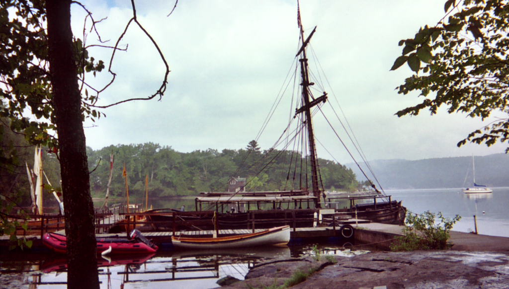
| Myself working on breakfast, 17 August 2005 | Our tent line in Whitehall, with the boats on the far right | The tent line | The hulk of the Ticonderoga | |
 |
 |
 |
 |
|
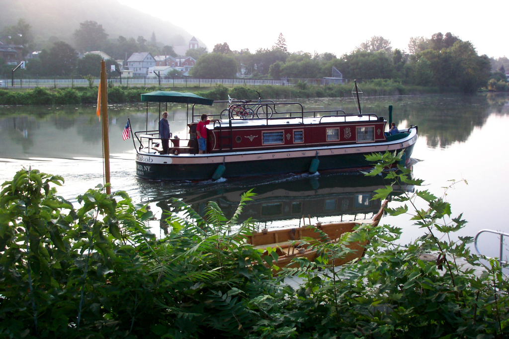
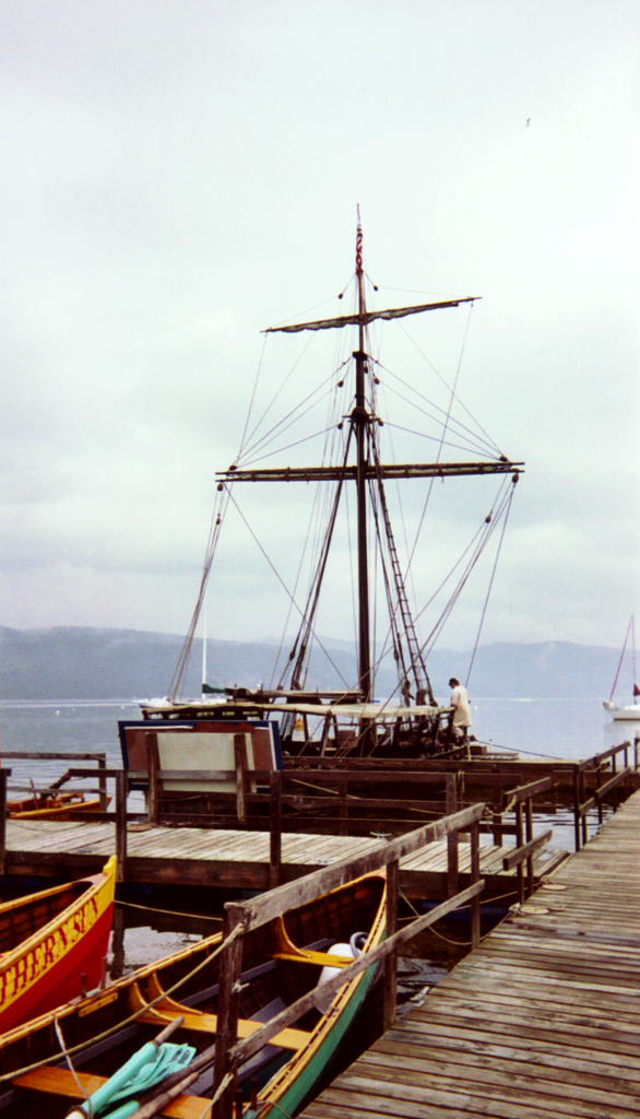
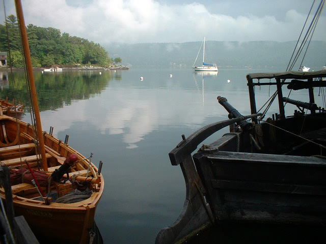
| The picnic pavillion and the enclosed pavillion at Whitehall | The boats on the dock | One of the Powell Line packet boats on its way south | Myself smiling in Lock C-12 | |
 |
 |
 |
 |
 |
| The lock wall | Into Lake Champlain | Myself steering with the DeSager and Whitehall in the background | The DeSager's bow gun | The DeSager under sail |
 |
 |
 |
 |
 |
| Wood 'fenders' along the cliffs to protect barges | Mary sews as we sail in the Bobbie G | The DeSager under sail | Idling in the the Bobbie G | Following the DeSager under oars and sail |
 |
 |
 |
 |
 |
| Myself and Dawn silhouetted with the DeSager in the background | The DeSager and crew alongside the Bobbie G for the oar swap | Distant hills and close shore | The Bobbie G taking a rest break | Rowing the DeSager: Harvey, Dan, Kevin, and Dave are rowing. |
 |
 |
 |
 |
 |
| Rowing the DeSager | The Bobbie G on the southern end of Lake Champlain | The DeSager following us | Hills and shore | Railroad bridge to South Bay |
 |
 |
 |
 |
 |
| The DeSager has a cookie break | The Bobbie G with the DeSager's crew in the foreground | The Bobbie G under oars | The Bobbie G under oars with Dawn at the helm | Myself steering with hills in the background |
 |
 |
 |
 |
|
| A panorama of the hills | The DeSager under oars, Lake Champlain | Both boats under oars | Myself rowing at sculls | |
 |
 |
 |
 |
 |
| Mary steers | Osprey nest | The women have lunch: Reb, Mary, and Dawn | The DeSager coming in for lunch | Lunch stop: Dave W., Kevin, Harvey, Bill, and Ed. |
 |
 |
 |
 |
 |
| The Vermont hills | Approaching the Dresden Narrows | In the Dresden Narrows | The New York shoreline in the Dresden Narrows | The DeSager in front of cliffs |
 |
 |
 |
 |
 |
| The DeSager in front of cliffs | A water chestnut (devilweed) harvester | A water chestnut harvester | A devilweed harvester | A devilweed harvester |
 |
 |
 |
 |
 |
| Bill at the steering oar of the DeSager | Bill at the steering oar of the DeSager | The DeSager seen from McPhearson's Landing in strong winds | The lake in an ugly mood | The silk pennant flying straight out |
 |
 |
 |
 |
 |
| McPhearson's camp and the DeSager | McPhearson's camp and the Bobbie G | The DeSager on the landing | On the platform | McPhearson's camp |
 |
 |
 |
||
| McPhearson's camp | McPhearson's camp | Gear on the landing's deck | ||
A long satisfying day.
Despite the lesson of strengthening winds that we had yesterday, people were slow getting up and packed. We finally were breakfasted and loaded around 8 or 8:15. We tried to leave McPhearson's deck as neat as we found it.
We set off with the same crews and oar arrangements as yesterday, less Dan, who had departed. The wind was still from the north, but fairly light. We were soon past where the DeSager turned about yesterday.
We could see Chipman's Point Marina to the north. Beyond it rose Mount Defiance, deemed inaccessible by General Gates during the American Revolution. The British proved the fallacy of this, dragging guns to the top of the hill and commanding Fort Ticonderoga. More capable commanders than Gates had forewarned of this eventuality. The Fort was evacuated posthaste, much to the shame of the American forces.
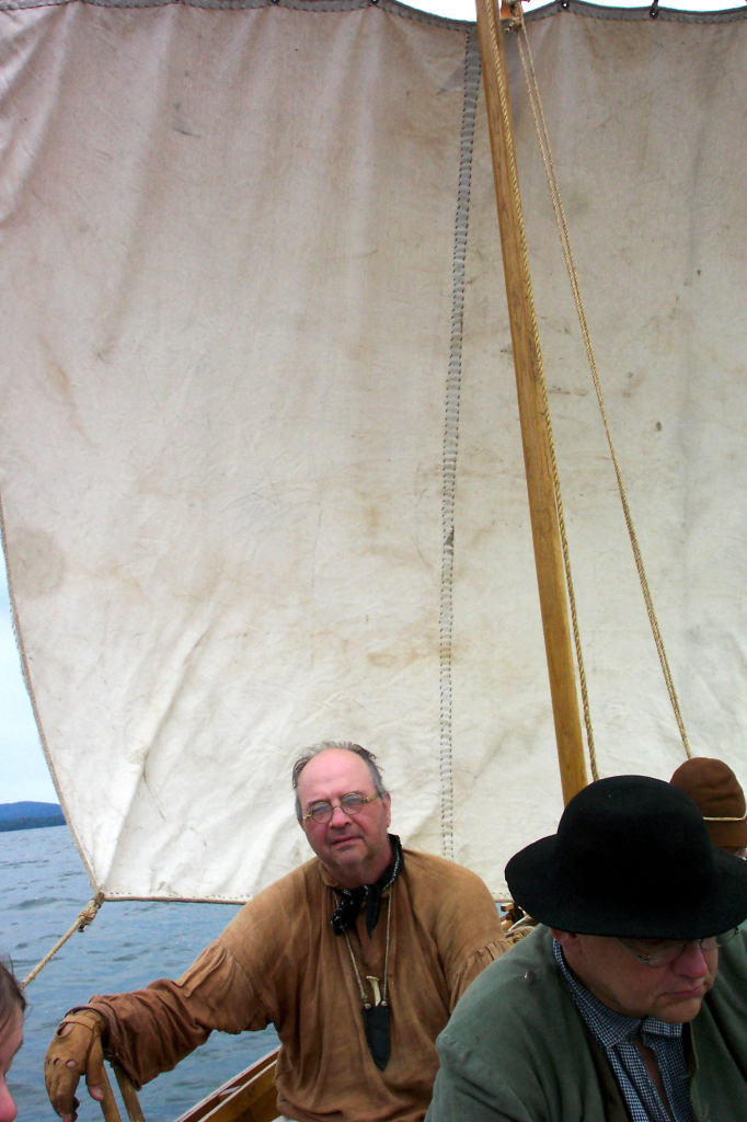
We pulled into Chipman's Point Marina around 9:30. Dean and Monica were waiting for us. Dean is a member of both the Ulster County Militia and the Second Albany. He sings well and is well read. Dean is from Kingston. Monica is from Saratoga Springs. She often portrays French milice (militia) at reenactments.
The boats were docked at the transient slip at the marina. In addition to taking on Dean and Monica, we all stopped for a restroom break, as we had not had facilities at McPhearson's landing. We filled our water jugs. The water turned out to be flavored with chlorine, rust, and plastic hose, the combination of which was quite unpleasant. It was better than no water, but hardly good.
The owners of the marina were an older couple. They seemed pleased to have us, and wished to take pictures of our boats. They let us use their facilities for free, which was very kind.
Dean was added to the Bobbie G, which now had a crew of six including myself. This meant that we always had at least one idler. Monica joined the DeSager, bringing their crew complement back up to five. Northward.
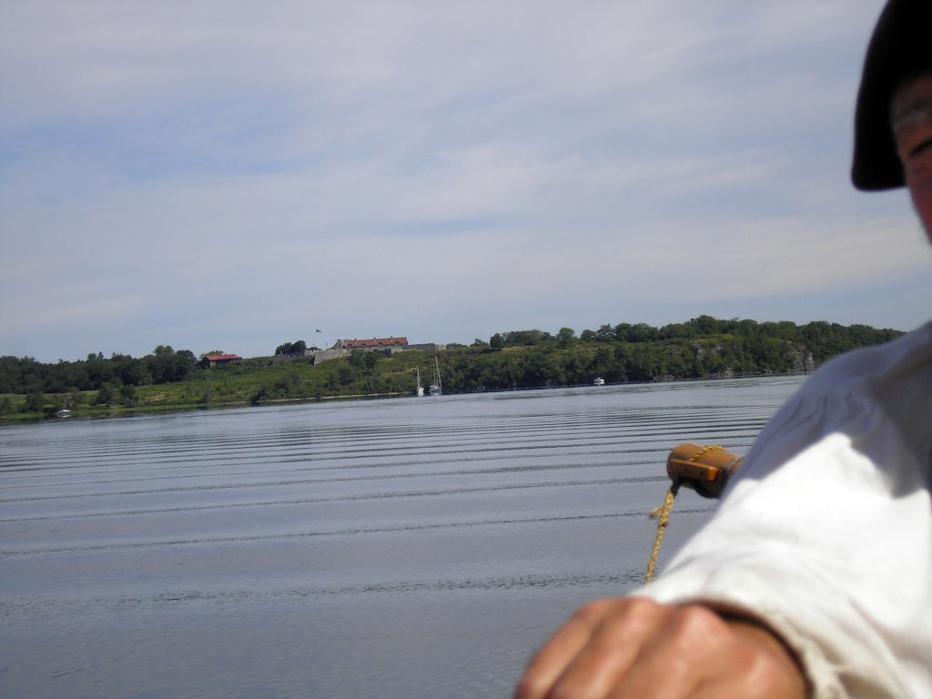
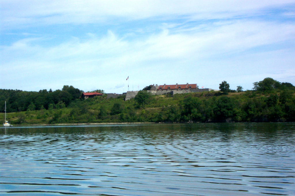
Mount Defiance loomed on our larboard. The side close to the lake is steep, but not absurdly so. The side near Fort Ticonderoga is a long ridge that, at least from the distance we were at, looked eminently climbable. A few more miles and Fort Ticonderoga's low, menacing mass became visible.
Fort Ticonderoga guards a narrow point in the lake. It also guards the outlet of La Chute River, which is the easiest route from Lake George to Lake Champlain. Thus, low water or high, the two most sensible routes from Albany and points south leading to Canada and points north, converge at Fort Ticonderoga. The military value is clear.
On our starboard side was Mount Independence. This is a stubby peninsula that juts northward into the lake, forming the opposite side of the narrows that Fort Ticonderoga guards. During the American Revolution, there was a system of fortifications on the Mount, and a partially floating bridge linking it to Fort Ticonderoga. Recently, a massive timber from one of the caissons (the bottom of a pier) from the bridge floated to the surface. The beam was preserved at LCMM and is on display there.
There are some short cliffs along Mount Independence. Some sources claim that this is where the masts were stepped for Arnold's fleet in 1776. I'm skeptical - the cliffs aren't that high. There are higher shear cliffs (near established saw mills, no less) along the narrows of the Lake just north of Skenesborough.
The fort occupies a wide swath of ground, and it took us a while to get past it. Another mile and a half brought us to the Ticonderoga Ferry. Here there is a modern cable ferry linking the New York and Vermont shores. The New York ferry landing has been gradually transformed into a nice waterfront park. The Vermont side is Larabee's point, which has a neat stone building dating back from the early Champlain Canal days and matching two buildings located down at Chipman's Point.
The next point of interest is the International Paper mill at Ticonderoga. This is a large complex visible for a dozen miles or more. At night it is lit up brightly. In the proper sunlight, it is not unattractive. We would continue to see it almost until we had reached Crown Point.
We landed briefly at Five Mile Point for a rest break, then proceeded on. The weeds here were fairly thick and unpleasant. The water is likewise quite shoal.
At some point in the trip, we ate a moving lunch. The Bobbie G was the slower of the two boats, and, again, I blame the oars. We played chase after clearing Five Mile Point, and we wouldn't take the lead all day.
The north wind was gradually rising, though not to yesterday's levels. The crew was getting tired rowing into the wind. I took over rowing and had Ed steer. Initially I kept up a good speed. This only lasted a few miles, and gradually I slowed down. After reaching one of the many small points on the starboard shore, we switched back to myself steering and the others rowing.
Crown Point bridge seemed never so far away. I often think, when traversing this stretch of lake, that I can make out the upper limb of the bridge. I don't know if this is true or not, but it gives me false hope that we are almost there. We rowed, and rowed, and rowed. Gradually the shore fell away. Gradually the wind rose. In time I could make out the distinctive streetlamps that are used on the roads near the bridge, then the bridge itself.
The DeSager was quite far ahead of us. She had loitered in wait for us a few times, but always maintained a lead. Now that the bridge was in sight, she continued apace.
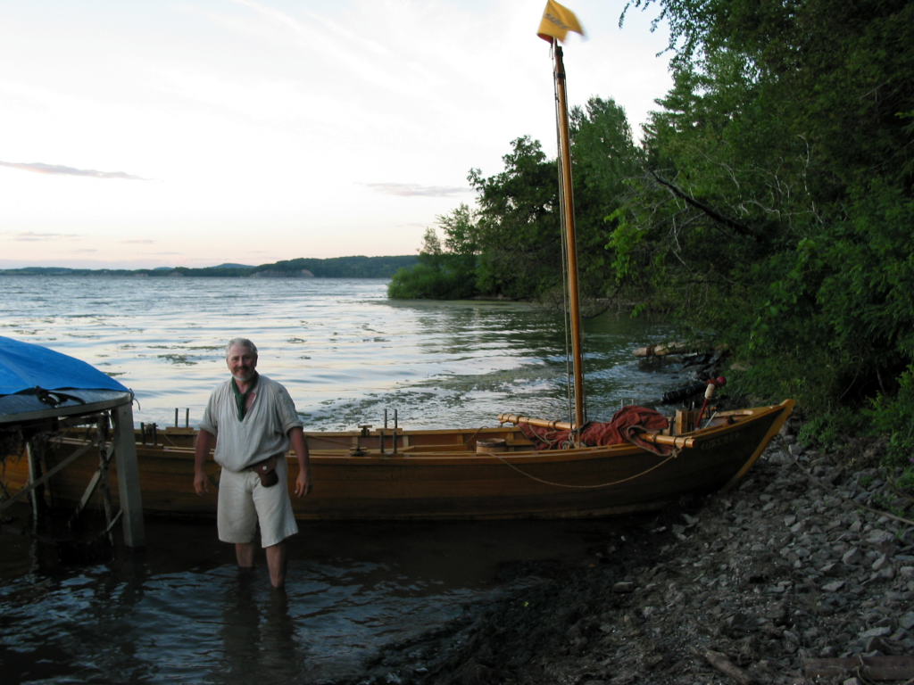
The Champlain Bridge runs nearly north-south. The Lake turns sharply to the west, then back to the north on its way to Canada. On the Vermont shore there is a boat launch and a historic site at a location called Chimney Point. On the New York shore, the east side of the bridge contains a state campground. The west side of the bridge is the Crown Point historic site and our destination for the evening.
At the New York state campground, there is a long pier that is mostly used for fishing. On shore, at the base of this pier, is a stone lighthouse with a statue dedicated to Samuel de Champlain, the famous French explorer after whom the Lake is named. Disappointingly, this lighthouse is no longer used as a navigational light.
We rounded the fishing pier, then, with a quartering wind on the starboard bow, slipped beneath the bridge. The bridge is pale and glints in the sunlight. Around a very small point of land, we can see the DeSager had pulled up onto the beach. In a few more minutes, we pull up just east of her.
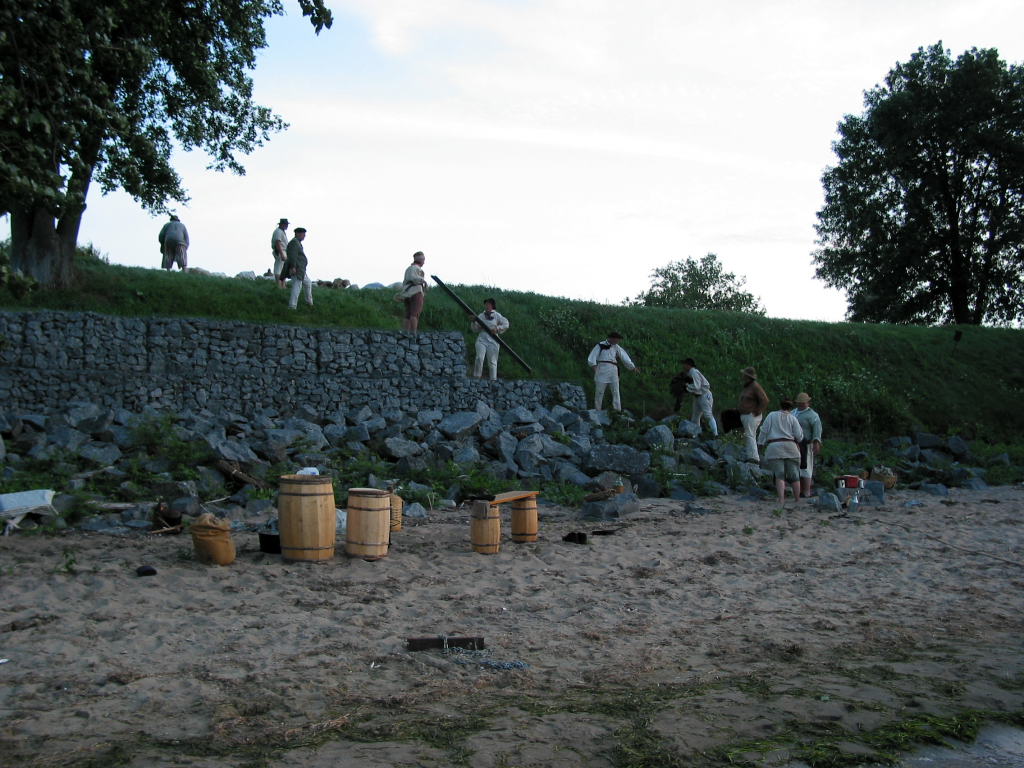
Crown Point is on a bluff, with a sand beach along the lake. Kevin and I had scouted out the landing spots last Saturday, and decided that this beach was our best option. Everyone clambered out of the boats, and we pulled them up onto the shore. The wind freshened, and we counted ourselves fortunate to be in for the night. The time was somewhere around 6:30 or 7 p.m. We covered around 22 miles today.
Awaiting us at Crown Point were John and Tom. Tom works for the historic site and had helped get us permission to camp there. John is a long-time reenactor who lives in Middleburgh. When we reenact military activities, John is our commander. He is also the de facto leader of our reenacting group, even if, on paper, others hold the official offices.
We formed a line of people up the slope to the bluff and passed up the camping gear. We set up the kitchen on the sand, using one of the thwarts from the Bobbie G, along with two small barrels, as a kitchen table. We cooked and ate dinner. I went to bed, while some of the others stayed up a short time longer.
A good day. We made up the three miles that we failed to accomplish yesterday. We did this despite continuing north winds and fatigue from the previous day.
 |
 |
 |
 |
 |
| Mount Defiance with the Chipman's Point Marina in the foreground | A Vermont farmhouse | The DeSager following us | The Bobbie G and crew | The Bobbie G and crew with Bill in the foreground |
 |
 |
 |
 |
 |
| Approaching Mount Defiance | Mount Defiance | Reb looking sunburnt | The back of Mary and Dean | Kevin steering the DeSager |
 |
 |
 |
 |
 |
| The Bobbie G sailing in front of Mount Defiance | Fort Ticonderoga in the distance | Fort Ticonderoga in the far distance | Harvey rowing | Fort Ticonderoga |
 |
 |
 |
 |
 |
| Fort Ticonderoga in the far distance | Reb from above | Dawn from above | Ed with Fort Ticonderoga in the background | Fort Ticonderoga |
 |
 |
 |
 |
 |
| The Bobbie G | Rest break, Reb at the bows | Rest break | The Crown Point bridge with the DeSager approaching it | The Crown Point bridge |
 |
 |
 |
 |
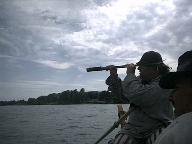
 |
| The Vermont shoreline in the evening sun | The Vermont shoreline | Kevin using a spyglass | Champlain lighthouse | The Crown Point bridge and Champlain lighthouse |
 |
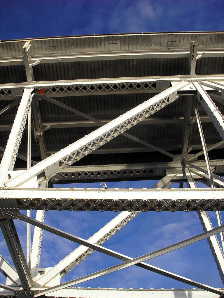 |
 |
 |
 |
| The Crown Point bridge with the swivel gun and bow of the DeSager in the foreground | The understructure of Champlain Bridge | Part of Champlain Bridge | The two boats pulled up on the beach at Crown Point with the bridge behind them | Our group talks with Tom Nesbitt, the boats and bridge around them |
 |
 |
 |
 |
 |
| Our group on the beach | On the beach at Crown Point, in the evening sun | Reb and Mary pull up the DeSager | Kevin, Bill, Ed, and Dean enjoy evening rum call on the beach | Bringing goods up to Crown Point |
 |
 |
|||
| Bringing goods up to Crown Point | Crown Point cooking area |
A fast conclusion.
Up slower than I'd have liked. Ed and Dave W. were already up and had taken walks through the historic site.
Breakfast was bacon, eggs, and coffee. I've been surprised that people have not been as hungry as I expected. Some of the extra food is because I had to plan in case another two or three people showed up. We ate more per person last year, possibly because it was colder. Either way, we've gradually accumulated a surplus of eggs and other foodstuffs.
My feet were bothering me from having stepped on sharp objects the night before (mainly shells, I think). This made the long walk to the public facilities somewhat tedious. I know some of the others are very tired. Today's weather is forecasted to be more favorable.
We don't get under way until 9 o'clock. Last year we were very prompt at getting up and going. I wish we could regain this ability.
We switch the long ash oars with the long cedar oars - the crew of the Bobbie G has had enough of the 'rubber' oars.
The air is calm, and we row on a smooth lake. This is a joy compared to the winds of the last two days. We've taken John into the Bobbie G, so we have a crew of seven while the DeSager still has five. The Bobbie G has a lot more capacity than the DeSager, and, at this point, we are equally crowded. We start with John, Dean, Reb, and Mary rowing, giving Ed and Dawn a rest.
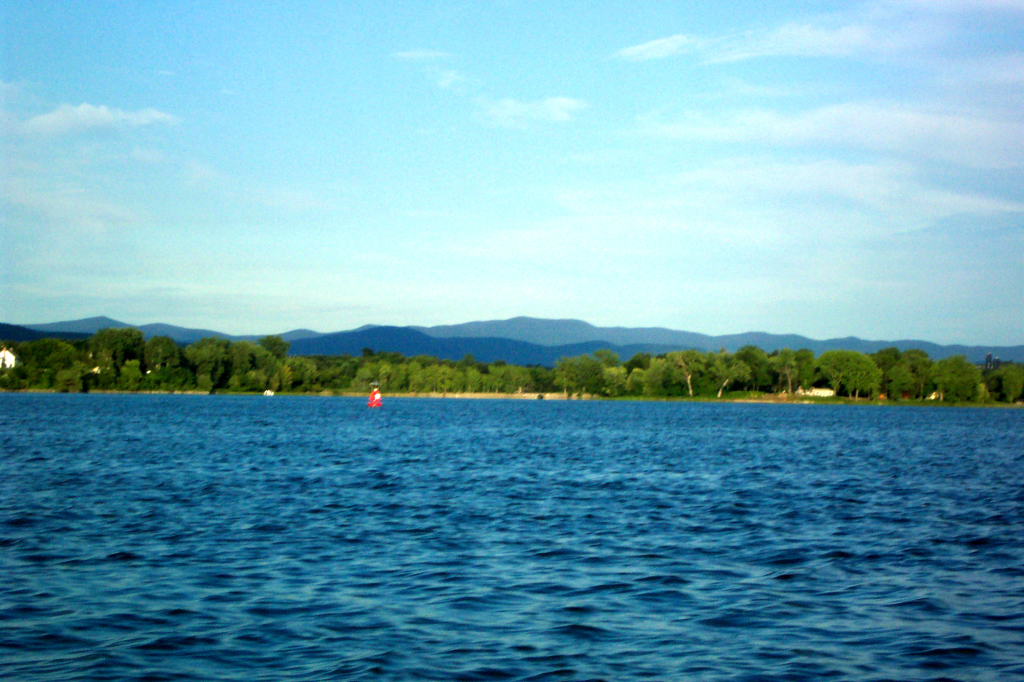
The Lake broadens significantly north of Crown Point. It is three miles wide here, and widening. The Vermont shore is farmland - rolling hills studded with houses and silos, with the occasional screen of trees. The New York shore is wooded and hilly. In either direction, the far distance reveals mountains.
We have a morning rum ration and cookie break. The Bobbie G is handily outdistancing the DeSager. The oars make a substantial difference.
A south wind begins to blow, tentatively at first, then steadier and stronger. The sails are raised, and the oars are banked. The wind is a little fluky, so steering is some work. Still, I'd much rather be sailing than at the mercy of a headwind.
The morning fairly flies by as we sail. The crew lounges as best they can in limited space. Dean, Mary, and Ed lead us in songs. Some of the songs are period, but many are strange amalgams of different eras.
I point out Arnold's Bay. This is the spot where Benedict Arnold's fleet was run aground when they were being pursued by the British fleet in 1776. Several years ago, Reb and I helped row the Perseverance to Arnold's Bay for a small ceremony. It was the occasion of the cookie mutiny, which, thankfully, hasn't been repeated.
As we approach Button Island, we temporarily strike sail to let the DeSager come up to us. We've already covered 10 miles and only have three to go. Everyone is for pushing on while the wind is fair and moderate rather than taking a break. The DeSager temporarily pulls by until we raise our sail and continue on.
The DeSager has the sail I made just for her. It has around 66 square feet of sail area. The Bobbie G is using an improvised rig with a sail that Reb borrowed. It is around 100 square feet in area. In light winds, the DeSager clearly has the advantage. In heavy winds, the area is all that matters, and the Bobbie G gains preference.
We sail close to the Vermont shore. The land is somewhat cliffy with homes at the top. Ahead in the Lake is a small rock pile known as Scotch Bonnet. It is white from bird droppings and barren of trees. I sail the Bobbie G between Scotch Bonnet and the shore, which is only made difficult because I can't see forward when the sail is raised. The DeSager takes the outside route, which, besides being easier, has the virtue of stronger winds.
We pass Basin Harbor. There is an inflatable trampoline with a slide in the harbor that kids are leaping up and down upon. Once again we speculate if this is Roger's Slide.
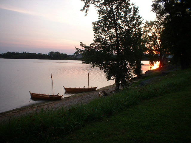
We continue. Soon we are at the entrance to North Harbor. I brace about the sail and we make the turn. We can see the Philadelphia II, which is berthed at the Maritime Museum. I blow the tin horn to announce our arrival. We strike sail as the land is now blanketing our wind, and row the final few hundred yards to the museum's dock.
Dale Henry is aboard the Philadelphia II and welcomes us. Stan Lee is on the docks, and helps us pull in. It is always a delight to see friends. The DeSager enters the harbor, sounds her horn, douses sail, and rows into dock. We've arrived. The time is around 1:30. We covered 13 or 14 miles today.
We wander up into the Museum grounds and greet all of our friends. This is quite the opposite reception from what we got at Kingston last year. There, no one seemed to care that we had just accomplished a significant journey, and, if anything, were resentful for us getting any attention. Here, everyone is interested and helpful.
We are loaned some wheeled carts to help lug gear up from the dock to the lawn of the museum where the camp is located. We unload the boats of pretty much everything except sails, oars, swivel gun, baling buckets, and sponges.
Almost as soon as we arrive, John departs. We wish him well. Likewise, Katie arrives. This is only her second reenactment. She's not too keen on spending time in the sun, so the row held no allure for her. Still, she's delighted to meet up with us at the Maritime Museum. With her is Reb's dog, Skye. Skye is a beautiful husky, currently in her lean summer phase.
We lazily set up camp. Our barrels and packages are strewn about, then gradually neatened. Some of the crew elects to sleep on the Philadelphia II, which is generally a fine spot to spent the night. We are given access to the staff shower, where, over the course of the rest of the day, we all clean up.
The crew, plus Katie and Bill the Taylor (he's a reenactor who hand-sews very nice shirts), go to dinner at the local restaurant called the Red Mill. Monica stays behind and awaits a ride home from her husband, Jim.
After dinner, Katie drives people back to pick up all the vehicles we've left strewn hither and yon. This feels like a very slow and tedious trip. We traveled some 76 miles from our starting point, and the land route is longer than that. We also have to double back to reach various points of land. Some four hours after we set off, we are all back at the museum.
After a check on the boats, I retire to my blankets, satisfied that we've accomplished our trip.
 |
 |
 |
 |
 |
| Both boats on the beach at Crown Point in the morning | The boats on Crown Point beach in early morning | The broad and placid lake, looking north from Crown Point | Sunrise above the old British fort at Crown Point | The ruins at Crown Point |
 |
 |
 |
 |
 |
| The tent line at Crown Point | Boats on the beach at Crown Point | Sunrise at Crown Point | The bateaux on the beach at Crown Point in the morning | Dean and myself loading the Bobbie G |
 |
 |
 |
 |
 |
| Dave W. loading the DeSager | Breakfast on the beach, viewed from above | Monica holding the bow painter of the DeSager | Breakfast | Dave W.; Bill and Kevin in the background |
 |
 |
 |
 |
 |
| Ready to launch the Bobbie G. Tom Nesbitt sees us off | Dave W., steering the DeSager away from Crown Point | Dave W. at the steering oar of the DeSager | The DeSager under oars and sail | Our sail |
 |
 |
 |
 |
 |
| Ed and our sail | The yard and sail | The crew and myself as we sail | The DeSager under sail | Myself steering the Bobbie G |
 |
 |
 |
 |
 |
| The New York shore | The New York shore | The DeSager under sail | The DeSager under sail alongside the Bobbie G | The DeSager under sail off Button Island |
 |
 |
 |
 |
 |
| The crew of the DeSager | The DeSager under sail | The Bobbie G under full sail | The Bobbie G under sail, 19 August 2005 | The Adirondacks |
 |
 |
 |
 |
 |
| Sailing past Scotch Bonnet | Sailing past Scotch Bonnet | Sailing past Scotch Bonnet with Dawn in the foreground | The DeSager sailing behind Scotch Bonnet | The DeSager sailing behind Scotch Bonnet |
 |
 |
 |
 |
 |
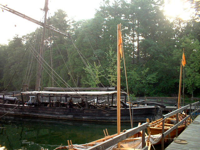
| Scotch Bonnet | Scotch Bonnet with Mary in the foreground | The Philadelphia and other boats | The Philadelphia and other boats | The Philadelphia and other boats |
 |
 |
 |
 |
 |
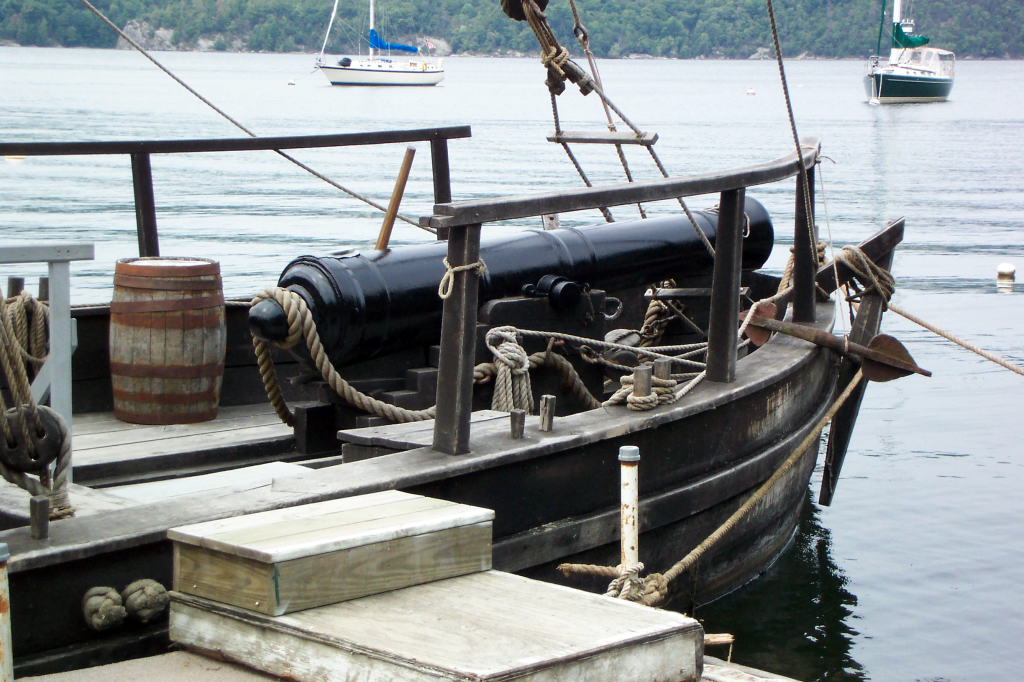
| The Philadelphia's mast and rigging | The bow gun on the Philadelphia | The bateau Perseverence | The dory General Arnold and gunboat Philadelphia II, photos by Dean Barnes | A swivel gun on the Philadelphia and the Bobbie G |
 |
 |
 |
 |
 |
| The Bobbie G and the DeSager at dock behind the Philadelphia II | Bows and flemished mooring line | The Philadelphia and both bateaux, seen from the Bobbie G | Both boats at dock at LCMM | The Bobbie G and the DeSager at dock behind the Philadelphia II |
 |
 |
 |
 |
 |
| The DeSager gunwales and thole pins | The swivel gun on the DeSager | The bateaux at dock at LCMM | The Philadelphia with the bateaux in the foreground | North Harbor beyond the DeSager and the Philadelphia |
 |
 |
 |
 |
|
| The bateaux and one of the swivels on the Philadelphia | The DeSager and the Philadelphia's tiller | The boats seen over the table on the Philadelphia | LCMM in the sun |
A pleasantly relaxed morning. We have a breakfast of eggs and bacon that Katie has brought us. We tour the museum, check on the boats, talk with our friends, and take naps.
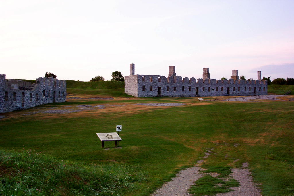
One of the items at the museum is the timber from the caisson of the bridge connected Fort Ticonderoga to Mount Independence in 1776. This is on display in the Key To Liberty building. It takes up half of one wall (which means it is 16 or 18 feet long, I think), and is very large. The surface has the weird smooth look of old, well-aged wood. There are a variety of notches and mortises cut into the timber, the purpose of which is not readily obvious. A table-top display shows how they sunk the caissons while working on the winter ice.
There is a general meeting at 9 in the morning. Dale discusses the day's events. The bulk of it is a reenactment of the Black Snake affair. I quote LCMM's write-up of the original historical incident:
During the early 19th century, Great Britain attempted to damage France's economy by restricting trade between their enemy and the young United States. America's merchant marine suffered as a result so President Thomas Jefferson and Congress attempted to counter England's action with the Embargo Act of 1807. The act limited trade with Canada thereby cutting off much of the legitimate income for those living in the Lake Champlain valley. The inhabitants of the region responded by starting a prolific smuggling trade.
In August, 1808, a revenue cutter named Fly, enforcing the embargo on the lake, had an encounter with a smuggling boat called Black Snake. Thirteen federalized Vermont militia men under the command of Lieutenant Daniel Farrington received word that smugglers had gone up the Winooski River to take on some potash destined for Canada. On August 3, Farrington rowed up the river looking for the smugglers and found Black Snake beached. He put some of his crew aboard Black Snake and started back down the river with both boats.
After threatening the revenue officers as they took Black Snake, the smugglers moved down the bank of the river and eventually fired shots at Fly killing the helmsman, Ellis Drake. Farrington put ashore in an attempt to capture the smugglers but walked into an ambush which wounded him and killed another of his men, Amos Marsh, along with Jonathan Ormsby, a farmer who had come along to talk with the officers. Within a matter of days, the officers captured all of the smugglers and most of them went on trial within a few weeks. The court found four of the men guilty of manslaughter but three eventually received pardons. However, the court sentenced Cyrus Dean, perhaps the most vocal of the smugglers, to be hanged. On November 11, a large crowd watched the sentence carried out in Burlington.
The Black Snake affair was reenacted on the North Harbor waterfront. The Kestrel, a dory that I'm not familiar with, portrayed the Black Snake, while the military bateau Perseverance portrayed the Fly. Kevin participated as one of the smugglers. I watched from the sidelines, content to not be doing anything.
Later in the day, they did a reenactment of the trial of the Cyrus Dean. They got several of us to portray part of a jury. I found it very hard to stay awake for this, not because the trial was uninteresting, but because I was very tired.
Every year the museum gets a large quantity of food donated to it for the event. Some ladies had volunteered to prepare lunch both Saturday and Sunday and also dinner. Lunch was ham, bread, cheese, and other items. Dinner had a wide variety of foods, including a nice venison stew, excellent beets, and an absolutely amazing steamed pudding made with apricots and hard sauce.
The weird food of the weekend was 'millers'. Kevin had noticed the recipe in the cookbook Lobscouse and Spotted Dog. This is a book of recipes that are allegedly from 18th century ships. Millers are a euphemism for rats. Strangely, Kevin had suggested trying this recipe on our email list, and a fellow named Brian at LCMM had actually obtained and prepared some rats for consumption. Leaving out the details, they were small, kind of gamy, and hardly worth the effort. Having tried them, I've no need to do it again.
After dinner, we took the DeSager and the Bobbie G out for an evening row. This gave some of the people who had met up with us at LCMM a chance to go on an outing. Kevin fired off the swivel gun on the DeSager, then returned to dock before it got especially dark.
We went a bit further in the Bobbie G, returning south of Basin Harbor. We set sail to return, using a lantern for our bow light and an electric lamp for the stern. We doused sail after a short time as the wind died, then rowed back to the harbor. By the time we arrived, it was quite hard to see.
 |
 |
 |
 |
 |
| A long boat in front of LCMM | Tim awaits the scenario, LCMM, 20 August 2005 | A fellow carries oars while an armed man walks forward | The Perseverance approaches | The Perseverance siezes another vessel |
 |
 |
 |
 |
 |
| The Perseverance siezes another vessel | James patrols the shore | A sail is secured | Kris Jarrett runs down the path with a musket | The smugglers fire upon the customs officials |
 |
 |
 |
 |
 |
| The customs boat lands | "Federal customs agents" man the Perserverence | Bruce and Sarah from LCMM | Our camp at LCMM | The camp at LCMM |
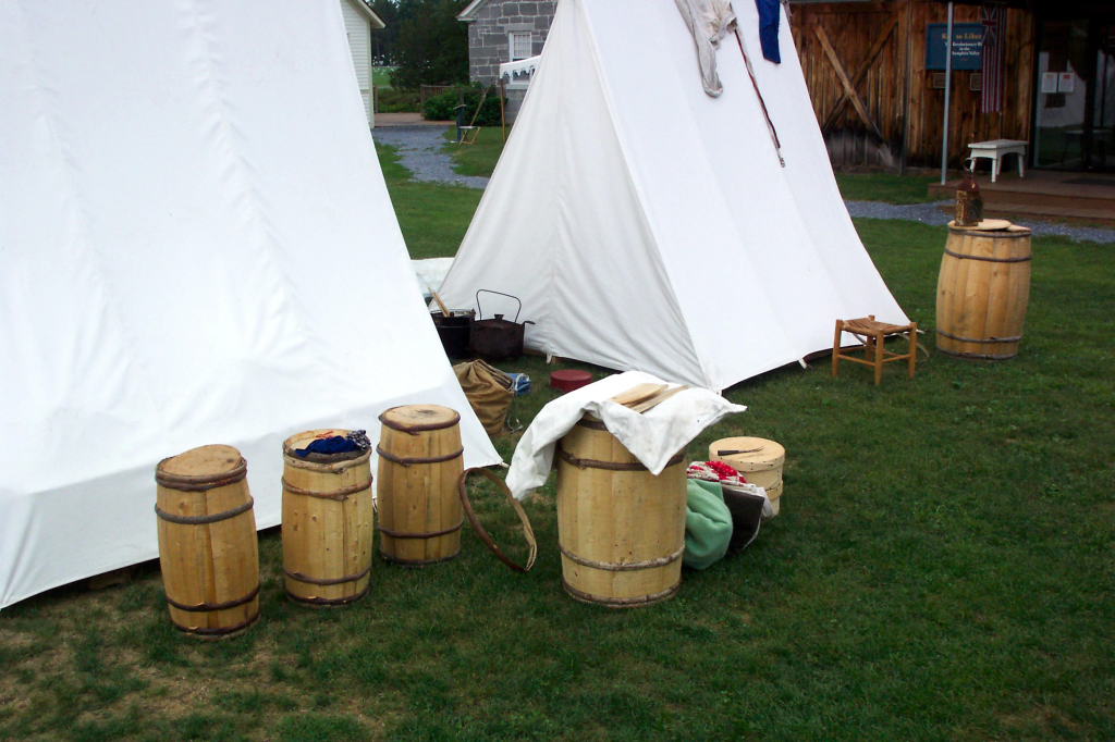 |
 |
 |
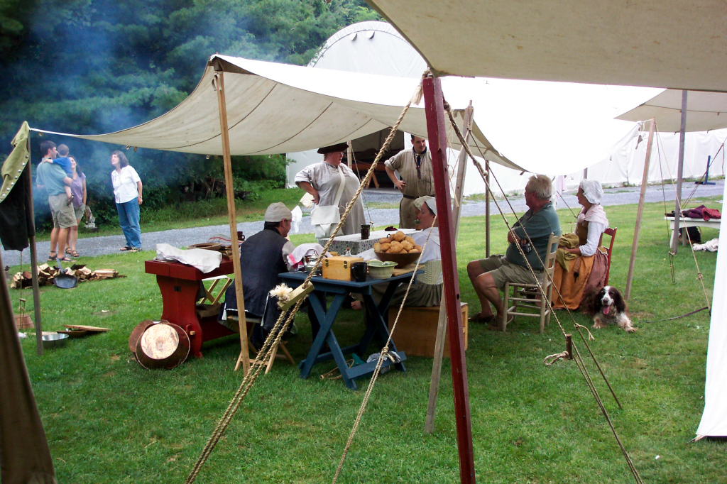 |
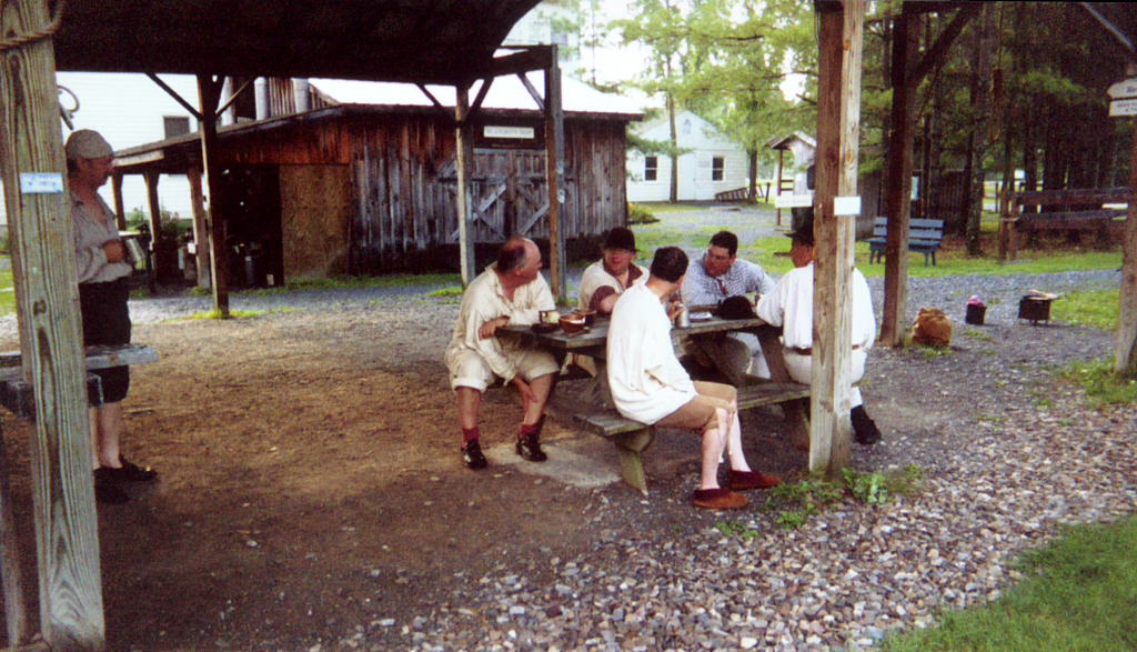
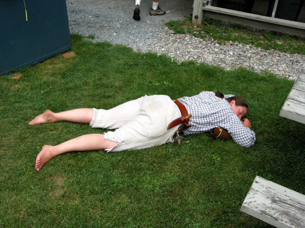 |
| Barrels at the camp | Hanging out at a picnic table at LCMM | Skye near the group at the picnic table | The kitchen fly | Reb asleep after a long week |
We had heavy rain in the night. Skye came and slept in my tent, as Reb was down on the Philadelphia II. Morning was pleasantly unstructured. An excellent lunch was prepared for us, consisting of pease soup, bread, cheese, and other stuff.
There was a naval reenactment in the afternoon. I don't think it was a reenactment of anything specific, but I could be wrong.
Three boats portrayed British craft - the big bateau Perseverance, and the dories General Arnold and Major Eyre. Additionally, an Indian reenactor was out in a canoe. The General Arnold and the Major Eyre are of very similar design. They are sprit-rigged dories with dagger boards. The Major Eyre has been around for many a year. It is owned and captained by Ed Bethel. The General Arnold was built this past winter by Scott Pedini (sp.?). He did a very nice job of it.
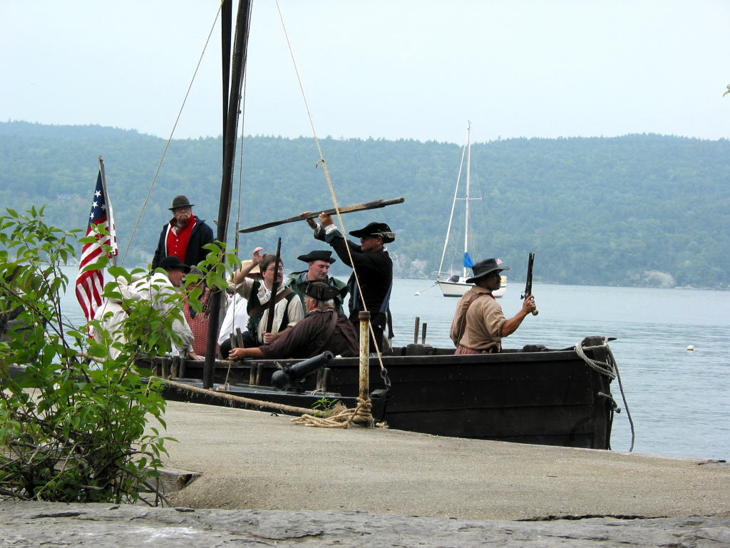
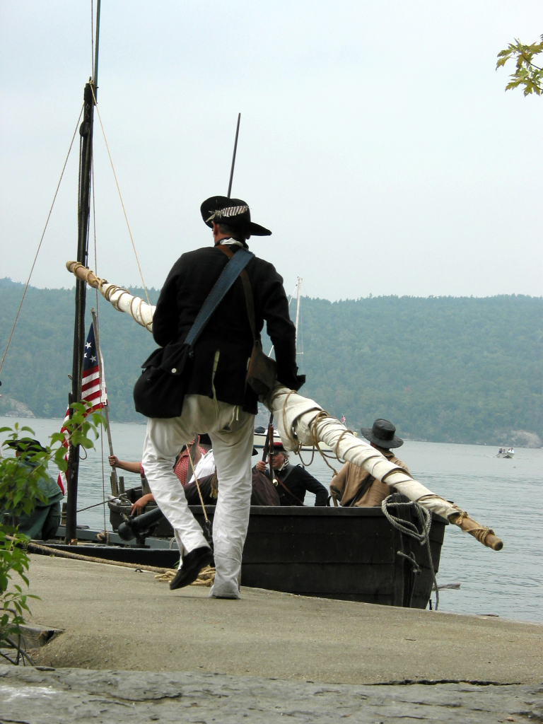
The Perseverance carried a number of armed men, and the two dories were armed with swivel guns. On shore, we had a group of militia. The DeSager represented an American boat. I captained her, Kevin manned the gun, and we had four rowers. We waited at the landing near the museum.
The three British boats came in for a raid. The alarm was sounded, and the American militia attempted to repel them. We rowed out into the harbor, fired our swivel at the dories, then retreated by backing astern. We repeated this several times, with some variation. The dories alternately fired their swivel guns at us and at the militia. Eventually the British troops withdrew.
Toward the end of the engagement, Scott in the General Arnold pretended to be shot and threw himself into the water. One of his crew took up the rudder and they rowed away. We rowed over and helped Scott aboard the DeSager. The Indian (whose name I don't know), did something similar, leaping into the water. He stayed with his canoe, but his paddle had fallen overboard and started to float away. We retrieved this.
At the conclusion of the action, we returned the paddle to the Indian, and Scott climbed into the canoe. They canoed out to the General Arnold. We returned to dock.
After the naval reenactment, we mostly struck camp. We couldn't take the boats out until 4 or 4:30 p.m., so we felt it was best to have everything else ready to leave.
Just after 4, we set out in the Bobbie G, followed by the DeSager. There was a south wind blowing, which ended up being a head wind on our row to Basin Harbor where the boat ramp was located. It wasn't bad. With the ash oars, the Bobbie G was faster than the DeSager.
Basin Harbor was quite congested. The boat ramp is right in the middle of a swimming area used by children. There were dozens of kids swimming back and forth, playing on the beach, leaping on the trampoline, rowing or towing small plywood boats, and generally frolicking.
Ultimately, we had Reb use Kevin's truck with each of the two trailers, backing them down the somewhat gravelly rock ramp. Other people herded kids away from the trailer as it entered the water. We got the DeSager loaded up, then the Bobbie G. After securing them for travel, the two vehicles returned to the Maritime Museum, and the rest of us walked the short distance there.
We finished packing, then headed home. Kevin, Ed, Mary, Harvey, Dawn, and myself stopped at a diner in Fort Edward for supper. Dawn and I departed separately, and the others took the boats back to the farm. I ended up getting home at 9:30.
A good trip; I'm very tired.
 |
 |
 |
 |
 |
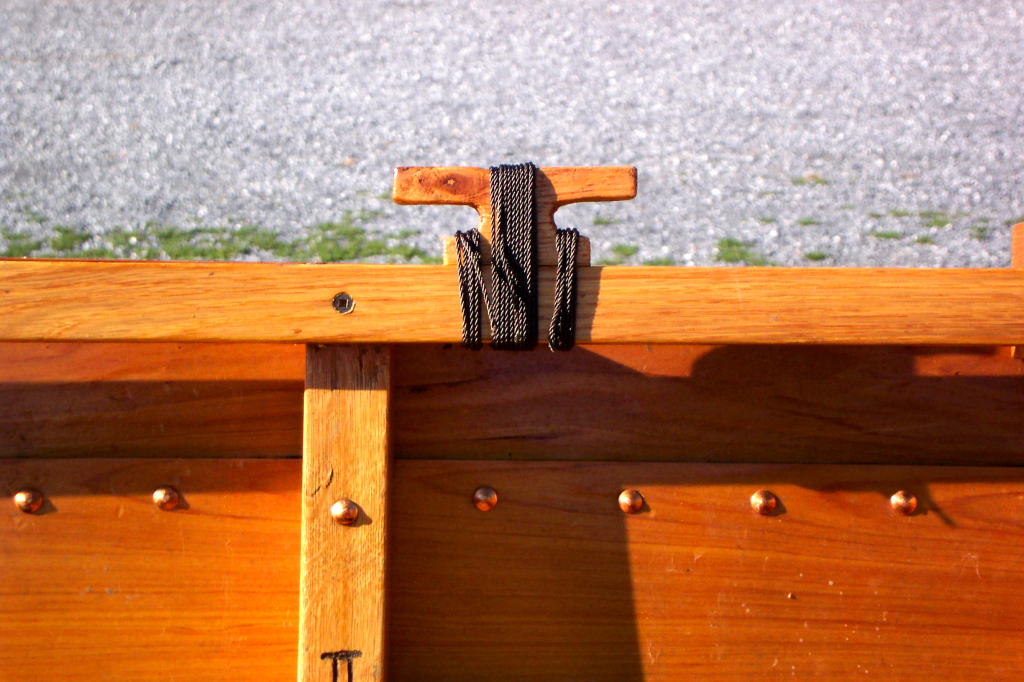
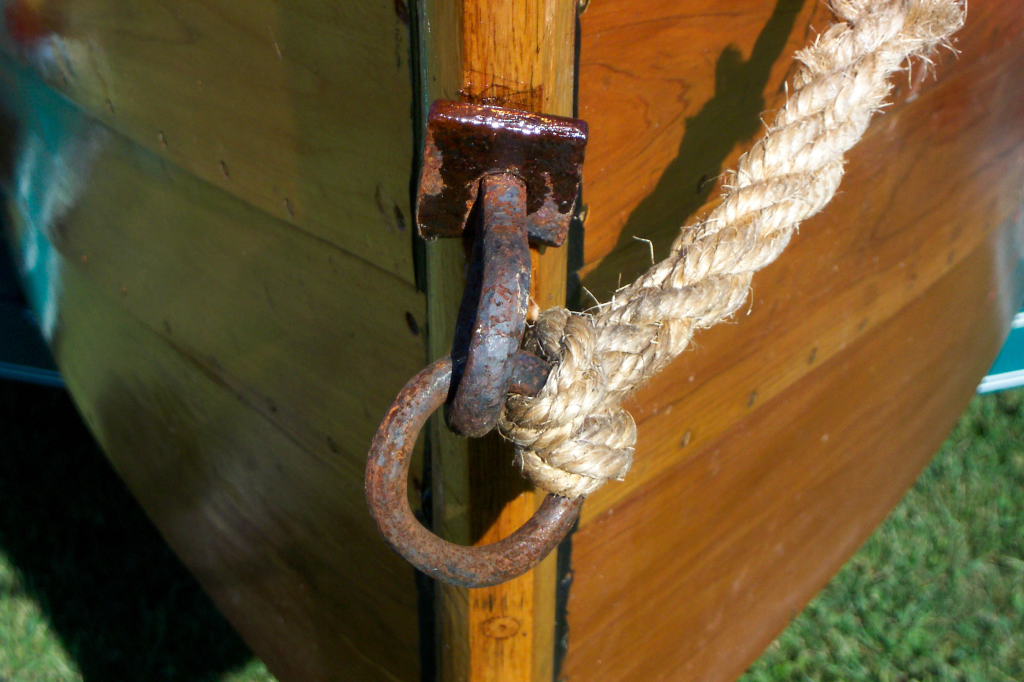
| Cleat closeup | Stern line and ring bolt | The DeSager moves out for the naval tactical | The DeSager moves out for the naval tactical | In action |
 |
 |
|||
| In action | Kevin says 'Yo!' |